1884-1911 Fire Insurance Maps and Atlas of Clyde, Ohio
1884-1911 Fire Insurance Maps and Atlas of Clyde, Ohio
Couldn't load pickup availability
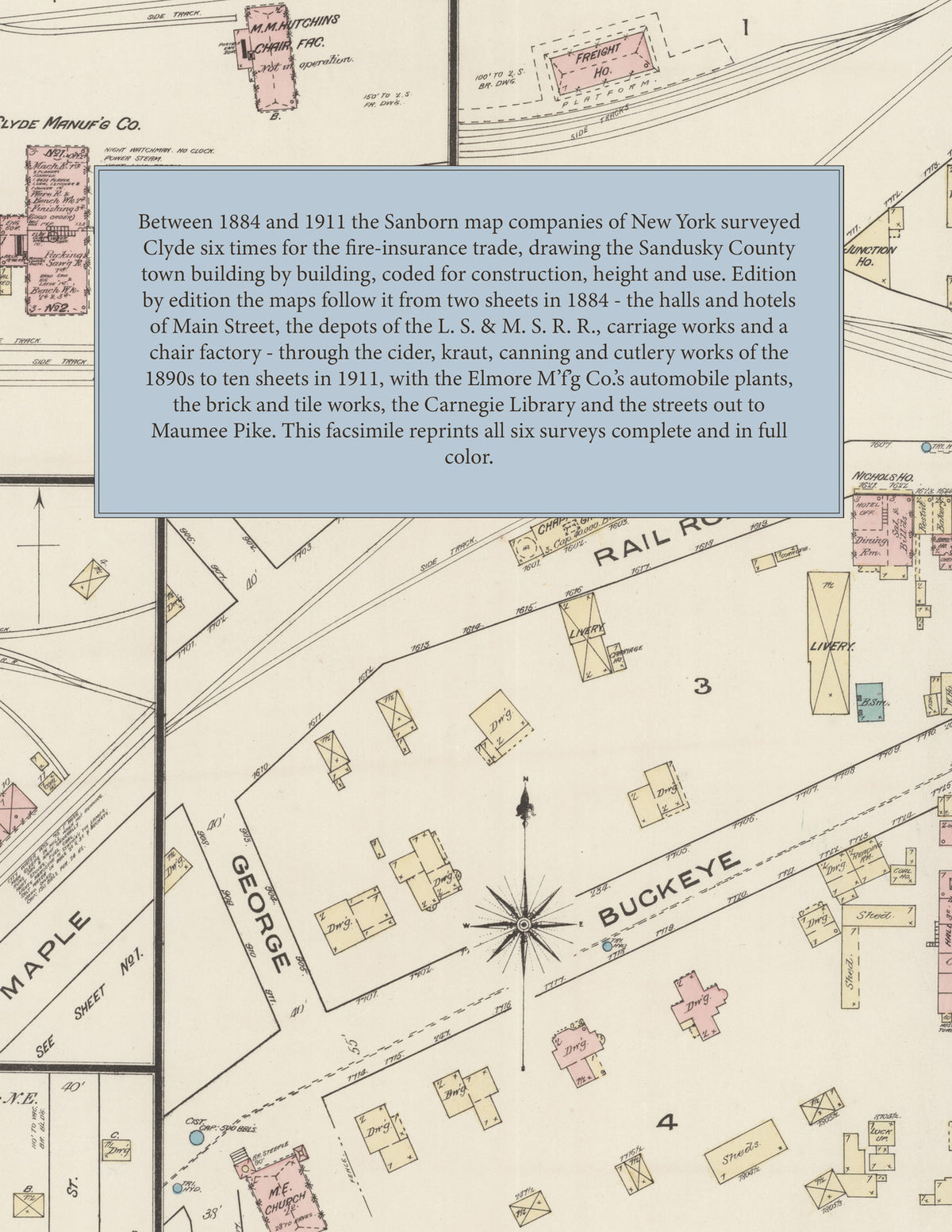
Facsimile of the six Sanborn fire-insurance surveys of Clyde, Ohio, made between 1884 and 1911, reproduced in full color from the Library of Congress copies. Together they cover the Sandusky County town where the L. S. & M. S. and W. & L. E. railroads cross: the stores, halls and hotels of Main Street between Maple, Duane, Buckeye and Forest Streets, the depots, mills, elevators and works along the tracks, and the residential streets out to Maumee Pike, Cherry, Grant and Vine Streets and the Fair Grounds.
In November 1884 two sheets show the business blocks of Main Street - Masonic Hall, Terry's Hall, the I. O. O. F. Hall, a business college, the Opera House, the Nichols, St. Vincent and Junction houses - with the L. S. & M. S. R. R. passenger depot and freight house, Chapman's grain elevator, The Clyde Manuf'g Co., M. M. Hutchins' chair factory, Arnold and Van Ator's grist mill and edge tool works, the Mefford Fruit Co., Vogt Bros.' and Geo. Adams' carriage works, E. T. Gettins' planing mill and E. E. Stark's stave factory and The Clyde Novelty Works. The three sheets of December 1888 add the Elton cider and jelly works, McConnell Bros.' flour mill and the Clyde Preserving Works. The 1893 and 1899 editions open with key maps and indexes: the Clyde Canning, Cutlery, Kraut and Produce companies, the electric light station, gas company and water works, Comstock and Slessman's elevator, Q. Adams and Co.'s saw mill, the Clipper Shear Co., Staderman and Fox's piano factory, Taylor and Fuller's stave factory, the Hughes Granite and Marble Co., H. Parker's cider and jelly works, the Elmore M'f'g Co., the City Hall, the Empire Hotel and the Baptist, Episcopal, First Presbyterian, Methodist Episcopal and St. Mary's churches. The seven sheets of May 1906 add the Elmore Mfg. Co.'s automobile works, J. V. Vogt's automobile factory, the American Steel Sign Co., the A. H. Jackson Mfg. Co., L. S. Reel and Co.'s flour mill and the C. C. C. and St. L. R. R. depots. The ten sheets of September 1911 reach the Elmore M'f'g Co.'s new plant, the Clyde Brick and Tile Works, the James Foundry Co.'s metal street sign works, the Hankey Lumber Co., the Standard Oil Co., the Star Laundry, the Carnegie Library, the Post Office, the Commercial Hotel, the L. S. E. R. R. depot and McPherson Cemetery.
Between 1884 and 1911 the Sanborn map companies of New York surveyed Clyde six times for the fire-insurance trade, drawing the town at fifty feet to the inch. Every building is shown to scale and color-coded for construction (yellow for frame, pink for brick, blue for stone), with heights, uses, mill machinery, hydrants, cisterns and water pipes all marked. The later editions add a key map of the town and an index of streets and named works, churches and hotels, and a divider page introduces each edition.
This edition is an unabridged facsimile republication of the atlas: all thirty-one sheets of the six editions of 1884, 1888, 1893, 1899, 1906 and 1911, with the key maps of 1888 to 1911 and the indexes of 1893, 1899, 1906 and 1911, each edition introduced by a divider page. Ideal for local historians, genealogists, architects, preservationists and anyone tracing a Clyde address back to 1884-1911.
40 pages. 8.5" x 11". Full color. Paperback.
Printed to order and shipped directly to you — please allow up to 7 business days before shipment.
Satisfaction guaranteed or you can send it back!