1884-1917 Fire Insurance Maps and Atlas of Eureka, Kansas
1884-1917 Fire Insurance Maps and Atlas of Eureka, Kansas
Couldn't load pickup availability
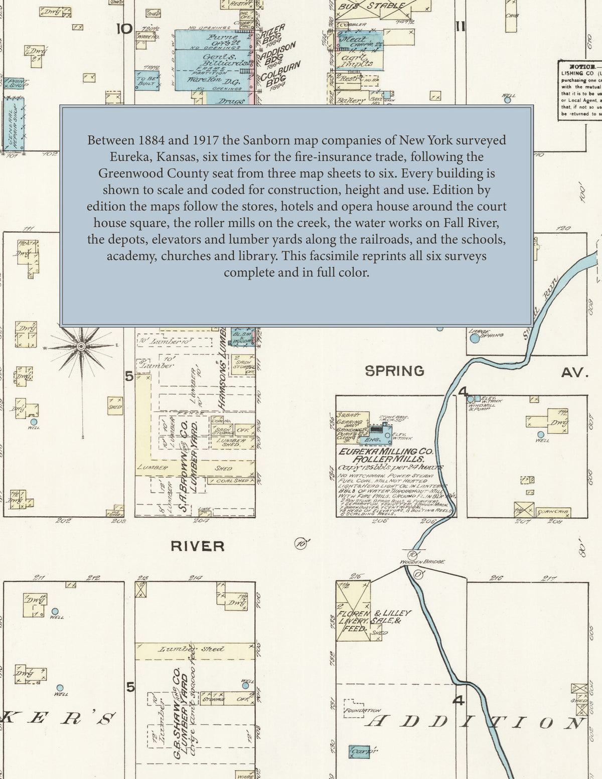
Facsimile of the six Sanborn fire-insurance surveys of Eureka, Kansas, made between 1884 and 1917, reproduced in full color from the Library of Congress copies. Together they cover the Greenwood County seat: the business blocks of Main Street around the court house square, the mills on the creek through town, the depots, elevators and lumber yards along the railroads, the water works on Fall River, the schools, academy and churches, and the residential additions, with the whole town on the key map of every edition.
In October 1884 three sheets show the County Court House in Court House Park, the Hotel Greenwood, the Opera House block, the City Hall, the Eureka Milling Co. roller mills on Small Run, the Central Mills, liveries and lumber yards, the public school, the Lutheran, Congregational and Methodist Episcopal churches, and R. Nicholas's grain elevator by the K. C. E. & S. R. R. stock yards. The 1890 survey adds the Eureka City Water Works and the Eureka Water Mills on Fall River, an academy north of the court house, a foundry and machine shop, the Eureka Novelty Works, the Commercial and Fourth Ave. hotels, the Republican printing office and the Christian, Catholic and Presbyterian churches, and in 1897 come the Eureka City Roller Mills, the Electric Light Station, the Houston Lumber Co., the Jackson Hotel, the Herald printing office and the Walnut St. School. The 1906 maps add the Eureka High School, the Southern Kansas Academy, the Steam Laundry, the Rock Island Lumber and Coal Co., the fire department and the Baptist church, with the Missouri Pacific and Atchison Topeka & Santa Fe railroads on the key map. In 1912 come the Masonic and I. O. O. F. halls, the Post Office, the Sun Flower Hotel, the Commercial Club, the Home Steam Laundry, the Eureka Ice & Cream Co., the Hodgson Elevator Co., the Electric Light and Power Plant, and the Episcopal, Seventh Day Adventist and Christ's English Lutheran churches, and in 1917 the Public Library, the M. P. R. R. passenger station, a moving-picture house, the Eureka Electric and Ice Co., the East Side School and the L. F. Reed & Co. lumber yard.
Between 1884 and 1917 the Sanborn map companies of New York surveyed Eureka six times for the fire-insurance trade, drawing the town at fifty feet to the inch from 1884 to 1912 (the 1917 edition by its scale bars). Every building is shown to scale and color-coded for construction (yellow for frame, pink for brick, blue for stone), with heights, uses, mill machinery, railroad tracks, hydrants and water pipes all marked. Every edition has a key map of the town and, from 1890, an index of named businesses, mills, elevators, churches, schools and hotels, and a divider page introduces each edition.
This edition is an unabridged facsimile republication of the atlas: all twenty-six map sheets of the six editions of 1884, 1890, 1897, 1906, 1912 and 1917, with the key map of every edition and the index of every edition from 1890, each edition introduced by a divider page. Ideal for local historians, genealogists, architects, preservationists and anyone tracing a Eureka address back to 1884-1917.
34 pages. 8.5" x 11". Full color. Paperback.
Printed to order and shipped directly to you — please allow up to 7 business days before shipment.
Satisfaction guaranteed or you can send it back!