1884-1918 Fire Insurance Maps and Atlas of Greenville, Michigan
1884-1918 Fire Insurance Maps and Atlas of Greenville, Michigan
Couldn't load pickup availability
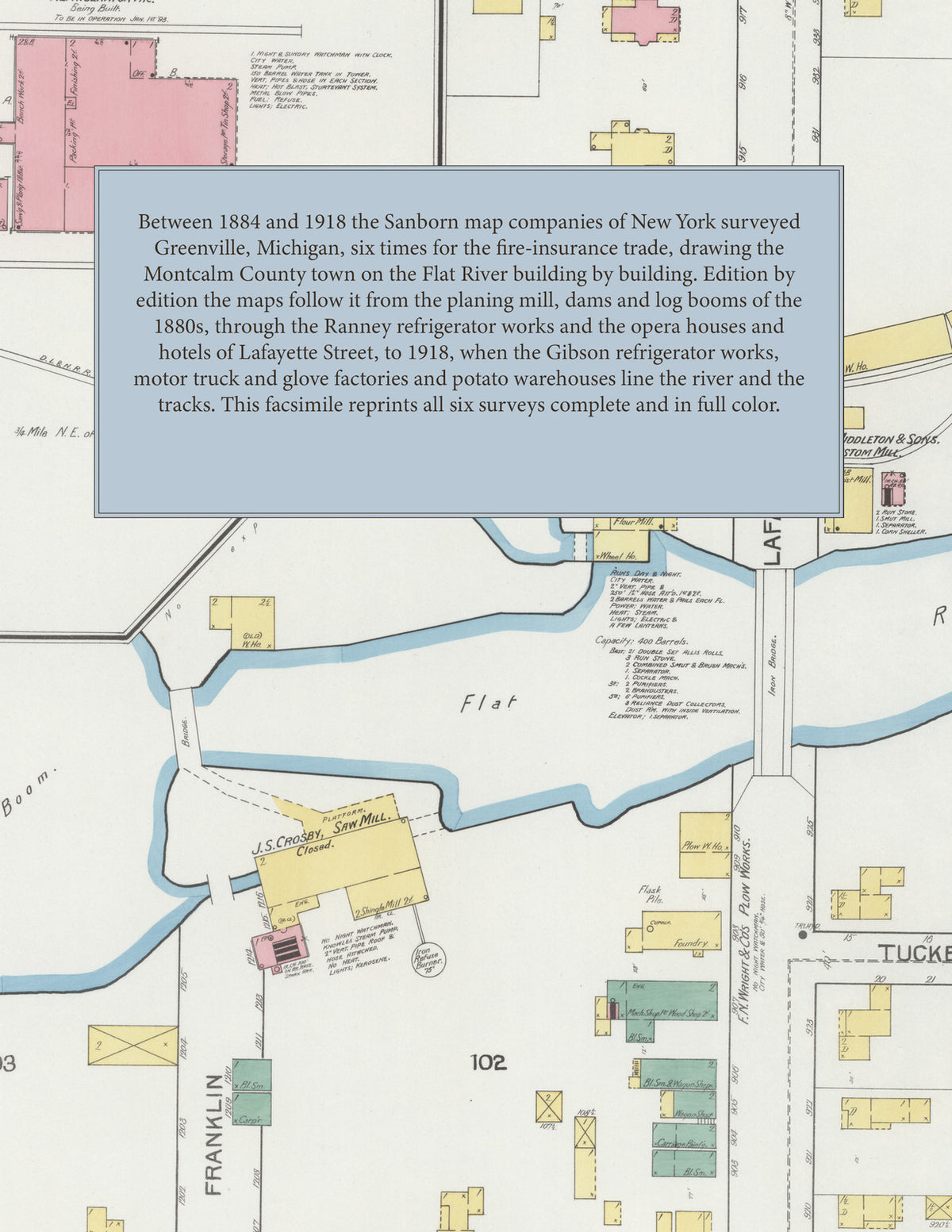
Facsimile of the six Sanborn fire-insurance surveys of Greenville, Michigan, made between 1884 and 1918, reproduced in full color from the Library of Congress copies. Every edition covers the Montcalm County town on both banks of the Flat River: the business blocks of Lafayette Street, the homes from Franklin, Clay and Webster to Irving and Barry streets, and the mills, refrigerator and furniture factories, warehouses and depots along the river, the mill pond and the railroad tracks.
In 1884 and 1887 four and then five sheets show Towle, Douglas & Co.'s planing mill, the mills, dams and log booms of the Flat River, the Webster House, the churches on Cass Street and the lumber yards by the tracks. The six sheets of 1892 add the Ranney Refrigerator Co.'s works on the river, and the seven of 1900 its factories "A" and "B" and the Greenville Planter Co. In 1908 eleven sheets bring the Eureka Glove Co. and Eureka Roller Mills, the Continental Starch Co., Skinner & Stenman's furniture factory, Slawson's bean warehouse, the P. M. R. R. freight house and the T. S. & M. R. R. freight and passenger depot, the Phelps Opera House, the Hotel Phelps and the Pere Marquette Hotel, the City Hall, Water Works and High School. The thirteen sheets of 1918 map the Gibson Refrigerator Co., the Tower Motor Truck Co., R. J. Tower's foundry and machine shop and milling company, Chase & Co.'s potato warehouse, the Greenville Floral Co., Wright Bros. & Co.'s flour mill, the Michigan Motor Garment Co., the Cupid Toy Co., the Atlas Elec. Storage Battery Co., J. T. Ridley's cold storage, the Silver Opera House, the United Memorial Hospital, the Central and North Greenville schools, and the Methodist Episcopal, Congregational, First Baptist, Advent and St. Charles Roman Catholic churches.
Between 1884 and 1918 the Sanborn map companies of New York surveyed Greenville six times for the fire-insurance trade, every edition at fifty feet to the inch. Every building is shown to scale and color-coded for construction (yellow for frame, pink for brick, blue for stone), with heights, uses, mills, dams, lumber yards, railroad tracks, hydrants and water pipes all marked. Each edition opens with a key map of the town, the later ones with an index of named businesses, churches, schools and hotels, and a divider page introduces each edition.
This Tangletown Press edition is an unabridged facsimile republication of the atlas: all forty-six map sheets of the six editions of 1884, 1887, 1892, 1900, 1908 and 1918, each with its key map on the title sheet, each edition introduced by a divider page. Ideal for local historians, genealogists, architects, preservationists and anyone tracing a Greenville address back to 1884-1918.
54 pages. 8.5" x 11". Full color. Paperback.
Printed to order and shipped directly to you — please allow up to 7 business days before shipment.
Satisfaction guaranteed or you can send it back!