1884-1921 Fire Insurance Maps and Atlas of Newport, New Hampshire
1884-1921 Fire Insurance Maps and Atlas of Newport, New Hampshire
Couldn't load pickup availability
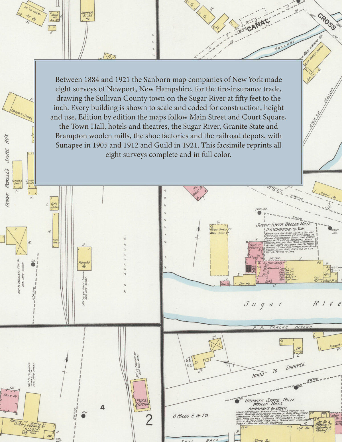
Facsimile of the eight Sanborn fire-insurance surveys of Newport, New Hampshire, made between 1884 and 1921, reproduced in full color from the Library of Congress copies. Together they cover the Sullivan County town on the Sugar River: Main Street, Court Square and Sunapee Street, the woolen mills, shops and tanneries along the river and Canal Street, the residential streets, and, as printed on the title sheets, Sunapee in the 1905 and 1912 editions and Guild in 1921.
In 1884 two sheets and a key map show the village around the Town Hall: the Newport House and Phoenix House, Woodbury and Gould's grist mill, Hunton's tannery, the mills on Canal Street, the Sugar River Woolen Mill, the Granite State Woolen Mill and the Concord and Claremont R.R. The editions of 1889 and 1894 add an index and redraw the town as it grows. By 1899 four sheets reach the Child-Chamberlain Co. shoe factory on Canal Street, the Sugar River Woolen Mills of D. Richards and Son with their electric light station, the Granite State Mills of Fairbanks and Dorr three miles east of the post office, the Peerless Mfg. Co., the passenger station and freight house, and D. Whiting and Son's creamery. The Sanborn Map Company's surveys of 1904 and 1905 follow, the second adding Sunapee, which returns in the nine sheets of 1912. The 1921 edition, including Guild, indexes the Court House and Town Hall on Court Square, the fire department, the Richard Library, the Coniston Theatre and The Empire moving pictures, the Winston Hotel, Hub Hotel and Brampton Inn, the National and Savings Bank Building, the Dexter Richards and Sons Co. Sugar River Woolen Mills, the Brampton Woolen Co. mill, the Dorr Woolen Co. Granite State Mills, the W. H. McElwain Co. shoe factory, the B. & M. R.R. depots, the Carrie Wright Hospital, the public schools and the Congregational, First Baptist, Episcopal, Methodist Episcopal and Roman Catholic churches.
Between 1884 and 1921 the Sanborn map companies of New York made eight surveys of Newport for the fire-insurance trade, drawing the town at fifty feet to the inch (the 1921 edition by its scale bar). Every building is shown to scale and color-coded for construction (yellow for frame, pink for brick, blue for stone), with heights, uses, mill machinery, hydrants and water pipes all marked. The title sheets carry a key map of the town and, from 1889, an index of streets and named buildings, and a divider page introduces each edition.
This Tangletown Press edition is an unabridged facsimile republication of the atlas: all forty map sheets of the eight editions of 1884, 1889, 1894, 1899, 1904, 1905, 1912 and 1921, with the key maps and indexes printed on their title sheets, each edition introduced by a divider page. Ideal for local historians, genealogists, architects, preservationists and anyone tracing a Newport address back to 1884-1921.
50 pages. 8.5" x 11". Full color. Paperback.
Printed to order and shipped directly to you — please allow up to 7 business days before shipment.
Satisfaction guaranteed or you can send it back!