1884-1923 Fire Insurance Maps & Atlas of East Greenwich, Rhode Island
1884-1923 Fire Insurance Maps & Atlas of East Greenwich, Rhode Island
Couldn't load pickup availability
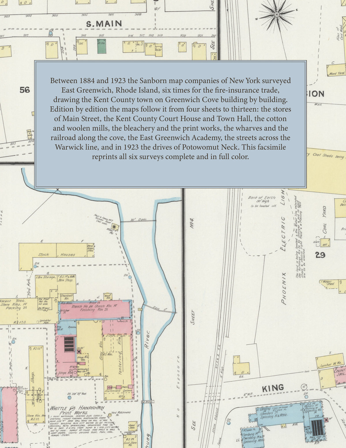
Facsimile of the six Sanborn fire-insurance surveys of East Greenwich, Rhode Island, made between 1884 and 1923, reproduced in full color from the Library of Congress copies. Together they cover the Kent County town on Greenwich Cove and the streets across Division Street in the Town of Warwick: the stores of Main Street, the Kent County Court House and the Town Hall, the mills, wharves and railroad along the cove, the residential streets west of Main Street, the print works a mile south of the post office, and, in 1923, Potowomut Neck on Greenwich Bay.
In January 1884 four sheets show the Orion Cotton Mill, the Phoenix Woolen Co., Crompton's Wharf, the stores and churches of Main Street and the Bolton M'f'g Co.'s print works a mile to the south. The 1891 edition adds an index naming the Kent County Court House, the Town Hall, the East Greenwich Seminary, the Public Library, the Updike and Central hotels, the Elizabeth Mill Co.'s No. 2 cotton mill, the Phoenix Electric Light and Coal Co., the Aetna Bottling Co., B. Crompton's coal and wood yard, the Friends Meeting House, St. Luke's Episcopal and the Baptist and Methodist churches, the County Jail and the N. Y. P. & B. R. R. depot. In July 1896 come the Bourne Bleachery, the boat building yard, the Providence Dry Salter Co., the R. I. "Pendulum" Printing office, the Armory, the Windsor House and the N. Y., N. H. & H. R. R. depot. The eight sheets of March 1903 add the Masonic Building, the Ferricup Metal Co., the Pierce Co.'s brush works, F. S. Nock's boat shop and the Union Free Baptist Church. In October 1910 eleven sheets reach the East Greenwich Academy, the Kentish Guards Armory, the Yacht Club, the Boston Wire Stitcher Co., the Regina M'f'g Co.'s tracing cloth works, A. H. Esten's dye works, the W. U. Farrington estate's dextrine and British gum works, the National Machine Co., the Free Public Library, the post office and Our Lady of Mercy R. C. Church. December 1923 adds the Greenwich Bleachery, the Greenwich Mills woolen and worsted works, the Varnum Memorial Armory, the Rueckert M'f'g Co., garages, the academy greenhouses and dairy, and the drives of Potowomut Neck.
Between 1884 and 1923 the Sanborn map companies of New York surveyed East Greenwich six times for the fire-insurance trade, drawing the town at fifty feet to the inch, with part of the 1923 edition at one hundred feet by its scale bars. Every building is shown to scale and color-coded for construction (yellow for frame, pink for brick, blue for stone), with heights, uses, mill machinery, railroad tracks, hydrants and water pipes all marked. Every edition opens with a key map of the town, every edition from 1891 with an index of streets and of named mills, churches, schools and halls, and a divider page introduces each edition.
This Tangletown Press edition is an unabridged facsimile republication of the atlas: all forty-six map sheets of the six editions of 1884, 1891, 1896, 1903, 1910 and 1923, with the key map of every edition and the index of every edition from 1891, each edition introduced by a divider page. Ideal for local historians, genealogists, architects, preservationists and anyone tracing a East Greenwich address back to 1884-1923.
54 pages. 8.5" x 11". Full color. Paperback.
Printed to order and shipped directly to you — please allow up to 7 business days before shipment.
Satisfaction guaranteed or you can send it back!