1885-1912 Fire Insurance Maps and Atlas of Thompsonville, Connecticut
1885-1912 Fire Insurance Maps and Atlas of Thompsonville, Connecticut
Couldn't load pickup availability
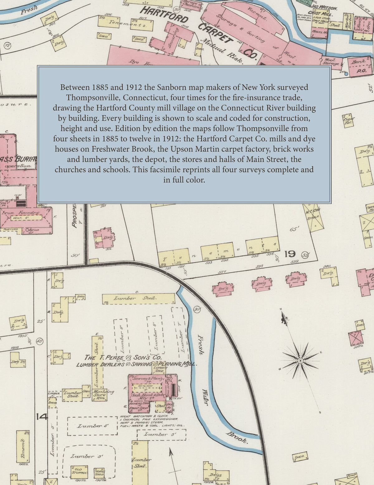
Facsimile of the four Sanborn fire-insurance surveys of Thompsonville, Connecticut, made between 1885 and 1912, reproduced in full color from the Library of Congress copies. Together they cover the Hartford County mill village on the Connecticut River and Freshwater Brook from four sheets in 1885 to twelve in 1912: the Hartford Carpet Co. works between Main, School and Pleasant Streets, the stores and halls of Main, High and Prospect Streets, the mills and yards along the N. Y. N. H. & H. R. R., and the residential streets out to Enfield Street and beyond.
In 1885 four sheets and a key map show the Hartford Carpet Co.'s carding and spinning mill, dye houses, scouring and wool storage buildings on Fresh Water Brook, Factory Pond, Mathewson's brewery and the steam ferry on the Connecticut River, Jas. Watson's grist mill, the bank and post office, the New England Glass Burial Case Co. (not in operation), the Pease & Son planing mill, a tobacco warehouse, Cottage Green and the N. Y. N. H. & H. R. R. The six sheets of 1892 and their index name the Allen House and Thompsonville Hotel, H. K. Brainard's warehouse, the G. H. Bushnell Co.'s press manufactory, the Electric Light Station, P. Lovejoy & Son's grist mill, J. Mathewson's brewery, C. Miller's carriage factory, the T. Pease Sons Co. lumber yard, the Westfield Plate Co., the railroad depot, the public schools and the Catholic, Congregational, Episcopal, First Presbyterian and Methodist Episcopal churches. By 1905 nine sheets take in the Hartford Carpet Corporation, the Upson Martin Co.'s carpet factory, the Thompsonville Lumber Corporation, the Alden and Bower & Best brick works, I. Meyer & Co.'s tobacco warehouses, Chamberlains Hotel, Franklin Hall, the Mulligan Block, the Town Hall, the Fire Department, the Catholic church and school and the United Presbyterian and Universalist churches. The twelve sheets of 1912 draw the carpet mill yard building by building - the Tapestry, Worsted, Filling, Axminster and Ingrain Weave mills, Dye House, Color House and the Brussels and Saxony weave sheds - and add the Standard Metal Work Co., Simplex M'f'g Co.'s machine shop, the Enfield Lumber and Coal Co., Ellen A. Smyth's coal yard, the Thompsonville Water Co.'s pumping station and reservoirs, the Northern Connecticut Light and Power Co. sub-station, the Majestic Theatre, Foresters' Hall, the Library, Post Office, Town Offices and jail, the High, North and South schools, St. Andrew's Episcopal and St. Patrick's Roman Catholic churches and St. Joseph's School and Hall.
Between 1885 and 1912 the Sanborn map makers of New York surveyed Thompsonville four times for the fire-insurance trade, drawing the village at fifty feet to the inch. Every building is shown to scale and color-coded for construction (yellow for frame, pink for brick, blue for stone), with heights, uses, mill machinery, hydrants and water pipes all marked. Each edition opens with a key map of the village, from 1892 with an index of streets and named businesses, mills, churches and schools, and a divider page introduces each edition.
This edition is an unabridged facsimile republication of the atlas: all thirty-one map sheets of the four editions of 1885, 1892, 1905 and 1912, the first sheet of each edition carrying its title and key map (from 1892 with an index), each edition introduced by a divider page. Ideal for local historians, genealogists, architects, preservationists and anyone tracing a Thompsonville address back to 1885-1912.
38 pages. 8.5" x 11". Full color. Paperback.
Printed to order and shipped directly to you — please allow up to 7 business days before shipment.
Satisfaction guaranteed or you can send it back!