1885-1919 Fire Insurance Maps and Atlas of Morgan City, Louisiana
1885-1919 Fire Insurance Maps and Atlas of Morgan City, Louisiana
Couldn't load pickup availability
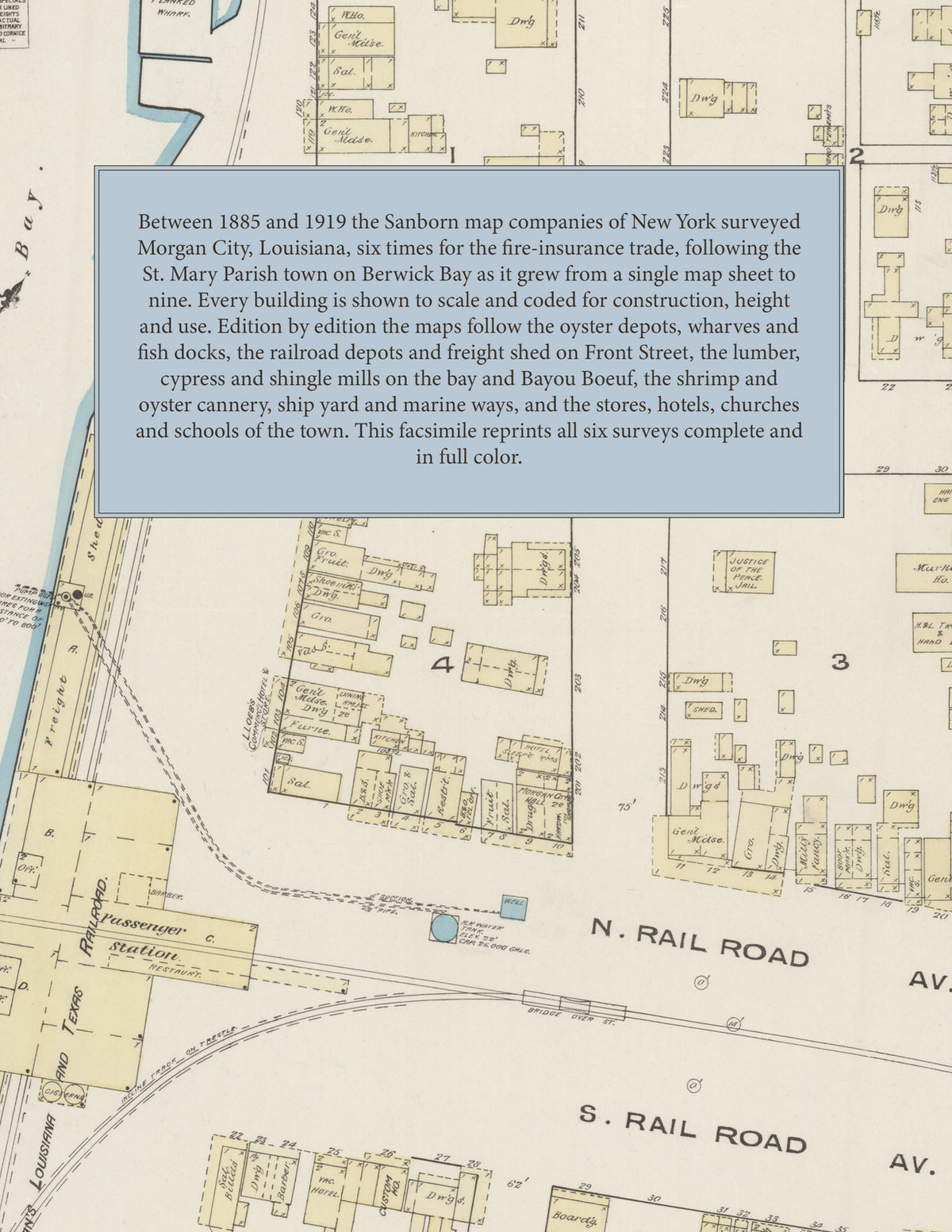
Facsimile of the six Sanborn fire-insurance surveys of Morgan City, Louisiana, made between 1885 and 1919, reproduced in full color from the Library of Congress copies. Together they cover the St. Mary Parish town on Berwick Bay: the wharves, oyster depots and Southern Pacific depots and freight shed along Front Street, the stores, hotels and churches of First, Second and Federal streets and the Railroad avenues, the lumber and cypress mills on the bay and on Bayou Boeuf, and the residential streets out to Brashear Avenue and the City Park.
In June 1885 a single sheet shows the oyster depot and landing and the planked wharf on Berwick Bay, Morgan's Louisiana and Texas Railroad passenger station, freight sheds and iron bridge, L. Loeb's Commercial Hotel, the theatre and post office, Morgan City Hall, the custom house, the market house and engine houses, and the justice of the peace and jail. The two sheets of July 1895 add E. Bass's and John Dalton's oyster factories, Jacques Lehman's Sons' oyster factory, the Morgan City Improvement Co.'s ice works and planing mill, the Phoenix Steam Laundry, the S. P. R. R. passenger depot and the railroad company's park, the Episcopal Church and the Academy of the Sacred Heart of Jesus. In 1899 come the Brownell-Drews Lumber Co., Dalton's oyster box and bucket factory, the Morgan City Bottling Works, the Chase, Costello and New Fowler hotels, the Sacred Heart Catholic Church, the Synagogue and Whitney Hall. The 1906 edition maps the Cotten Bros. Cypress Co. and Geo. Vinsen Shingle Mfg. Co. on Bayou Boeuf, the Morgan City Boiler and Sheet Iron Works, the electric light works, City Hall, City Market and Opera House; in 1912 the Dunbar, Lopez & Dukate Co.'s shrimp and oyster canning factory, the Berwick Bay Fish & Oyster Co., the Masonic Temple, the high school, the Texas Oil Co. and the water works pumping station. In December 1919 nine sheets reach the Morgan City Docking Co. and its marine ways, R. J. Terrebonne's ship yard and moss gin, the Knight Fish Co. and Monarch Packing Co. fish docks, the Gulf Refining and Standard Oil depots, the Louisiana and Thurston hotels, the B. P. O. E. Home and the Presbyterian Church.
Between 1885 and 1919 the Sanborn map companies of New York surveyed Morgan City six times for the fire-insurance trade, drawing the town at fifty feet to the inch in the five editions of 1885 to 1912 and to the scale bars of the edition of 1919. Every building is shown to scale and color-coded for construction (yellow for frame, pink for brick, blue for stone), with heights, uses, mill machinery, wharves, railroad tracks, hydrants and water pipes all marked. The editions of 1899 to 1919 have an index of streets and named businesses, mills, churches, schools and hotels and a key map of the town, and a divider page introduces each edition.
This edition is an unabridged facsimile republication of the atlas: all twenty-seven map sheets of the six editions of 1885, 1895, 1899, 1906, 1912 and 1919, with the indexes and key maps of 1899 to 1919, each edition introduced by a divider page. Ideal for local historians, genealogists, architects, preservationists and anyone tracing a Morgan City address back to 1885-1919.
36 pages. 8.5" x 11". Full color. Paperback.
Printed to order and shipped directly to you — please allow up to 7 business days before shipment.
Satisfaction guaranteed or you can send it back!