1885-1920 Fire Insurance Maps and Atlas of Brenham, Texas
1885-1920 Fire Insurance Maps and Atlas of Brenham, Texas
Couldn't load pickup availability
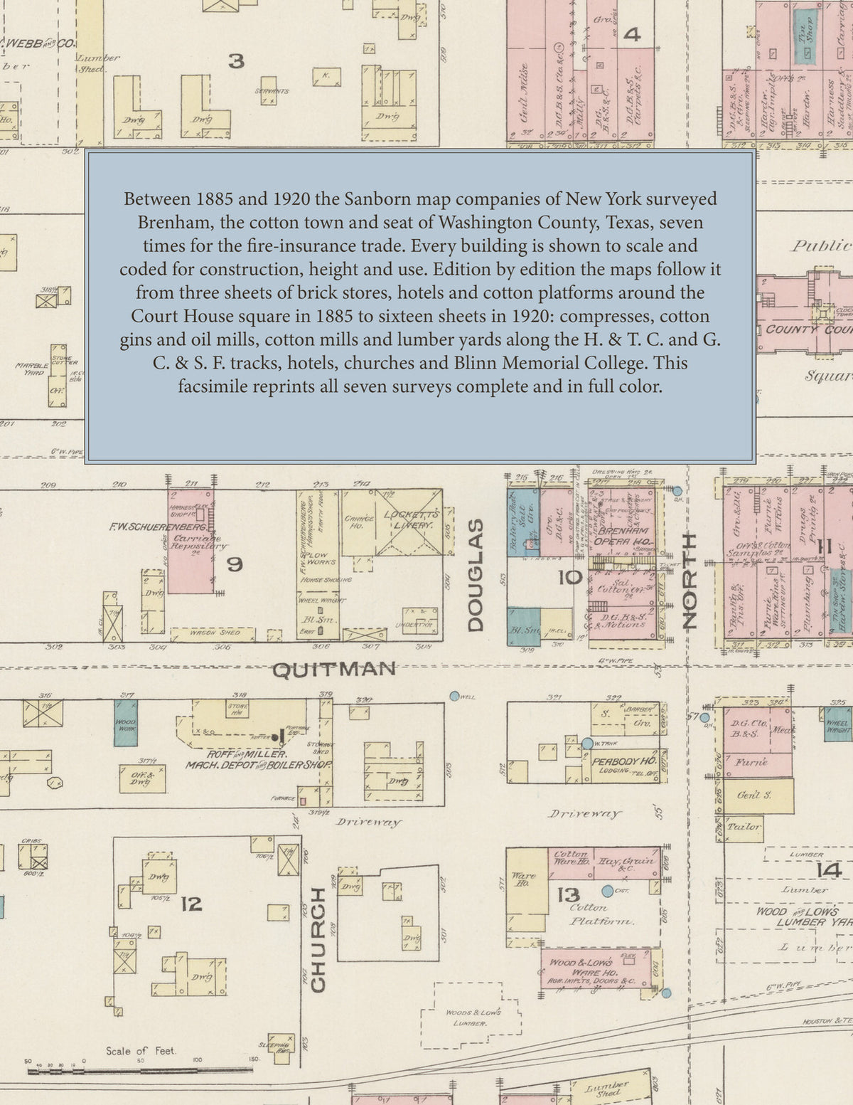
Facsimile of the seven Sanborn fire-insurance surveys of Brenham, Texas, made between 1885 and 1920, reproduced in full color from the Library of Congress copies. Together they cover the Washington County seat from the business blocks around the Court House square on Main, Sandy, Ant, Alamo, Quitman and St. Charles streets, through the compresses, cotton gins, oil mills, cotton platforms and lumber yards along the H. & T. C. and G. C. & S. F. tracks, to the churches, schools and residential streets out to Academy, Germania and Fifth.
The three sheets of September 1885 show a town of 5500: the County Court House on the public square, the Brenham Opera House, the McGuire and Exchange hotels, St. Peter's Episcopal Church, the jail, Roff & Miller's machine depot and boiler shop, Beaumier Bros.' foundry, F. W. Schuerenberg's carriage repository, the Wood & Low, F. W. Wood and Wilkins & Tarver lumber yards, the cotton platforms of the Houston & Texas Central freight depot, the Brenham Compress Co. and the Ahrenbeck Oil Works. In July 1891 five sheets add a key map and index: the Brenham Compress & M'f'g Co.'s compress, gin and oil mills, the Brenham ice, pulp and laundry works, M. Russi's planing mill, P. R. Dawson's cotton condenser factory, the City Hall, Hotel Levy and Pennington Hotel, O. A. Lindeman's wagon works, W. Meyer's cotton gin, the Union Depot and the G. C. & S. F. and H. & T. C. depots. The 1896 edition brings the National Compress Co., H. A. Cordray's planing mill, the Harrison House and the Brenham Agricultural Implement & M'f'g Co.; December 1901 adds the American Cotton Co., the Electric Light and Ice Factory, Farmer Bros.' cotton-yard, the Oaks and Central hotels, Artillery Hall, the Waters-Pierce Oil Co. and the Brenham Furniture Co.'s works and saw mill. The ten sheets of 1906, fourteen of October 1912 and sixteen of August 1920 reach the Brenham Cotton Mills and South Texas Cotton Mills, the Zeiss Bros. and W. Seidel & Son gins, the Farmers' Union cotton warehouse, the Brenham Creamery and Brenham Sanitarium, the Magnolia Petroleum, Texas Co. and Pierce Oil depots, Wangemann-Reichardt Co.'s wholesale grocery, the Washington Inn and Phifer Hotel, the City Water Works, Germania Park and Firemen's Park, Blinn Memorial College, the Sacred Heart Convent, the Church and School of the Immaculate Conception, the High School, the synagogue and the town's churches.
Between 1885 and 1920 the Sanborn map companies of New York surveyed Brenham seven times for the fire-insurance trade, drawing the town at fifty feet to the inch. Every building is shown to scale and color-coded for construction (yellow for frame, pink for brick, blue for stone), with heights, uses, gin and mill machinery, cotton platforms, hydrants and water pipes all marked. Each edition opens with a key map of the town, from 1891 with an index of named businesses, gins, mills, churches, schools and hotels, and a divider page introduces each edition.
This Tangletown Press edition is an unabridged facsimile republication of the atlas: all sixty-one map sheets of the seven editions of 1885, 1891, 1896, 1901, 1906, 1912 and 1920, with the key maps of every edition and the indexes of the 1891 to 1920 editions, each edition introduced by a divider page. Ideal for local historians, genealogists, architects, preservationists and anyone tracing a Brenham address back to 1885-1920.
70 pages. 8.5" x 11". Full color. Paperback.
Printed to order and shipped directly to you — please allow up to 7 business days before shipment.
Satisfaction guaranteed or you can send it back!