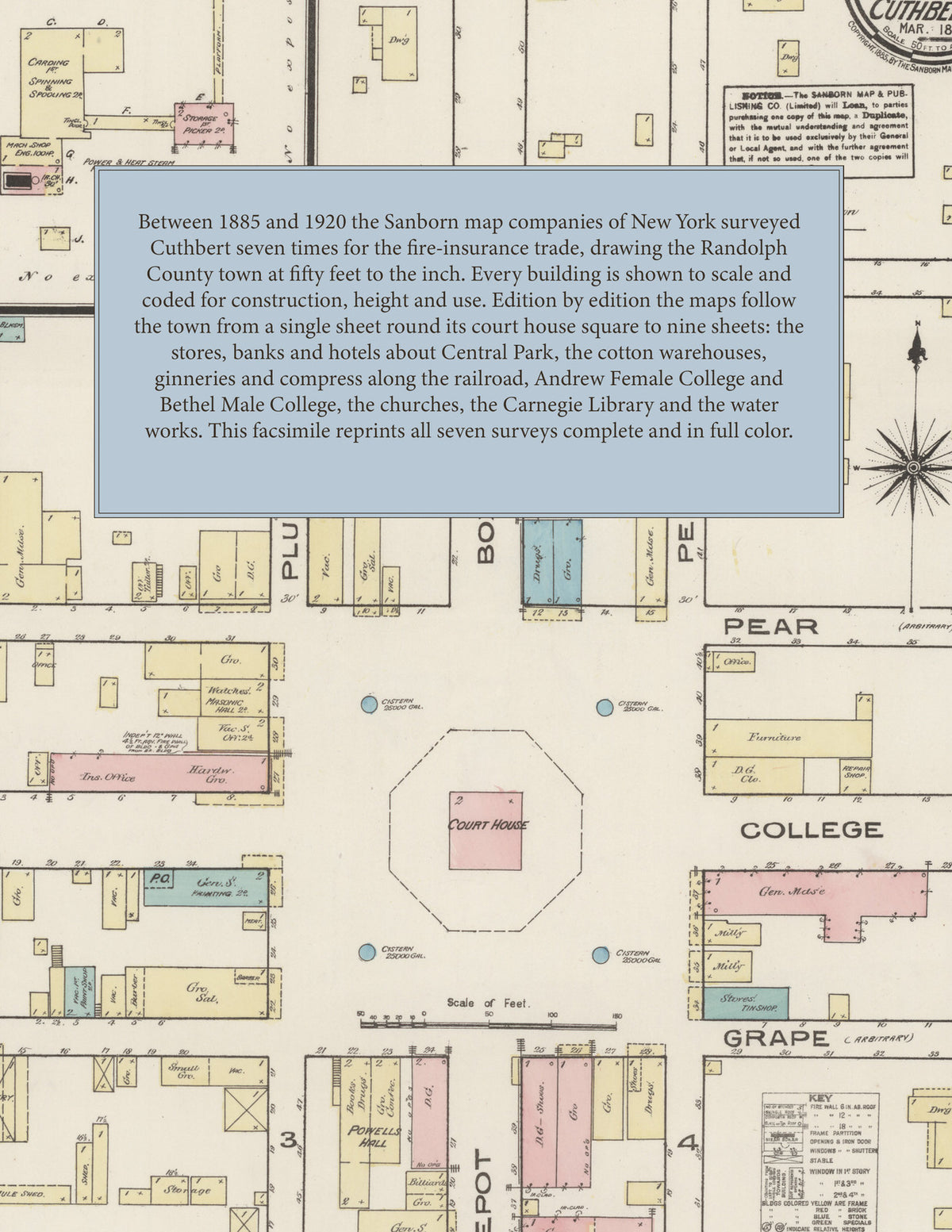
1885-1920 Fire Insurance Maps and Atlas of Cuthbert, Georgia
1885-1920 Fire Insurance Maps and Atlas of Cuthbert, Georgia
Couldn't load pickup availability
Facsimile of the seven Sanborn fire-insurance surveys of Cuthbert, Georgia, made between 1885 and 1920, reproduced in full color from the Library of Congress copies. Together they cover the Randolph County town from 1885 to 1920: the court house square and Central Park, the stores, banks and hotels of Depot, College and Lumpkin streets, the cotton warehouses, ginneries and mill along the railroad, Andrew Female College and Bethel Male College, and the residential streets out to Hamilton Avenue and the Western Cemetery.
In 1885 a single sheet shows the whole town: the Court House in its octagonal square ringed by four cisterns, Masonic Hall, Powell's Hall, Cobbs Hotel, the Post Office, the engine house, liveries and mule sheds, the Planters and Merchants Cotton Warehouse of A. C. Moye and Co., and the carding, spinning and spooling mill of the Randolph Cotton Mfg Co. The 1890 sheet redraws the same blocks. From 1895 each edition opens with a key map and index: in 1895 the County Court House, Hotel Randolph, Castle Duke (Hotel), Andrew Female College, the Baptist, Methodist Episcopal and Presbyterian churches, Liberty Baptist Church (Colored), the Alliance, J. C. Martin, A. J. Moye and J. M. Redding cotton warehouses, Weaver and Co.'s cotton ginnery, F. Allison's lumber yard, C. L. Tumlin's wagon shop and the Randolph Cotton M'f'g Co., marked not in operation. The 1900 survey adds Bethel Male College, the Barnes Hotel, the Opera House, the Central of Ga. R. R. Depot, the Cuthbert Ice Co. and Water Works and A. J. Moye and Sons' ginnery. By 1911 the town has the Bank of Cuthbert, the Bank of Randolph and McPherson's Bank, the County Court House and Jail, Hotel Cuthbert and Hotel Gay, the C. of G. R. R. depots and G. F. and A. R. R. freight house, the Cuthbert Compress Co., Bottling Works, Ice House and Pumping Station and Lighting Plant, the Home Mixture Guano Co., McDonald and Weaver Fertilizer Co., E. A. Jackson's lumber yard, the Payne Institute and Friendship Baptist Church. The 1920 edition reaches the Confederate Monument, band stand and pavilion in Central Park, Andrew College, the Carnegie Library, the First National Bank, the Patterson Sanitarium, the County Convict Camp, Payne Chapel A. M. E. Church, the Chero-Cola Bottling Works, the Cuthbert Crate and Refrigerating Co., the King Lumber Co., the Standard Oil Co. and Gulf Refining Co. and N. M. Weaver's ginnery.
Between 1885 and 1920 the Sanborn map companies of New York surveyed Cuthbert seven times for the fire-insurance trade, drawing the town at fifty feet to the inch, the 1920 edition by its scale bars. Every building is shown to scale and color-coded for construction (yellow for frame, pink for brick, blue for stone), with heights, uses, cotton warehouses, ginneries, cisterns, hydrants and water pipes all marked. From 1895 each edition opens with a key map of the town and an index of named businesses, warehouses, churches, schools and hotels, and a divider page introduces each edition.
This edition is an unabridged facsimile republication of the atlas: all thirty-one map sheets of the seven editions of 1885, 1890, 1895, 1900, 1905, 1911 and 1920, the first sheet of each edition from 1895 on carrying its key map and index, each edition introduced by a divider page. Ideal for local historians, genealogists, architects, preservationists and anyone tracing a Cuthbert address back to 1885-1920.
40 pages. 8.5" x 11". Full color. Paperback.
Printed to order and shipped directly to you — please allow up to 7 business days before shipment.
Satisfaction guaranteed or you can send it back!