1885-1922 Fire Insurance Maps and Atlas of Lawrenceburg, Indiana
1885-1922 Fire Insurance Maps and Atlas of Lawrenceburg, Indiana
Couldn't load pickup availability
Facsimile of the six Sanborn fire-insurance surveys of Lawrenceburg, Indiana, made between 1885 and 1922, reproduced in full color from the Library of Congress copies. Together they cover the Dearborn County town on the Ohio River from the business blocks of High and Walnut Streets around the County Court House to the distilleries, cooperages and furniture factories along the railroad, the Newtown streets on Front, Main and Second, the distilleries at Rossville and Greendale, the fair grounds, churches and schools, and the residential streets out to Ash, Mary and St. Clair Streets.
In 1885 six sheets of Lawrenceburg and Newton show the Court House, the C. I. St. L. & C. R. R. and O. & M. R. R. depots, the distilleries of N. J. Walsh, W. P. Squibb & Co., N. Oester and Rodenberg & Co., Walsh's bonded warehouse, J. B. Garnier's brewery, the Bauer Cooperage Co., the Lawrenceburg Furniture, Mill, Wheel and Woolen Mills companies and gas works, the Miami Stove Works, Yourtee & Co.'s stove works, the Miami Valley and Greendale furniture companies, the Ohio Valley Coffin Co., Tuthill & Co.'s saw mill, the Stedman mill and the town's hotels. The 1891 survey adds the G. Y. Roots Co.'s flour mills, the James & Meyer buggy works, A. D. Cook's stove works and tube well supplies, the C. C. C. & St. L. R. R. depot and the electric light company. By 1896 nine sheets reach the B. & O. R. R. station, the Cereal Distilling Co., the Rossville Distillery, G. H. Bishop & Co.'s edge tool factory, Mitchell Bros.' brick works, M. E. Lee's cooperage and flour mill, the Odd Fellows Opera House, the town hall, the fair grounds and the Newtown public school. The 1902 sheets show N. J. Walsh & Co.'s Rossville Distillery and the Greendale Distilling Co. with their bonded warehouses and steel grain tanks. In 1910 eleven sheets add the Batesville Lumber & Veneer Co., the James & Meyer Buggy Co., the Diehl fireworks factory, G. H. Bishop & Co.'s paper box factory and saw factory, the Lawrenceburg Roller Mills, Lumber, Gas and Coke and Sanitary Milk companies, the A. Wieman & Co. frame factory, W. P. Squibb & Co.'s Registered Distillery No. 8, the Greendale public school and St. Lawrence church and school. The eleven sheets of 1922 reach the Greendale Co. and Rossville Co. industrial distilleries, the Theroz Co.'s solidified alcohol works, the Hawthorne Milling Co., A. D. Cook's pump and well supply works, the Standard Vehicle Co., the Frolicher Shoe Co., the Ohlen-Bishop Co.'s paper box and saw factories, Suer Bros.' brick yard, the electric light plant and water works and the public library.
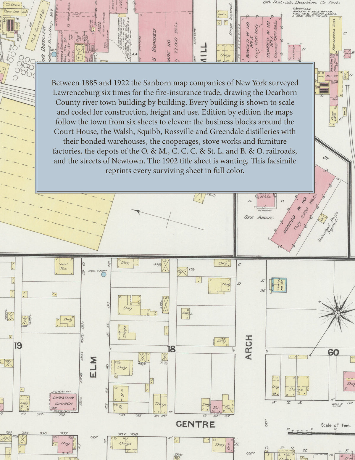
Between 1885 and 1922 the Sanborn map companies of New York surveyed Lawrenceburg six times for the fire-insurance trade, drawing the town at fifty feet to the inch (the 1902 and 1922 editions by their scale bars). Every building is shown to scale and color-coded for construction (yellow for frame, pink for brick, blue for stone), with heights, uses, distillery and factory machinery, hydrants and water pipes all marked. Every edition but 1902, whose title sheet is wanting, carries a key map of the town and an index of named businesses, distilleries, factories, churches, schools and hotels, and a divider page introduces each edition.
This Tangletown Press edition is an unabridged facsimile republication of the atlas: all fifty-three surviving map sheets of the six editions of 1885, 1891, 1896, 1902, 1910 and 1922, with the key map and index of every edition except 1902, whose title sheet is wanting, each edition introduced by a divider page. Ideal for local historians, genealogists, architects, preservationists and anyone tracing a Lawrenceburg address back to 1885-1922.
62 pages. 8.5" x 11". Full color. Paperback.
Printed to order and shipped directly to you — please allow up to 7 business days before shipment.
Satisfaction guaranteed or you can send it back!