1885-1923 Fire Insurance Maps and Atlas of Longview, Texas
1885-1923 Fire Insurance Maps and Atlas of Longview, Texas
Couldn't load pickup availability
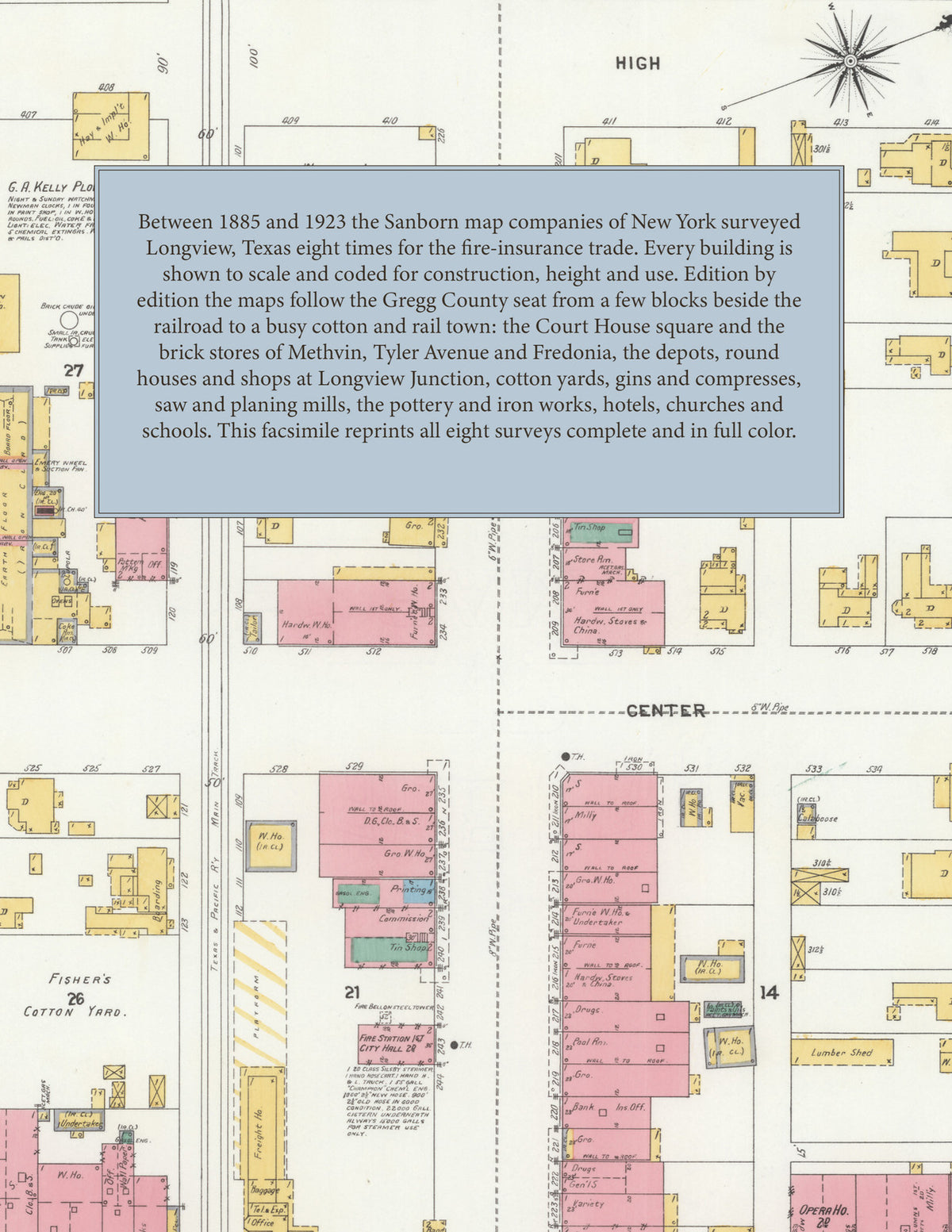
Facsimile of the eight Sanborn fire-insurance surveys of Longview, Texas, made between 1885 and 1923, reproduced in full color from the Library of Congress copies. Together they cover the Gregg County seat from its railroad depot grounds to 1923: the stores and brick business blocks of Methvin, Tyler Avenue, Fredonia and Center around the Court House square, the depots, yards and cotton yards along the railroad, Longview Junction, and the residential streets out to Northcutt Heights, Mobberly Avenue and the County Fair Park.
In 1885 three sheets show the young town beside the railroad: the Mobberly House and Junction Hotel, the Court House square between North and Methvin, the Presbyterian church, L. Letcher's wagon yard and the stores along Fredonia, Methvin and Fifth Street. The 1890 survey adds a key map of the Texas & Pacific R.R. and the International & Great Northern R.R., the Union Passenger Station, the Magnolia and Mobberly hotels, the Opera House, G. A. Kelley's plow works, Brown & Flewellen's saw and planing mills and the Waters-Pierce Oil Co.'s warehouse. By 1901 the maps reach Longview Junction and the Texas, Sabine Valley & Northwestern R.R. shops, the City Hall, Masonic Temple, Flanders Hotel, Fisher's cotton yard, C. W. Lawrence's cotton gin and the Longview Cotton Oil-mill Co. The 1906 edition shows twelve sheets: R. G. Brown's saw and planing mill, the City Water Works pumping station, the Longview Pottery Works, Box & Wooden Ware M'f'g Co., Iron Works and Ice, Light and Bottling Co., the Castleberry & Flewellen saw mill, the Ansley Hotel and the Gulf, Colo. & S. Fe round house and shops. In 1911 and 1916 come the Loeb Compress Co., the Longview Mattress & Bedding Co., the Grand M'f'g Co.'s crate and basket factory, the Shippers' Compress & Warehouse Co., the High School, the Post Office, the Rembert Theatre, St. Anthony's R. C. Church and School and the Northcutt Heights School. The 1923 edition spreads over nineteen sheets, from the T. & P. R. R. depot, Union Depot and round house, the Palace Hotel, the Armory and the Edwards-Young Casket & M'f'g Co. to the Rodgers Lumber Co.'s saw and planing mills, the oil stations of the Texas Co. and Producers Refining Co., Greenwood and Grace Hill cemeteries and the County Fair Park.
Between 1885 and 1923 the Sanborn map companies of New York surveyed Longview eight times for the fire-insurance trade, drawing the town at fifty feet to the inch and, in 1923, at one hundred feet to the inch. Every building is shown to scale and color-coded for construction (yellow for frame, pink for brick, blue for stone), with heights, uses, hydrants, water pipes, cotton yards, gins and railroad tracks all marked. From 1890 each edition adds an index of streets and named businesses, mills, churches, schools and hotels and a key map of the whole town, and a divider page introduces each edition.
This Tangletown Press edition is an unabridged facsimile republication of the atlas: all seventy-eight map sheets of the eight editions of 1885, 1890, 1896, 1901, 1906, 1911, 1916 and 1923, with the indexes and key maps of the 1890 to 1923 editions, each edition introduced by a divider page. Ideal for local historians, genealogists, architects, preservationists and anyone tracing a Longview address back to 1885-1923.
88 pages. 8.5" x 11". Full color. Paperback.
Printed to order and shipped directly to you — please allow up to 7 business days before shipment.
Satisfaction guaranteed or you can send it back!