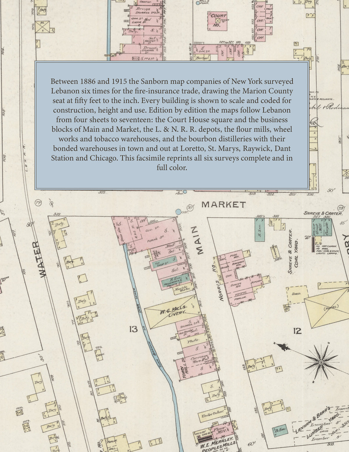
1886-1915 Fire Insurance Maps and Atlas of Lebanon, Kentucky
1886-1915 Fire Insurance Maps and Atlas of Lebanon, Kentucky
Couldn't load pickup availability
Facsimile of the six Sanborn fire-insurance surveys of Lebanon, Kentucky, made between 1886 and 1915, reproduced in full color from the Library of Congress copies. Together they cover the Marion County seat: the Court House square and the business blocks of Main and Market streets, the L. & N. R. R. depots on the Knox Branch and the Cumberland & Ohio Branch, the distilleries, mills and tobacco warehouses along the railroad and Hardins Creek, the residential streets out to Woodlawn Avenue and the city limits, and the outlying distilleries and colleges at Loretto, St. Marys, Raywick, Dant Station and Chicago.
In 1886 four sheets show the Court House and Town Hall, the business blocks of Main and Market streets, the Norris House and Faraher House hotels, W. E. Merkley's People's Mills, Owen Rubel's carriage factory, Lanham & Barr's lumber yard, St. Augustine's Academy, the First Presbyterian Church and the distilleries of Chas. Kobert & Co., Wathen, Mueller & Co., R. B. Lancaster and Boldrick and Callaghan. The 1890 survey adds a key map and index with the distilleries of Blair & Ballard, R. Cummings & Co., J. W. Dant, W. H. Head & Co. and Smith & Smith, E. Britney's tannery, A. Offutt's planing mill, the Lebanon Electric Light & Ice Co., Gas Light Co. and Water Works, City Hall and the Veranda Hotel. In 1895 the Royer Wheel Co., Humkey & Scott's carriage works, B. F. Mattingly's distillery and the Lebanon Roller Mills appear, and 1901 adds the Cumberland and Rolling Fork distilleries, the Jesse Moore Hunt Co., Van Cleave & Hardesty, J. A. Sterk's cooperage and Elizabeth's Hospital. The editions of 1908 and 1915 reach the American Tobacco Co., the Marion County Tobacco Warehouse Co., the Modern Mill & Elevator Co., the Brown-Forman Distilling Co., the Dant Distillery Co., Burks Spring Distillery Co., Thixton, Millett & Co., the Lebanon Brick and Tile Co., Hardwood Flooring Co. and Opera House, the Standard Oil Co., the Masonic Temple, the Post Office, the Vaughan and New Hardesty hotels, Loretto Academy, St. Mary's College and St. Augustine's Catholic Church and School.
Between 1886 and 1915 the Sanborn map companies of New York surveyed Lebanon six times for the fire-insurance trade, drawing the town at fifty feet to the inch (the 1915 edition by its scale bars). Every building is shown to scale and color-coded for construction (yellow for frame, pink for brick, blue for stone), with heights, uses, distillery stills, bonded warehouses, railroad tracks, hydrants and water pipes all marked. From 1890 each edition opens with a key map and an index of named businesses, distilleries, mills, churches, schools and hotels, and a divider page introduces each edition.
This Tangletown Press edition is an unabridged facsimile republication of the atlas: all fifty-eight map sheets of the six editions of 1886, 1890, 1895, 1901, 1908 and 1915, with the key maps and indexes of the 1890, 1895, 1901, 1908 and 1915 editions, each edition introduced by a divider page. Ideal for local historians, genealogists, architects, preservationists and anyone tracing a Lebanon address back to 1886-1915.
66 pages. 8.5" x 11". Full color. Paperback.
Printed to order and shipped directly to you — please allow up to 7 business days before shipment.
Satisfaction guaranteed or you can send it back!