1886-1918 Fire Insurance Maps and Atlas of Columbia City, Indiana
1886-1918 Fire Insurance Maps and Atlas of Columbia City, Indiana
Couldn't load pickup availability
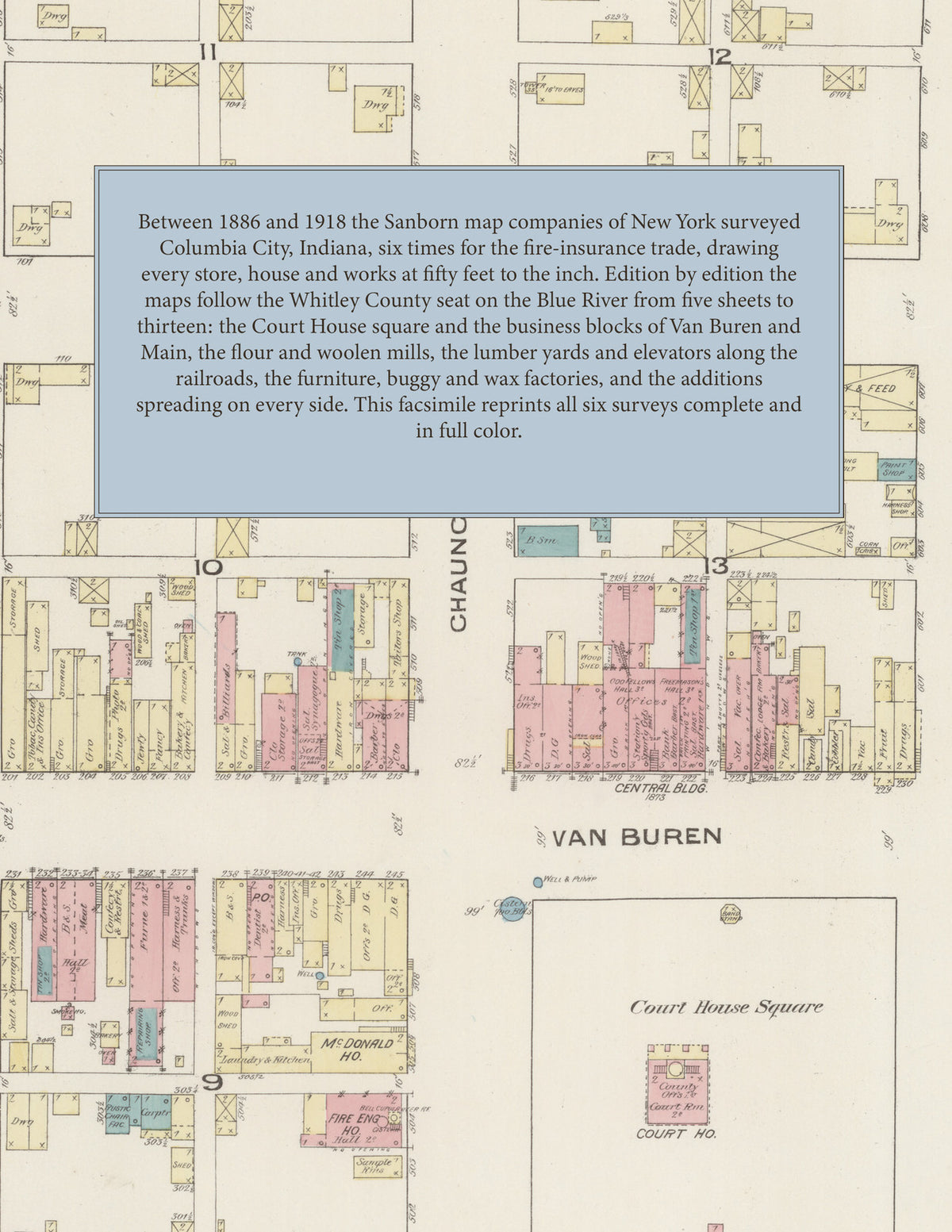
Facsimile of the six Sanborn fire-insurance surveys of Columbia City, Indiana, made between 1886 and 1918, reproduced in full color from the Library of Congress copies. Together they cover the Whitley County seat on the Blue River: the Court House square and the business blocks of Van Buren, Main and Chauncey Streets, the flour mills, woolen mills, lumber yards and elevators along the railroads, the furniture, buggy and wax factories, and the churches, schools and residential additions on every side of the town.
The five sheets of January 1886 open with a key map, index and signed certificate and show the County Court House and Jail, the Central Building, Foust Block and Opera House, the Maine Hotel, the Columbia City Brewing Co. and its flour mills, stave works and woolen mill, the Eel River Woolen Mill Co., the City and Tuttle flour mills, the Hydrocarburetted Coal Gas M'f'g Co., S. J. Peabody's saw mill, the Winker Brace Factory and the Wab., St. L. & P. R. R. depot and elevator. The seven sheets of February 1890 add the new County Court House, the City Electric Light Plant, the Clugston, Hollinger, Tuttle and Myer & Click blocks, the Hoosier Foundry & Mach. Works, G. H. Harper's wagon shop, St. Joseph's School and the West End Public School. In October 1897 eleven sheets reach the Columbia City Water Works, Heel Co. and Cash Lumber Co., the Eagle Brewery, the McNown M'f'g Co., the Waidlich Buggy Body Co., D. Myers & Son's creamery, the Chambers Hotel and the P. Ft. W. & C. R. R. depot and elevator. August 1905 adds the City Hall, Masonic Temple, Peerless Mills, Kraus & Apfelbaum's wool warehouse, the Vandalia R. R. depots and grain elevator and P. Zuber's tile and brick yard, and the twelve sheets of December 1910 the Post Office and Public Library, the Whitley County Hospital, the Superior Garment Co. overall factory, the Dicks & Wiggin Co. sealing wax factory and the Wagner Floral Co. The thirteen sheets of February 1918 show the Columbia City Woolen Mills and Water Works & Electric Light Plant, the Farmers' Mill and Elevator Co., the Pike Lake Ice Co., F. W. Vance Co.'s canning factory, the Simplex Gas Lighting Co., the Riverside Dairy and the P. C. C. & St. L. and P. F. W. & C. depots.
Between 1886 and 1918 the Sanborn map companies of New York surveyed Columbia City six times for the fire-insurance trade, drawing the town at fifty feet to the inch. Every building is shown to scale and color-coded for construction (yellow for frame, pink for brick, blue for stone), with heights, uses, wells, hydrants and water pipes all marked. Each edition opens with a key map of the whole town and an index of named mills, factories, businesses, churches, schools and public buildings, and a divider page introduces each edition.
This Tangletown Press edition is an unabridged facsimile republication of the atlas: all fifty-nine map sheets of the six editions of 1886, 1890, 1897, 1905, 1910 and 1918, with the key map and index of every edition, each edition introduced by a divider page. Ideal for local historians, genealogists, architects, preservationists and anyone tracing a Columbia City address back to 1886-1918.
68 pages. 8.5" x 11". Full color. Paperback.
Printed to order and shipped directly to you — please allow up to 7 business days before shipment.
Satisfaction guaranteed or you can send it back!