1886-1919 Fire Insurance Maps and Atlas of Miamisburg, Ohio
1886-1919 Fire Insurance Maps and Atlas of Miamisburg, Ohio
Couldn't load pickup availability
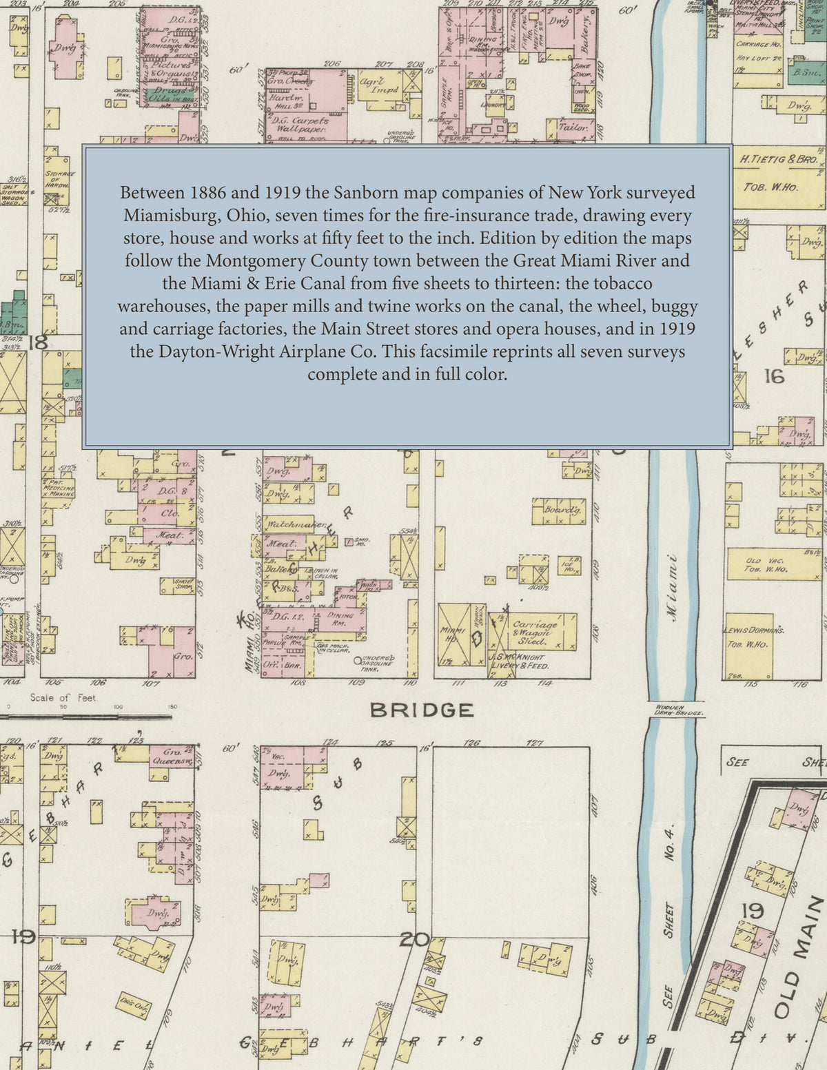
Facsimile of the seven Sanborn fire-insurance surveys of Miamisburg, Ohio, made between 1886 and 1919, reproduced in full color from the Library of Congress copies. Together they cover the Montgomery County town between the Great Miami River and the Miami & Erie Canal: the stores of Main Street, the tobacco warehouses, the paper mills and twine works along the canal and the hydraulic, the railroad depots, and the residential streets and additions on both sides of the canal.
The five sheets of April 1886 open with a key map and index and show the Miami Valley Paper Mills, the Ohio Paper Co. and its pulp mill, the Excelsior Twine Binder Works, Hoover & Gamble's twine binder works, the Miamisburg Binder Twine & Cordage Co., the Miamisburg Mowing Machine Co., U. Engleman's flour mill, D. Groby's sash and blind factory, the Kauffman Buggy Co., the Miami Valley Brewery, the tobacco warehouses of H. Tietig & Bro., Rothschild & Co. and G. Schubert, the C. C. C. & I. and C. H. & D. depots, the Star City Opera House, Town Hall, Kress Hotel and Washington Hotel. The seven sheets of April 1892 add the Acme Folding Boat Co., the American Wheel Works, the Bookwalter Wheel Co., the Enterprise Carriage M'f'g Co., G. H. Friend's paper company, the Thomson-Houston Electric Light Works, the Baum Hotel & Opera House and the public schools. In July 1896 eight sheets show the Miamisburg Paper Co., the Miamisburg Twine & Cordage Co., the Victoria Cordage Co., the Miami Valley Machine Works, the Miamisburg Brewing Co. and Star Bottling Co. and Hotel Young, and the eight new sheets of October 1901 add the Franklin Electric and M'f'g Co., the Globe Foundry Co., the Star City Sash, Door and Blind Factory, the Riverside Hotel and the Park. The nine sheets of June 1905 show the Mitchell Wheel Co., the J. C. Groendyke Twine Co., the Miamisburg Ice and Cold Storage Co., the Water Works, the Armory and the Toedtmann Cigar Co.; the eleven sheets of October 1911 add the Masonic Temple, I. O. O. F. Block, Post Office, Carnegie Library, First National Bank Building, the B. & O. depots and Grove & Weber's planing mill. The thirteen sheets of March 1919 show the Dayton-Wright Airplane Co., the General Cigar Co. factory, the American Cigar Co. and Miami Grower's leaf tobacco warehouses, the Miami Foundry Co., the National Stove Repair Co., Hoover & Gamble's binder twine machinery works, the High School and the Public Library.
Between 1886 and 1919 the Sanborn map companies of New York surveyed Miamisburg seven times for the fire-insurance trade, drawing the town at fifty feet to the inch. Every building is shown to scale and color-coded for construction (yellow for frame, pink for brick, blue for stone), with heights, uses, wells, hydrants and water pipes all marked. Each edition opens with a key map of the whole town and an index of named factories, warehouses, businesses, churches, schools and public buildings, and a divider page introduces each edition.
This Tangletown Press edition is an unabridged facsimile republication of the atlas: all sixty-one map sheets of the seven editions of 1886, 1892, 1896, 1901, 1905, 1911 and 1919, with the key map and index of every edition, each edition introduced by a divider page. Ideal for local historians, genealogists, architects, preservationists and anyone tracing a Miamisburg address back to 1886-1919.
70 pages. 8.5" x 11". Full color. Paperback.
Printed to order and shipped directly to you — please allow up to 7 business days before shipment.
Satisfaction guaranteed or you can send it back!