1886-1922 Fire Insurance Maps and Atlas of Albia, Iowa
1886-1922 Fire Insurance Maps and Atlas of Albia, Iowa
Couldn't load pickup availability
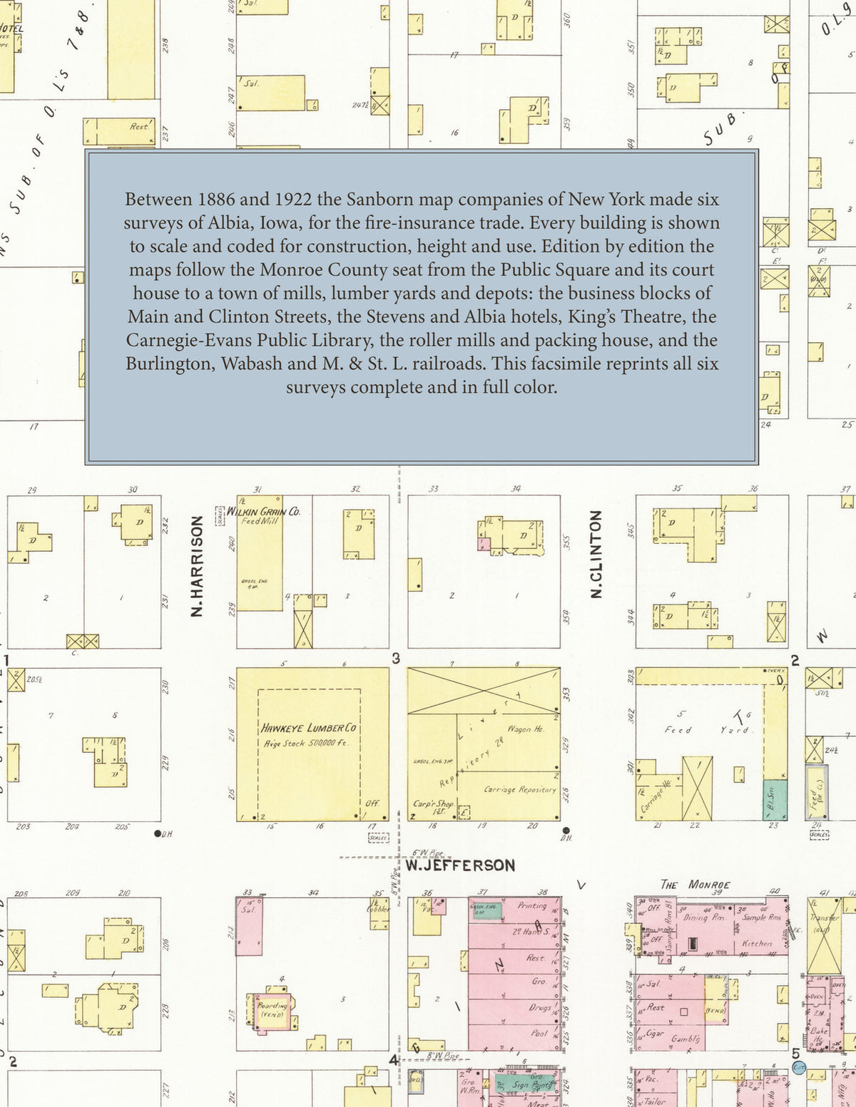
Facsimile of the six Sanborn fire-insurance surveys of Albia, Iowa, made between 1886 and 1922, reproduced in full color from the Library of Congress copies. Together they cover the Monroe County seat from the Public Square and its court house outward: the business blocks of Main and Clinton Streets and Benton and Washington Avenues, the depots and yards of the Chicago, Burlington & Quincy and Wabash railroads, the mills and lumber yards, and the residential additions on every side of the square.
In 1886 two sheets show the Public Square with the court house at its center, the stores on the four streets around it, a M. E. Church, lumber yards and the first residential blocks. The 1891 and 1899 surveys follow the town out to the C. B. & Q. R. R. tracks, with an index of streets and named buildings. By 1907 seven sheets show the C. B. & Q. R. R. depot, the I. C. & W. R. R. depots and stock pens, the Cottage Hotel, The Monroe, the Hawkeye Lumber Co., Clark Bros.' implement storage, the Wilkin Grain Co. feed mill, King's Opera House, the Love Block, the Perry Building, the I. O. O. F. Building, the C. W. Monroe Packing Co., Pepper's Livery, the Friends Church, St. Mary's Catholic Church, the United Presbyterian Church and the Grant Public School and High School. The 1913 edition adds a key map with insets of the Albia Roller Mills, the Albia Packing Co. and the Albia Creamery Co., the Hotel Wilcox, the Citizen's Lumber Co., Falvey Bros. lumber yard, J. Z. Evans M'f'g and Supply Co., Diamond Bottling Works, Worth's Electric Laundry and the Washington and Jefferson public schools. The 1922 survey reaches the M. & St. L. R. R. depots, the Albia Light and Railway Co.'s power house, car barns and gas works, the Stevens, Albia and Byerlee hotels, King's Theatre, the Carnegie-Evans Public Library, the City Hall, Fire Department and Telephone Exchange, the County Court House and Jail, the Miner's Hospital, the United Mine Workers of America District No. 13 hall, W. H. Kreger Creamery Co., the Sinclair, Standard and S. L. Collins oil companies, and the Lincoln Public School.
Between 1886 and 1922 the Sanborn map companies of New York made six surveys of Albia for the fire-insurance trade, the first five drawn at fifty feet to the inch and the 1922 edition with its own scale bars. Every building is shown to scale and color-coded for construction (yellow for frame, pink for brick, blue for stone), with heights, uses, hydrants and water pipes all marked. The later editions add an index of streets and named businesses, churches, schools and hotels, the 1913 and 1922 editions add a key map of the whole town, and a divider page introduces each edition.
This Tangletown Press edition is an unabridged facsimile republication of the atlas: all thirty-nine map sheets of the six editions of 1886, 1891, 1899, 1907, 1913 and 1922, with the indexes of the later editions and the key maps of 1913 and 1922, each edition introduced by a divider page. Ideal for local historians, genealogists, architects, preservationists and anyone tracing a Albia address back to 1886-1922.
48 pages. 8.5" x 11". Full color. Paperback.
Printed to order and shipped directly to you — please allow up to 7 business days before shipment.
Satisfaction guaranteed or you can send it back!