1886-1922 Fire Insurance Maps and Atlas of Petersburg, Illinois
1886-1922 Fire Insurance Maps and Atlas of Petersburg, Illinois
Couldn't load pickup availability
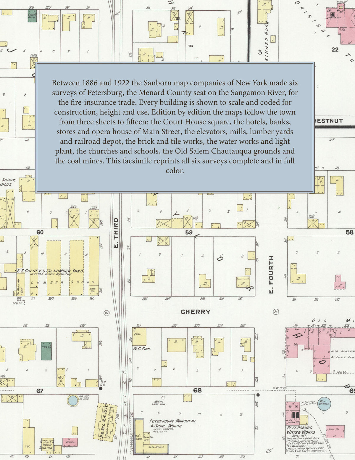
Facsimile of the six Sanborn fire-insurance surveys of Petersburg, Illinois, made between 1886 and 1922, reproduced in full color from the Library of Congress copies. Together they cover the Menard County seat on the Sangamon River: the stores, banks and hotels around the Court House square on Main Street, Sheridan Road and Jackson Street, the elevators, mills and lumber yards along the railroad and the river, the residential streets of John Taylor's, Harris's and Wright's additions, and, by 1922, the Old Salem Chautauqua grounds, the coal mines and the County Farm.
In April 1886 three sheets show the town on the Sangamon River, with the Martin Hatfield Mill and the Public School. The December 1892 survey of four sheets and the March 1901 survey of five add the water works with its iron tank drawing from the Sangamon, the W. L. Wilm Elevator and the old station. By June 1909 six sheets and an index name the Menard County Court House and jail, the City Hall, Fire Department, Post Office and Carnegie Library, the Commercial Hotel, Hotel Smoot and Williamson House, the First Harris Opera House, the Eagle Roller Mills and Huffner's roller mill, the Charter Oak and Frankelton elevators, the C. P. and St. L. R. R. depot, E. S. Cheney and Company's lumber yard and sheds, Apken's lumber yard, the Petersburg Bottling Works, Electric Light Plant, Monument and Stone Works and Water Works, the Sangamon Steam Laundry, Levering's ice houses, Edward Shipps's winter circus, the Salveson brick yard and greenhouses, Anderson's tile works, the Junction Coal Shaft, the South Mountain Coal Company, the Virginia Canning Company, the High School and public schools, the Baptist, Bethlehem Lutheran, Catholic, Christian, Cumberland Presbyterian, Episcopal, Methodist Episcopal and Presbyterian churches, and the Old Salem Cumberland Presbyterian State Chautauqua Association. The August 1914 edition has seven sheets. In November 1922 fifteen sheets reach the Abbott Light and Power Company's power house and transformer station, the Lincoln Inn, Hotel Eckman, Opera House, Auditorium, Masonic Hall and Brownell Memorial Hall, the Public Library, City Hall and Post Office, the Petersburg Face Brick and Tile Company, Mallergren's ice plant, Brass's canning factory, the Old Salem, Black Diamond, Riverside and Amberger coal mines, the County Farm, the Chautauqua buildings, the Lincoln Memorial Church, St. Paul's Evangelical Church, St. Peter's R. C. Church and School, and the First Ward and Third Ward public schools.
Between 1886 and 1922 the Sanborn map companies of New York made six surveys of Petersburg for the fire-insurance trade, the editions of 1886 to 1909 at fifty feet to the inch. Every building is shown to scale and color-coded for construction (yellow for frame, pink for brick, blue for stone), with heights, uses, elevators, mills, lumber piles, hydrants and water pipes all marked. The editions of 1909, 1914 and 1922 add a key map of the whole town and an index of streets and of named businesses, churches, schools and public buildings, and a divider page introduces each edition.
This Tangletown Press edition is an unabridged facsimile republication of the atlas: all forty map sheets of the six editions of 1886, 1892, 1901, 1909, 1914 and 1922, with the indexes of the 1909, 1914 and 1922 editions and their key maps, each edition introduced by a divider page. Ideal for local historians, genealogists, architects, preservationists and anyone tracing a Petersburg address back to 1886-1922.
48 pages. 8.5" x 11". Full color. Paperback.
Printed to order and shipped directly to you — please allow up to 7 business days before shipment.
Satisfaction guaranteed or you can send it back!