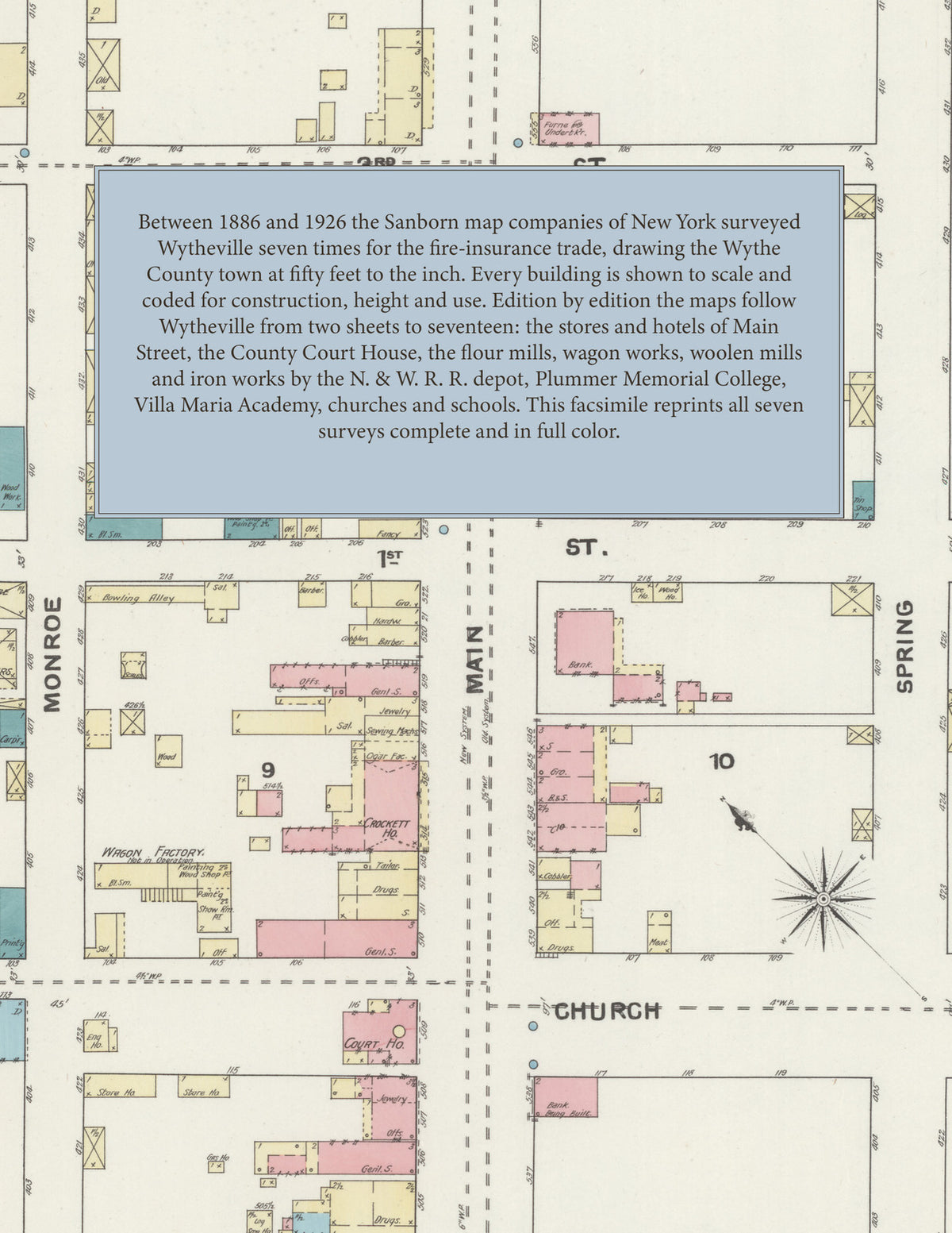
1886-1926 Fire Insurance Maps and Atlas of Wytheville, Virginia
1886-1926 Fire Insurance Maps and Atlas of Wytheville, Virginia
Couldn't load pickup availability
Facsimile of the seven Sanborn fire-insurance surveys of Wytheville, Virginia, made between 1886 and 1926, reproduced in full color from the Library of Congress copies. Together they cover the Wythe County town from the business blocks of Main Street around the County Court House outward: the flour mills, wagon works and factories along the N. & W. R. R., the churches, hotels and schools of Church, Franklin, Spring, Monroe and Washington Streets, and the residential streets out to Fourteenth Street and Fairground Road.
In 1886 two sheets show Main, Monroe and Spring Streets with Foot & Johnson's wagon works, and in 1891 three sheets index the County Court House, the Crockett, Boyd's, Fourth Avenue, Hancock, Jackson Park, Mountain View and Shores hotels, Sexton's Hall, the Episcopal Church, the Electric Light Station, M. W. Bishop's flour mill, Schrader Bros.' wagon works, H. E. McWane & Co.'s plow factory, the Wytheville Mill, the Wytheville Ice & Dairy Co. and the Wytheville Woolen & Knitting Mill Co. beside the N. & W. R. R. depot. The 1903 edition adds a key map, the Academy of the Visitation and Catholic Convent, the Baptist, Lutheran, Presbyterian and St. Paul's M. E. churches, the Opera House, the Jail, the Hotel Otey and Hotel Boyd, W. H. Dodgion's planing mill, A. F. Stone's roller mills, the Standard Oil Co. and the Wytheville Foundry & Mach. Co. By 1908 ten sheets reach the City Hall, Christ Church, Plummer Memorial College, the Wytheville Iron Works, the Wytheville M'f'g Co., the Wytheville Crystal Ice Co. and E. H. McDonald's foundry and machine shop, and in 1913 the First National Bank Building, the Initial Co.'s embroidery initial factory, the Monarch Milling Co. and J. F. Johnson's flour mills, the Post Office, the Hotel Lindsey and Villa Maria Academy. The 1921 survey adds the Appalachian Power Co. sub-station, the Library, the Masonic Hall, the Christian Church, the Telephone Exchange, the Wytheville High School, Granite & Marble Works, Steam Laundry and Woolen Mills, the Valley of Virginia Butter Co.'s creamery and the Wythe Cooperage Shop, and the 1926 edition, on seventeen sheets, the Gibboney Hall Inn, the Baldock Hotel, Boyd Manor, the Inspiration Knitting Mills, Inc., St. John's Episcopal Church, the Betterway Laundry, the Wytheville Coal and Ice Co. and Creamery, the Stephens Mink Ranch and Menagerie and the Wytheville Woolen Mills, Inc.
Between 1886 and 1926 the Sanborn map companies of New York surveyed Wytheville seven times for the fire-insurance trade, every edition drawing the town at fifty feet to the inch (the 1926 edition by its scale bars). Every building is shown to scale and color-coded for construction (yellow for frame, pink for brick, blue for stone), with heights, uses, railroad tracks, mill machinery, hydrants and water pipes all marked. From 1891 each edition carries an index of named businesses, mills, churches, schools and hotels, from 1903 a key map of the whole town, and a divider page introduces each edition.
This Tangletown Press edition is an unabridged facsimile republication of the atlas: all sixty map sheets of the seven editions of 1886, 1891, 1903, 1908, 1913, 1921 and 1926, with the indexes of the 1891 to 1926 editions and the key maps of 1903 to 1926, each edition introduced by a divider page. Ideal for local historians, genealogists, architects, preservationists and anyone tracing a Wytheville address back to 1886-1926.
70 pages. 8.5" x 11". Full color. Paperback.
Printed to order and shipped directly to you — please allow up to 7 business days before shipment.
Satisfaction guaranteed or you can send it back!