1887-1905 Fire Insurance Atlas of Athol, Massachusetts, Volume 1
1887-1905 Fire Insurance Atlas of Athol, Massachusetts, Volume 1
Couldn't load pickup availability
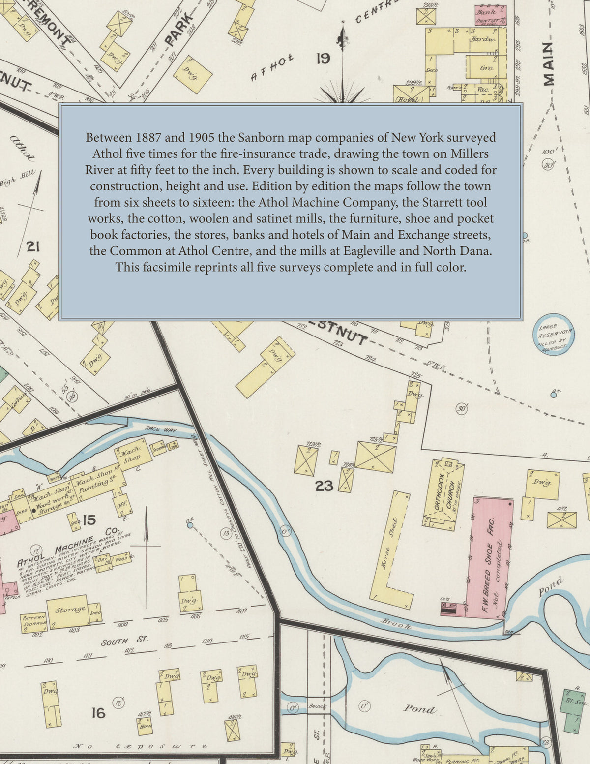
Facsimile of the five Sanborn fire-insurance surveys of Athol, Massachusetts, made between 1887 and 1905, reproduced in full color from the Library of Congress copies. Together they cover the town on Millers River, with the outlying mills at Eagleville, Pinedale, Tully and North Dana: the stores, banks and hotels of Main Street and Exchange Street, the mills and factories along the river, the brook and the mill ponds, the Common and the streets of Athol Centre, and the residential streets out to River Bend and Silver Lake.
In November 1887 six sheets show the Athol Machine Company's foundry and shops, the L. Starrett tool factory, the Millers River Manufacturing Company, the Bennett and Von Valkenburg and F. Cheney cotton mills, W. H. Caufman's woolen mill, the furniture factories of J. M. Cheney, C. Miller, L. Morse and Sons, J. Peirce and the Eagle Furniture Company, the Lee and Breed shoe factories, Bates Brothers' pocket book factory, Hapgood and Smith's match splint works, the Fitchburg R. R. depot, the Pequoig, Summit, Stevens and Exchange Street hotels, Tyler Hall and the Baptist, Orthodox and Unitarian churches. By April 1892 ten sheets add the Academy of Music, the Athol Gas and Electric Light Company, the Athol Reed and Rattan, Shoe, Silk and Soap Stone works, Goddard and Manning's piano case factory, the Eagleville and Partridge satinet mills, the Pinedale woolen mill, the Tully mill, the Town Hall at Athol Centre, and the straw hat, box and woolen mills at North Dana. The December 1896 survey of twelve sheets shows the Athol Opera House, Athol House, Hamilton Block, the Athol Carriage Works, Sawyer Tool Company, L. S. Starrett Company's tool factory and the Worcester North-West Agricultural Society; in December 1900 thirteen sheets add the Diamond Match Company, Gay and Ward's machine works, the High School, the Windsor House, Wilcox's comb factory and the B. and A. R. R. freight house. In March 1905 sixteen sheets reach the B. and M. R. R. passenger depot, the Y. M. C. A. Building, the Public Library, the Pythian, Bank and Union blocks, the Transcript Building, St. John's Episcopal and the Catholic churches, the Lake Park and Main Street schools and Silver Lake.
Between 1887 and 1905 the Sanborn map companies of New York surveyed Athol five times for the fire-insurance trade, drawing the town at fifty feet to the inch. Every building is shown to scale and color-coded for construction (yellow for frame, pink for brick, blue for stone), with heights, uses, mill machinery, power, watchmen, hydrants and water pipes all marked. Each edition opens with a key map of the whole town and an index of streets and of named businesses, mills, churches, schools and hotels, and a divider page introduces each edition.
This Tangletown Press edition is an unabridged facsimile republication of the atlas: all fifty-seven map sheets of the five editions of 1887, 1892, 1896, 1900 and 1905, each edition with its key map and its index of streets and specials, each introduced by a divider page. Ideal for local historians, genealogists, architects, preservationists and anyone tracing a Athol address back to 1887-1905.
64 pages. 8.5" x 11". Full color. Paperback.
Printed to order and shipped directly to you — please allow up to 7 business days before shipment.
Satisfaction guaranteed or you can send it back!