1887-1914 Fire Insurance Maps and Atlas of Fayetteville, Tennessee
1887-1914 Fire Insurance Maps and Atlas of Fayetteville, Tennessee
Couldn't load pickup availability
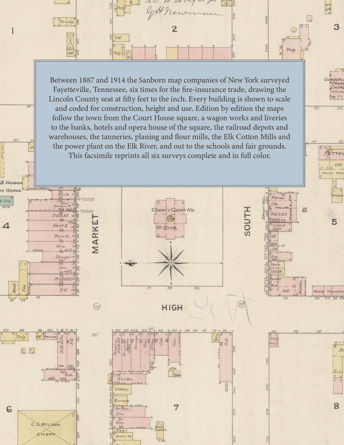
Facsimile of the six Sanborn fire-insurance surveys of Fayetteville, Tennessee, made between 1887 and 1914, reproduced in full color from the Library of Congress copies. Together they cover the Lincoln County seat: the Court House square and the stores, banks and hotels of Market, South, Water and High streets (by 1914 College, Market, Elk and Main avenues), the residential blocks out to Washington, Franklin, Mulberry, Lincoln and Bellview, the depots and warehouses along the N. C. & St. L. R. R., and the mills, gin and tanneries out to the Elk River.
In June 1887 two sheets show the County Court House on the public square ringed by stores, the Masonic Hall, J. S. Vaughn's wagon works, the C. S. Wilson and R. M. Wilson liveries and the Cumberland Presbyterian Church, with the Episcopal and Christian churches, the McElroy House and J. L. Waggoner's Fayetteville Planing Mill on Water, Franklin, Mud and Washington streets. The 1891 edition adds a key map and index: the N. C. & St. L. R. R. depot, the American Ice & Cold Storage Co., Bearden & Thomas' flour mill, the Elk River Mill, H. D. Medearis & Co.'s tannery, G. H. Platt & Co.'s wool carding, W. R. & T. H. Smith's stock yard, the Williams & Swainson and G. L. Waggoner planing mills, the Pope Hotel, Bright Hall, Dick White College, the Fayetteville Collegiate Institute and the Baptist and Methodist churches. By 1897 the Ellis House, the Presbyterian Church and the Standard Oil Co. warehouse appear, and 1902 brings the Citizens Opera House, the Fayetteville Electric Light Plant and B. F. Marshall's grist mill and cotton gin. The 1907 survey reaches the Elk Cotton Mills, the Elk National Bank and First National Bank Building, the Fayetteville Coal & Ice Co., Mill Co. and Tobacco Works, the Harms Milling Co., W. J. Landers & Co.'s tannery, the Williams & Haas Lumber Co., the Fire Department, the High School and Morgan School and the railroad's freight and passenger stations. In 1914 nineteen sheets spread to the Fayetteville Light & Power Co.'s water-power plant on the Elk River, the Coca-Cola Bottling Works, the Crystal Steam Laundry, the Fayetteville Tannery and M'f'g Co., the Stock Yard Co., the Hiller Morris Lumber Co., J. A. Sloan & Co.'s and the Strong, Bagley & Bagley warehouses, the Post Office, the Spon Hotel and Moores House, the County Jail and County School, the Public High School and the Lincoln County Fair Association.
Between 1887 and 1914 the Sanborn map companies of New York surveyed Fayetteville six times for the fire-insurance trade, drawing the town at fifty feet to the inch (the 1914 edition by its scale bars). Every building is shown to scale and color-coded for construction (yellow for frame, pink for brick, blue for stone), with heights, uses, mill machinery, hydrants, water pipes and fire stations all marked. From 1891 each edition opens with a key map of the town and an index of its named businesses, churches, schools, hotels and mills, and a divider page introduces each edition.
This Tangletown Press edition is an unabridged facsimile republication of the atlas: all forty-three map sheets of the six editions of 1887, 1891, 1897, 1902, 1907 and 1914, with the indexes and key maps of the 1891, 1897, 1902, 1907 and 1914 editions, each edition introduced by a divider page. Ideal for local historians, genealogists, architects, preservationists and anyone tracing a Fayetteville address back to 1887-1914.
52 pages. 8.5" x 11". Full color. Paperback.
Printed to order and shipped directly to you — please allow up to 7 business days before shipment.
Satisfaction guaranteed or you can send it back!