1888-1914 Fire Insurance Maps and Atlas of Rich Hill, Missouri
1888-1914 Fire Insurance Maps and Atlas of Rich Hill, Missouri
Couldn't load pickup availability
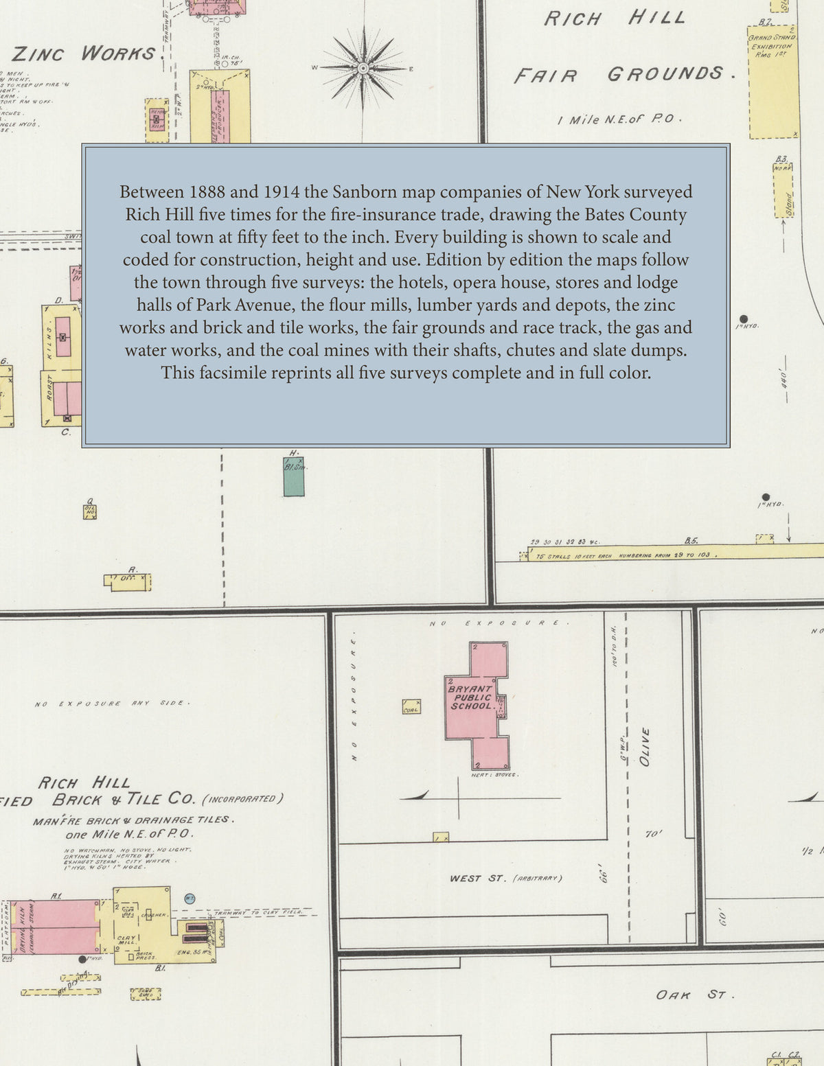
Facsimile of the five Sanborn fire-insurance surveys of Rich Hill, Missouri, made between 1888 and 1914, reproduced in full color from the Library of Congress copies. Together they cover the Bates County coal town from 1888 to 1914: the business blocks of Park Avenue and Park Place, the stores along Walnut, Maple and Pine and the East and West Railroad streets, the Town Company's additions, Sperry's Addition and Geo. Reips Addition, the zinc works, brick and tile works and fair grounds north-east of town, and the outlying coal mines to the south and south-west.
In 1888 five sheets show the town with a population of 6000: the Merchants Hotel, Talmage Hotel and Arcade Hotel, the Opera House, the Mo. Pac. R. R. depot and the K. C. Ft. S. & G. R. R., E. Falor and Son's flour mill, S. C. Lemar's Rich Hill City Mills, the Rich Hill M'f'g Co. foundry and machine shop, the lumber yards of A. P. Hamilton and A. J. Hurley, Krieger and Klumpp's beer depot and ice house, the Bryant and Franklin public schools, the Catholic, Christian, Cumberland Presbyterian, Presbyterian and Methodist Episcopal churches, and the Southwest Zinc and Lead Smelting Company's roasting kilns, zinc furnaces and pottery. The 1893 survey adds the Rich Hill Zinc Works, the Rich Hill Fair Grounds of forty acres with a half-mile race track, grand stand and stalls, the Rich Hill Vitrified Brick and Tile Company's kilns and clay mill, the Southside Public School, and a whole sheet of coal mines - Nos. 7, 8, 15, 16, 17 and 18, one to three and a half miles from the post office, with their shafts, hoisting houses, coal chutes, slate dumps, inclined cable roads and powder houses beside the Mo. Pac. R. R. In 1898 Mines Nos. 15, 17 and 21 are drawn, the brick and tile works stand idle, and Park Avenue's churches face the park. The 1906 edition shows Rich Hill Gas Works with its gasometer, the Eagle House and Merchants' House, City Hall, the fire department, the post office, Calvary Baptist Church, J. H. Cook's carriage factory, the Farmer's Corn and Feed Mill and I. R. Lamport's brick and tile works. By 1914 the maps reach the Rich Hill Water Works and Electric Light Plant and its reservoir, the St. L. & S. F. R. R. depot, People's Elevator Co., R. J. Hurley Lumber Co., E. R. Williamson's lumber yard, Albert Wiek's wagon shop, R. S. Greenslate and Son's handle factory, and the Jones, Eureka, Beller and Heck-More coal mines.
Between 1888 and 1914 the Sanborn map companies of New York surveyed Rich Hill five times for the fire-insurance trade, drawing the town at fifty feet to the inch (the 1914 edition by its scale bars). Every building is shown to scale and color-coded for construction (yellow for frame, pink for brick, blue for stone), with heights, uses, mine shafts, kilns, furnaces, tramways, hydrants and water pipes all marked. Each edition has a key map of the whole town and an index of streets and of named businesses, mills, mines, churches, schools and hotels, and a divider page introduces each edition.
This edition is an unabridged facsimile republication of the atlas: all thirty-two map sheets of the five editions of 1888, 1893, 1898, 1906 and 1914, with the index and key map of every edition, each edition introduced by a divider page. Ideal for local historians, genealogists, architects, preservationists and anyone tracing a Rich Hill address back to 1888-1914.
40 pages. 8.5" x 11". Full color. Paperback.
Printed to order and shipped directly to you — please allow up to 7 business days before shipment.
Satisfaction guaranteed or you can send it back!