1889-1919 Fire Insurance Maps and Atlas of Provincetown, Massachusetts
1889-1919 Fire Insurance Maps and Atlas of Provincetown, Massachusetts
Couldn't load pickup availability
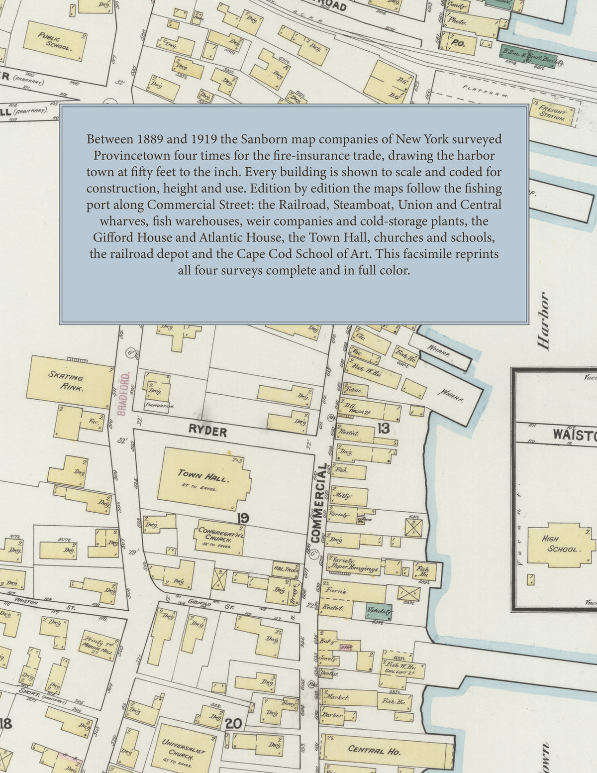
Facsimile of the four Sanborn fire-insurance surveys of Provincetown, Massachusetts, made between 1889 and 1919, reproduced in full color from the Library of Congress copies. Together they cover the whole harbor town: Commercial Street and Bradford Street from end to end, the wharves, fish houses and cold-storage plants along Provincetown Harbor, the side streets and lanes between them, and the railroad yard and outlying ice houses.
In October 1889 six sheets show a fishing port strung along the shore: the wharves of the Paines, the Cooks and the Smalls, Union, Central, Steamboat, Railroad, Hilliard's, Knowles', Lancy's, Menter's and Swift's wharves, J. and L. N. Paine's fish warehouse, S. S. Swift's fish factory, A. T. Williams' coal houses, the Allen and Lancy lumber yards, the Puritan Shirt Company, the O. C. R. R. freight depot and passenger station, the Gifford, Central and Pilgrim hotels, the Town Hall and Town Library, Marine Hall, the skating rink, the High School and public schools, and the Centenary and Center Street Methodist Episcopal, Congregational and Universalist churches. By February 1902 eight sheets extend the survey along the shore and add the Consolidated Weir Company, the National Weir Company, the Provincetown Cold Storage Company, P. A. Whorf's fish storehouses, Lewis and Brown's coal and lumber yard and wharf, Dyer and Company's, Manta's, Matheson's and Conwell's wharves, the N. Y. N. H. & H. R. R. depots and wharf, the Atlantic House, the I. O. O. F. Building, the Franklin Club-house, The White House, W. Welch's ice-houses and the Governor Bradford, Center, Eastern and Western schools. The July 1912 survey shows the Cape Cod Cold Storage, Fisherman Cold Storage and North Truro Cold Storage companies, the W. Underwood Company's fish cannery, the Cape Cod Heat, Light and Power Company's power plant, the railroad locomotive house, the Board of Trade and National Bank buildings, the Post Office, the Star Theatre, the fire department's hose houses and steamer, the water works pumping station and St. Peter's Church. In September 1919 come the Cape Cod Fish Product, Colonial and Puritan Fish Freezing cold-storage plants, the East Harbor Fertilizer Company, the Cape Cod Specialty Company's bayberry candle and jelly works, the Cape Cod School of Art, Vinton Studios, the Pilgrim Theatre, the Christian Science Reading Room, the Church of St. Mary of the Holy Harbor, the Masonic Hall, the Paige and Curley's garages and the Wet Wash Laundry.
Between 1889 and 1919 the Sanborn map companies of New York surveyed Provincetown four times for the fire-insurance trade, drawing the town at fifty feet to the inch (the 1919 edition by its scale bars). Every building is shown to scale and color-coded for construction (yellow for frame, pink for brick, blue for stone), with heights, uses, wharves, fish houses, cold-storage plants, hydrants and water pipes all marked. Each edition opens with a key map of the whole town and an index of streets and of named businesses, wharves, churches, schools and public buildings, and a divider page introduces each edition.
This edition is an unabridged facsimile republication of the atlas: all thirty-two map sheets of the four editions of 1889, 1902, 1912 and 1919, each edition with its key map and its index of streets and specials, each introduced by a divider page. Ideal for local historians, genealogists, architects, preservationists and anyone tracing a Provincetown address back to 1889-1919.
38 pages. 8.5" x 11". Full color. Paperback.
Printed to order and shipped directly to you — please allow up to 7 business days before shipment.
Satisfaction guaranteed or you can send it back!