1889-1920 Fire Insurance Maps and Atlas of Maxwell, California
1889-1920 Fire Insurance Maps and Atlas of Maxwell, California
Couldn't load pickup availability
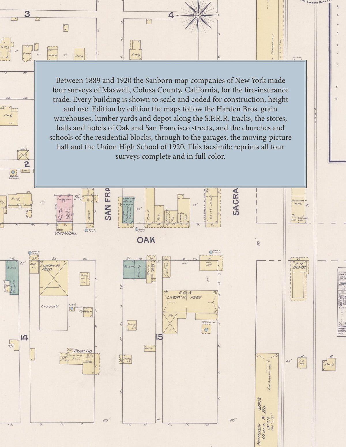
Facsimile of the four Sanborn fire-insurance surveys of Maxwell, Colusa County, California, made between 1889 and 1920, reproduced in full color from the Library of Congress copies. Together they cover the town blocks between Vine and Pine streets on either side of San Francisco Street, the grain warehouses, lumber yards and depot along the S.P.R.R. tracks, and by 1920 the residential streets out to Elm and North streets.
In April 1889 two sheets show the stores, shops and saloons of Oak and San Francisco streets, the Union Hall with its lodge hall, the Russ House, livery and feed stables, blacksmith, harness and tin shops and the post office, with the Harden Bros. grain warehouses Nos. 1, 2 and 3, the West Valley Lumber Co., the R.R. depot and the R.R. Ho. beside the S.P.R.R., and the Baptist, M.E., Christian and Catholic churches among the dwellings of Vine, Olive, California and Pacific streets. The September 1897 survey finds the Sierra Lumber Co. on the railroad and the Maxwell House on Oak Street. In March 1907 the maps add the Maxwell Public School on Cherry Street, the Maxwell Hotel and the blocks along Elm Street. The March 1920 edition runs to three sheets with a key map: the Maxwell Grain Storage warehouses Nos. 1, 2 and 3 of Harden & Sutton, the Diamond Match Co.'s lumber yard, the I.O.O.F. lodge hall and bank, the Tripett Garage, the Maxwell Garage and The E.T. Garage, the Moving Pictures & Hall, the Harden Hotel, the telephone office, the Union High School with its gymnasium, the Maxwell Grammar School, the R.C., M.E. and Baptist churches, and the residential streets of Elm, North, Orange, Marshall Lane and Railroad Avenue.
Between 1889 and 1920 the Sanborn map companies of New York made four surveys of Maxwell for the fire-insurance trade; the 1889, 1897 and 1907 editions are drawn at fifty feet to the inch, and the 1920 edition, by its scale bars, at the same scale. Every building is shown to scale and color-coded for construction (yellow for frame, pink for brick, blue for stone), with heights, uses, wells, pumps and water tanks all marked. The 1920 edition adds a key map of the town, and a divider page introduces each edition.
This Tangletown Press edition is an unabridged facsimile republication of the atlas: all nine map sheets of the four editions of 1889, 1897, 1907 and 1920, with the key map of the 1920 edition, each edition introduced by a divider page. Ideal for local historians, genealogists, architects, preservationists and anyone tracing a Maxwell address back to 1889-1920.
16 pages. 8.5" x 11". Full color. Paperback.
Printed to order and shipped directly to you — please allow up to 7 business days before shipment.
Satisfaction guaranteed or you can send it back!