1890 Fire Insurance Maps & Atlas of Los Angeles, California, Volume 2
1890 Fire Insurance Maps & Atlas of Los Angeles, California, Volume 2
Couldn't load pickup availability
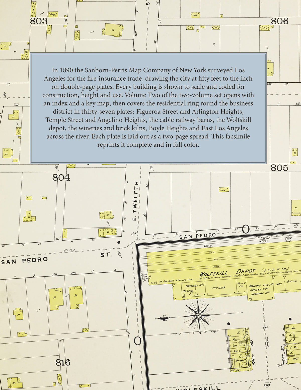
Facsimile of the 1890 Sanborn fire-insurance atlas of Los Angeles, California, reproduced in full color from the Library of Congress copy. This is Volume Two of the two-volume Los Angeles set, covering the ring of residential streets around the business district of Volume One: Figueroa, Flower, Hope and Grand south to Washington Street and Manhattan Avenue; Arlington Heights and Knob Hill along Seventh, Eighth and Ninth out to Park View; Temple Street, Belmont, Union and Angelino Heights below the Reservoir; Bellevue, Castelar and College Streets; San Pedro, San Julian and Maple at Twelfth Street and the Wolfskill depot; and across the river Boyle Heights, Aliso and Macy Streets and East Los Angeles along Downey Avenue.
The thirty-seven double-page plates, numbered 41 to 77, work block by block from the hotels and halls of the residential streets - the Hotel Armidon, the Figueroa, Templeton, Rogers, Arcade, Narcisse and Missouri hotels, the Palm House, the Rochester, the Toltec, the Winona, the Minneapolis, Penn Villa and the Campbell, Cummings and Hendrick blocks - through the Southern Pacific Wolfskill Depot, the Los Angeles Electric Railway station, the Los Angeles Cable Railway barns and power plant, the Temple Street Cable Railway plant and carriage shops, the Main Street warehouse, the Los Angeles Ice & Cold Storage Company, the Washington Street and Western lumber yards, the California Sewer Pipe Works, the Los Angeles Pressed Brick & Terra Cotta Company, the Continuous Brick Kiln Company of Englewood, the Moran and Nadeau wineries, the Pacific and James' soda water works and the Engel and Lieber nurseries, to St. Paul's Hospital, the French Hospital and the Maison de Sante Francaise, the Mechanics Home, Ellis College, St. Mary's Academy for Girls, St. Vincent's Church and College, St. Joseph's German Catholic Church, the Catholic Church of the Sacred Heart, the Third Presbyterian Church, the Bellevue Avenue Methodist churches, Epiphany Chapel and the East Los Angeles Baptist Church, the Montgomery Street, Pine Street, Sand Street, Temple Street, Castelar Street, Macy Street, Breed Street and Griffin Avenue schools, and the residential streets of Arlington Heights, Knob Hill, Angelino Heights, Boyle Heights and East Los Angeles.
In 1890 the Sanborn-Perris Map Company of New York surveyed Los Angeles for the fire-insurance trade, drawing the city at fifty feet to the inch. Every building is shown to scale and color-coded for construction (yellow for frame, pink for brick, blue for stone), with heights, uses, windows, party walls, hydrants and water mains all marked. The index lists every street and every named business, church, school, hotel, mill and works in this volume with the plate it appears on, and the key map places the colored plate grid over this part of the city.
This edition is an unabridged facsimile republication of the atlas: the index, the two-sheet key map carrying the title, and all thirty-seven numbered double-page plates, numbered 41 to 77, each laid out here as a two-page spread. Ideal for local historians, genealogists, architects, preservationists and anyone tracing a Los Angeles address back to 1890.
78 pages. 8.5" x 11". Full color. Paperback.
Printed to order and shipped directly to you — please allow up to 7 business days before shipment.
Satisfaction guaranteed or you can send it back!