1892-1909 Fire Insurance Maps and Atlas of Alexandria, Indiana
1892-1909 Fire Insurance Maps and Atlas of Alexandria, Indiana
Couldn't load pickup availability
Facsimile of the four Sanborn fire-insurance surveys of Alexandria, Indiana, made between 1892 and 1909, reproduced in full color from the Library of Congress copies. Together they cover the Madison County town and its outlying works: the business blocks of Harrison, Canal, Church and Washington streets, the residential additions on both sides of Pipe Creek, the glass, steel and brick works along the railroads west and south of the post office, and the neighboring places of Orestes and West Alexandria.
In October 1892 three sheets show the stores of John, Church and Washington streets between West and Wayne, the Brannum Lumber Co., J. W. Neily's boat oar and handle factory and E. C. Ward & Co.'s brick yard, and, out along the Big Four and L. E. & W. tracks, the Lippincott Chimney Works, the De Pauw Plate Glass Co., the Alexandria Window Glass Co. and the Indiana Brick Works. By May 1896 ten sheets and an index cover the Opera House, the Eyck & Perry Block, Hotel Alexandria, Hotel Arlington, the Kent and Powell hotels, the C. C. C. & St. L. and L. E. & W. depots, the Kelly Axe M'f'g Co., the American Plate Glass Co., the Union Steel Co., the United Glass Co., Jeffrey's Electric Light Station, the City Water Works, the Tomlinson and Clarke schools, and Orestes and West Alexandria on sheet 10. The 1902 edition adds a key map of the whole town, the American Window Glass Co., the Republic Iron and Steel Co., the Alexandria Paper Co., Hospital and Steam Laundry, the Crystal Chemical Co., the Union Traction Co. plant, McKinley Hall, the I. O. O. F. Building, St. Paul's Episcopal Church and the Orestes Tile-works. In 1909 the maps show the Penn-American Plate Glass Co., the Imbler Fence & M'f'g Co., the Hoosier Rock Wool Co., the Central Indiana Lighting Co., the Public Library and Post Office, St. Mary's Catholic Church and School, the Washington Street School, the Times Tribune Printing Co., the Union Traction Co. waiting rooms and the Orestes Drain Tile and Grain companies.
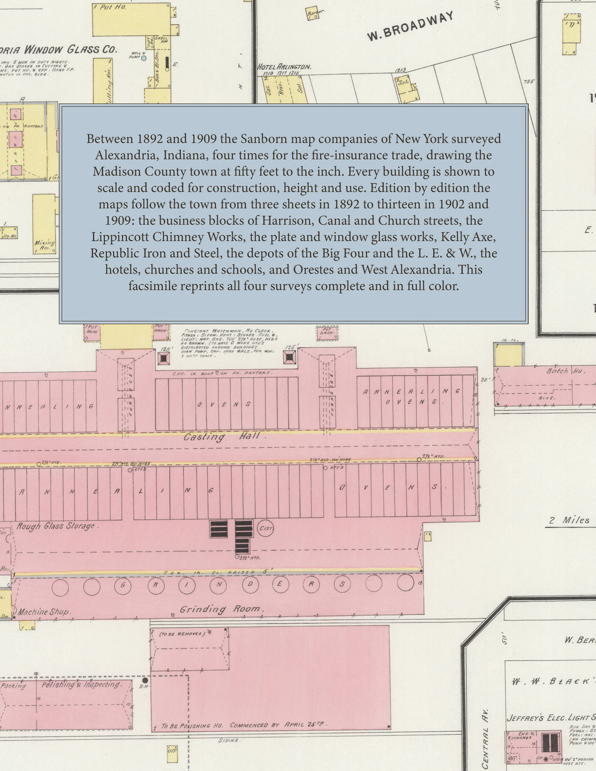
Between 1892 and 1909 the Sanborn map companies of New York surveyed Alexandria four times for the fire-insurance trade, drawing the town at fifty feet to the inch. Every building is shown to scale and color-coded for construction (yellow for frame, pink for brick, blue for stone), with heights, uses, furnaces, ovens, hydrants and water pipes all marked. The 1896, 1902 and 1909 editions add an index of streets and named businesses, works, churches, schools and hotels and a key map of the town, and a divider page introduces each edition.
This Tangletown Press edition is an unabridged facsimile republication of the atlas: all thirty-nine map sheets of the four editions of 1892, 1896, 1902 and 1909, with the indexes and key maps of the 1896, 1902 and 1909 editions, each edition introduced by a divider page. Ideal for local historians, genealogists, architects, preservationists and anyone tracing a Alexandria address back to 1892-1909.
46 pages. 8.5" x 11". Full color. Paperback.
Printed to order and shipped directly to you — please allow up to 7 business days before shipment.
Satisfaction guaranteed or you can send it back!