1893-1924 Fire Insurance Maps & Atlas of Bay Saint Louis, Mississippi
1893-1924 Fire Insurance Maps & Atlas of Bay Saint Louis, Mississippi
Couldn't load pickup availability
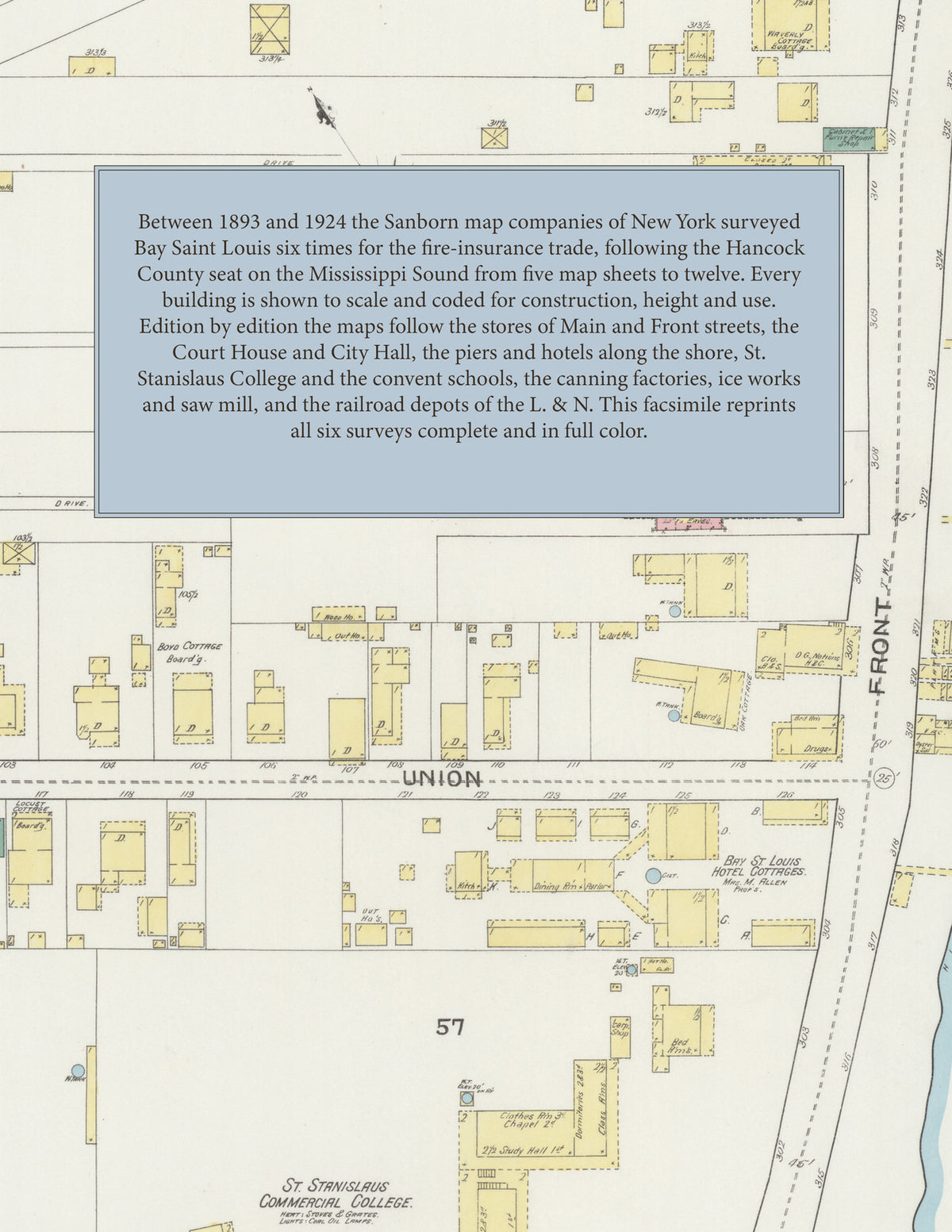
Facsimile of the six Sanborn fire-insurance surveys of Bay Saint Louis, Mississippi, made between 1893 and 1924, reproduced in full color from the Library of Congress copies. Together they cover the Hancock County seat on the Mississippi Sound: the stores of Main Street and Front Street along the shore, the County Court House, the piers on the water, the hotels and boarding cottages, St. Stanislaus College and the Catholic convent and schools, the canning factories, ice works and mills, the L. & N. R. R. depots, and the residential streets out to the beach road.
In 1893 five sheets show the County Court House, the Crescent Hotel, the Bay St. Louis Hotel Cottages, the Catholic church, St. Joseph's Convent, St. Stanislaus' Commercial College, the Gulf Coast Ice M'f'g Co., G. W. Dunbar's Sons' canning factory, Ulman's woolen and grist mill and J. Heitzman's wagon shop. The 1898 survey adds the Methodist Episcopal church, St. Rose's School and the Echo and Progress printing offices. In 1904 come the Audubon, Gilmore and Pickwick hotels, the public school, St. Joseph's Academy and St. Paul's Methodist Episcopal Church. The 1909 edition shows the City Hall, post office and fire department, the Tulane and Klock hotels, the Bay View, Bellevue, Rosebower and Nellie's Villa boarding houses, Christ Church, the Bay St. Louis Ice, Light and Bottling Works, the Peerless Oyster Co. and the Dunbar-Lopez-Dukate Co. canning factory. In 1917 come the L. & N. R. R. depots, the Masonic Temple, the W. O. W. Lodge Hall, the Audubon House, Our Lady of the Gulf R. C. Church, the First Baptist and Bethlehem A. M. E. churches, the Central Public School, St. Joseph's School for Girls and Conrad Sick's saw mill, and in 1924 the Hotel Weston, the Rosemary Inn, the Bay-Waveland Yacht Club House, the Bay Ice and Light Plant, the Standard Oil Co., the K. of C. and Firemen's halls, St. Augustine's Mission House, the St. Rose Di Lima School and the Webb Public School.
Between 1893 and 1924 the Sanborn map companies of New York surveyed Bay Saint Louis six times for the fire-insurance trade, drawing the town at fifty feet to the inch, with the outlying streets of 1917 and 1924 at one hundred feet. Every building is shown to scale and color-coded for construction (yellow for frame, pink for brick, blue for stone), with heights, uses, piers, hydrants and water pipes all marked. Every edition carries a key map of the town and an index of streets and of named hotels, churches, schools and works, and a divider page introduces each edition.
This Tangletown Press edition is an unabridged facsimile republication of the atlas: all fifty-one map sheets of the six editions of 1893, 1898, 1904, 1909, 1917 and 1924, with the key map and index of every edition, each edition introduced by a divider page. Ideal for local historians, genealogists, architects, preservationists and anyone tracing a Bay Saint Louis address back to 1893-1924.
60 pages. 8.5" x 11". Full color. Paperback.
Printed to order and shipped directly to you — please allow up to 7 business days before shipment.
Satisfaction guaranteed or you can send it back!