1894-1922 Fire Insurance Maps and Atlas of Sistersville, West Virginia
1894-1922 Fire Insurance Maps and Atlas of Sistersville, West Virginia
Couldn't load pickup availability
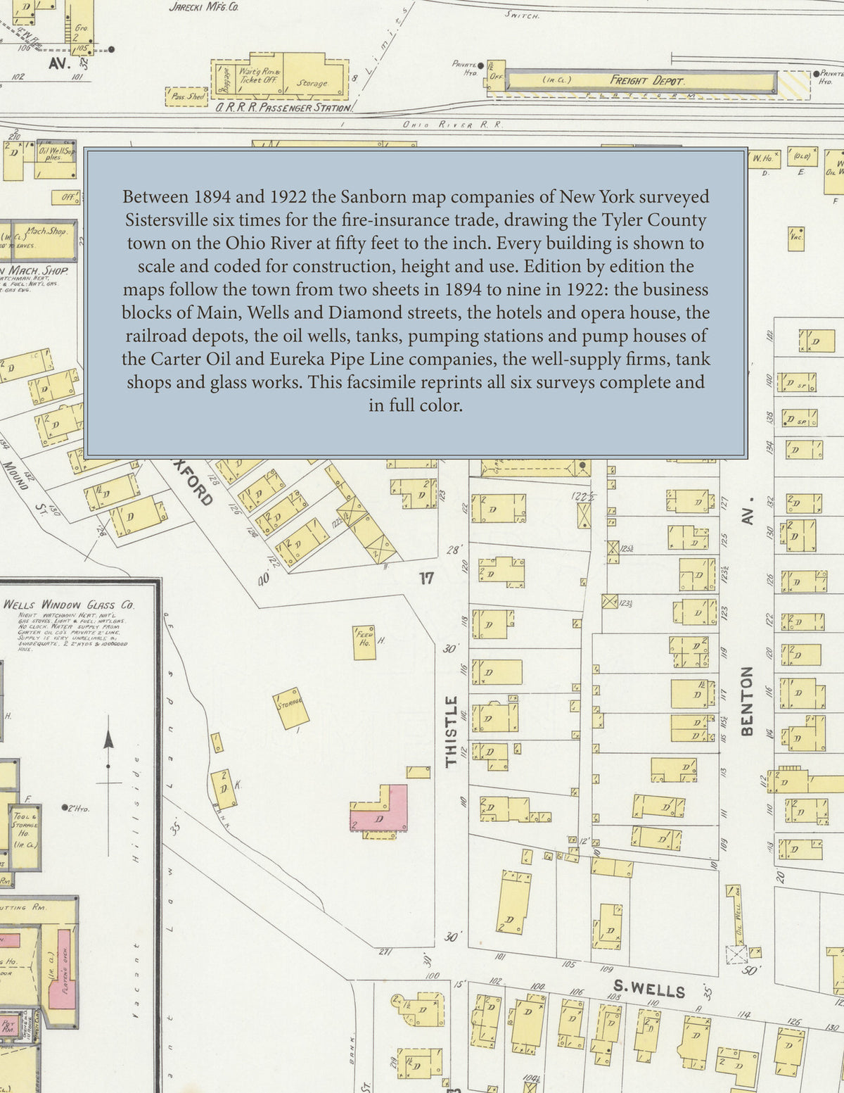
Facsimile of the six Sanborn fire-insurance surveys of Sistersville, West Virginia, made between 1894 and 1922, reproduced in full color from the Library of Congress copies. Together they cover the Tyler County town on the Ohio River from its first two sheets to 1922: the stores and business blocks of Main, Wells and Diamond streets, the river front along Water Street, the railroad and its depots, the works along Brown Betty (later Chelsea) Street, Burt Avenue and Railroad Avenue, and the residential streets climbing the hillside to Wharry's Run, Klondike Avenue and Urban Avenue.
In November 1894 two sheets show the town between the Ohio River and the railroad: the blocks of Main, Wells, Elizabeth, Diamond, Charles and Catherine streets, Brown Betty Street, the Riverside Mill and an oil storage building. By 1898 four sheets and an index add the Ohio River R. R. depot, the Sistersville Elec. Light & Pow. Co. and water works, the High School, City Hall, the Opera House, the Columbia Theatre, the Hosford, Knoke and Wells hotels, the Riverview Hotel, the Leidecker Tool Co., the West Virginia Tool Co., the Jarecki M'f'g Co., tank and boiler shops, machine shops, S. W. Lawrence's elevator, Wilson & Holliday's planing mill and the Catholic, Baptist, Episcopal, Methodist Episcopal and Presbyterian churches. The 1902 survey adds the Sistersville Boiler Shop, Ice Co. and Window Glass Co., the Manhattan Club, the New Arlington and the Eureka Steam Laundry. In 1907 the index lists the O. R. R. R. freight and passenger station, the Oil Well Supply Co., the National Supply Co., the Wells Window Glass Co., Sexton Machine Shop, Jones & Co.'s tank shop, the Sistersville Brewing Co., Hotel Paeszler and the Riverside and E. Roome & Co. flour mills. The 1913 edition reaches the B. & O. R. R. depots, the Tyler Traction Company, the Eureka Pipe Line Co., the Carter Oil Co., the Pure Oil Co., the Independent Glass Co., the Armory, the City Hospital, the Post Office and four fire stations. The 1922 edition, on nine sheets, maps the Carter Oil Co.'s wells, pumping station, gasoline plant and boiler and machine shop, the Eureka Pipe Line Co. pump house and tanks, the Eastern Refining Co. tanks, the American Oil Development Storage Co., the Reno Oil Co. plant, the Sistersville Tank and Boiler Works, the J. B. Schohy Glass Co., the Booth Lumber & Supply Co., the Tyler Traction Co. car barn, the General Hospital, Hotel Tyler, the Elk's Club House and the Country Club House.
Between 1894 and 1922 the Sanborn map companies of New York surveyed Sistersville six times for the fire-insurance trade, drawing the town at fifty feet to the inch. Every building is shown to scale and color-coded for construction (yellow for frame, pink for brick, blue for stone), with heights, uses, oil wells, tanks, pipe lines, hydrants and water pipes all marked. The editions from 1898 on add an index of named businesses, works, churches, schools and hotels and a key map of the whole town, and a divider page introduces each edition.
This edition is an unabridged facsimile republication of the atlas: all thirty-one map sheets of the six editions of 1894, 1898, 1902, 1907, 1913 and 1922, with the indexes and key maps of the 1898, 1902, 1907, 1913 and 1922 editions, each edition introduced by a divider page. Ideal for local historians, genealogists, architects, preservationists and anyone tracing a Sistersville address back to 1894-1922.
40 pages. 8.5" x 11". Full color. Paperback.
Printed to order and shipped directly to you — please allow up to 7 business days before shipment.
Satisfaction guaranteed or you can send it back!