1896 Fire Insurance Maps and Atlas of Kansas City, Missouri, Volume 3
1896 Fire Insurance Maps and Atlas of Kansas City, Missouri, Volume 3
Couldn't load pickup availability
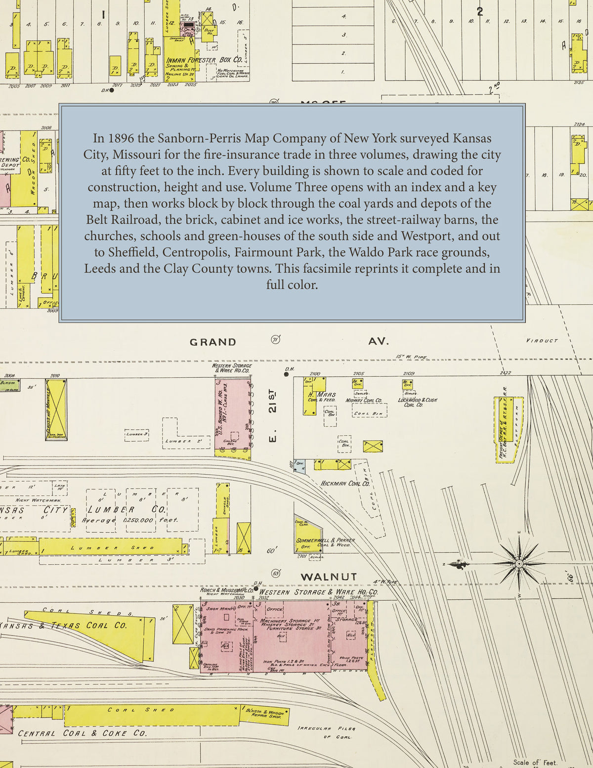
Facsimile of the third volume of the 1896 Sanborn fire-insurance atlas of Kansas City, Missouri, reproduced in full color from the Library of Congress copy. Volume Three of the three-volume set covers the south and east of the city: from Twentieth Street south to the 31st Street city limits between Main Street and Cleveland Avenue, with Westport and the suburban territory beyond, and east along Independence Avenue and Twelfth Street to the Blue River - followed by outlying sheets for Sheffield, Centropolis, Fairmount Park, the Waldo Park race grounds, Leeds, the Fair Grounds, and Harlem, Randolph, Birmingham and Minnaville in Clay County.
The one hundred eight numbered sheets work block by block from Main Street, Grand Avenue, McGee, Holmes, Troost, Prospect and Indiana Avenue south of Twentieth Street - the Kansas City Belt Railroad's Grand Avenue station, the Anheuser-Busch and Lemp depots, the Western Storage & Warehouse Company, the Central Coal & Coke, Lanning-Harris and Kansas & Texas coal yards, the Standard Oil Company's Harrison Street station, the Continental Varnish & Color Works, the Great Western and Ideal cabinet works, the Gates & Comber Vitrified Brick Company, Trask & Hudson's ice house, the Cowles & Dennison works, the Holmes Street cable line plant, the Metropolitan street-railway barns and power plant and the new Work House - through Westport and the suburban territory south of 31st Street, Independence Avenue and Twelfth Street out to the Blue River, the Kansas City Bolt & Nut works at Sheffield, the Centropolis Car & Machine Company, Centropolis Mills and the Missouri Frog & Crossing Company, the Kansas City Sewer Pipe Company and the Missouri, Kansas & Texas Trust Company's Diamond, Eclipse, Exchange and Sun elevators, the Kansas City Stove Works and Luce Manufacturing Company at Leeds, the Randolph Handle Company, the Minnaville brick yard and the National Hotel at Birmingham, to the Kansas City and German hospitals, the Home for the Aged, the House of the Good Shepherd, the Protestant Home for Homeless Women and Girls, St. George's Protestant Cathedral, St. Joseph's, St. Mary's, Holy Name and Holy Trinity churches, the Linwood, Longfellow, Bryant, Irving, Hyde Park, Morse, Oakley and Philip schools, the Kansas City Boat Club House, the green-houses of the south side, Troost, Fairmount and Washington parks, the Waldo Park race grounds, the Agricultural & Horticultural Fair Grounds, Union, Elmwood and St. Mary's cemeteries, and the residential streets of the south side and Westport.
In 1896 the Sanborn-Perris Map Company of New York surveyed Kansas City for the fire-insurance trade in three volumes, drawing the city at fifty feet to the inch. Every building is shown to scale and color-coded for construction (yellow for frame, pink for brick, blue for stone), with heights, uses, windows, party walls, hydrants, water mains and fire stations all marked. The index lists every street and every named business, church, school, hotel, mill and works in this volume with the sheet it appears on, and the key map places the colored sheet grid over the south and east of the city and its suburbs.
This edition is an unabridged facsimile republication of the atlas: the title sheet, the index, the key map and all one hundred eight numbered map sheets (251 to 358). Ideal for local historians, genealogists, architects, preservationists and anyone tracing a Kansas City address back to 1896.
112 pages. 8.5" x 11". Full color. Paperback.
Printed to order and shipped directly to you — please allow up to 7 business days before shipment.
Satisfaction guaranteed or you can send it back!