1897 Fire Insurance Maps and Atlas of Eau Claire, Wisconsin
1897 Fire Insurance Maps and Atlas of Eau Claire, Wisconsin
Couldn't load pickup availability
Facsimile of the 1897 Sanborn-Perris fire-insurance atlas of Eau Claire, Wisconsin, reproduced in full color from the Library of Congress copy. It covers the whole lumber city of 20,000 people where the Eau Claire River meets the Chippewa - the East Side business district, the North Side and the West Side around Half Moon Lake and Island Park - with the sawmills of the lumber district and the outlying towns of Porterville, Altoona, Fall Creek and Fairchild.
The fifty-nine numbered sheets work block by block from the stores, banks and hotels of the East Side - the County Court House and Jail, the City Building, the Chippewa Valley Bank Building, the Ingram, Laycock, Pioneer, Kahn and Brooks blocks, the Chicago Store, the Opera House, the Armory, and the Galloway, Farwell, Hart, Frawley, Fox, Kneer, Central, Nicollet and American hotels - through the Chicago, St. Paul, Minneapolis and Omaha passenger station, freight depot, round house and elevator, the Chicago, Milwaukee and St. Paul and Wisconsin Central depots, the Chippewa Valley Electric Railway car shed, the Daniel Shaw, Empire, Valley, Dells, Foster and North-Western lumber companies with their sawmills, planing mills, lumber yards and log ponds, the Dells Paper and Pulp Company, the Eau Claire Linen Mill, the Eau Claire Box Shook and Lumber Company, the Linderman box and veneer works, the Half Moon Lake shingle mill, the Crescent elevator and the Eau Claire roller mills, the Eagle and Walter breweries, the Drummond packing house, the Eagle Iron Works and the Eau Claire Boiler Works, the McDonough and Phoenix manufacturing companies, the wagon, carriage and trunk works, the gas works and the water works, to Sacred Heart Hospital, the County Poor Farm, the High School and the ward schools, St. Patrick's and the Sacred Heart churches and schools, the Norwegian, Swedish and German churches, the Lake Street Methodist and Congregational churches, Island Park and Forest Hill Cemetery, and the residential streets of the East, North and West sides, with Porterville, Altoona, Fall Creek and Fairchild.
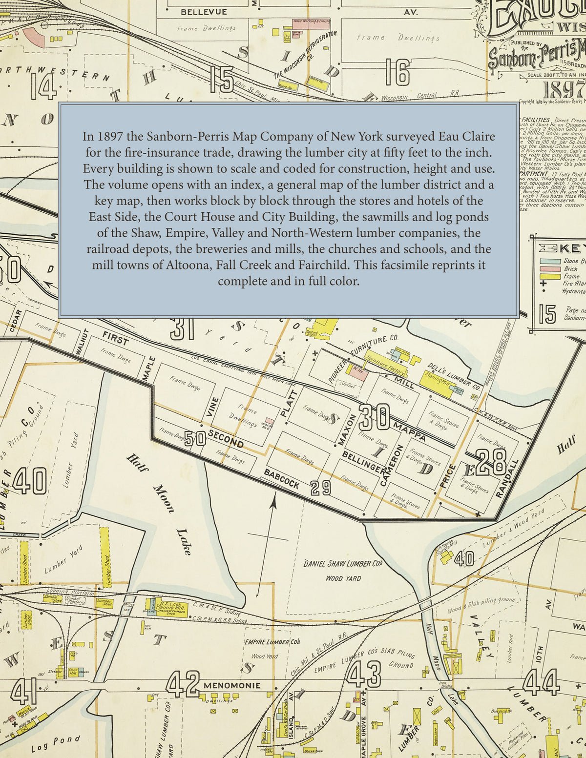
In 1897 the Sanborn-Perris Map Company of New York surveyed Eau Claire for the fire-insurance trade, drawing the city and its outlying mill towns at fifty feet to the inch, with a general map of the lumber district at two hundred feet to the inch. Every building is shown to scale and color-coded for construction (yellow for frame, pink for brick, blue for stone), with heights, uses, windows, party walls, hydrants, water mains and fire stations all marked. The index lists every street and every named business, church, school, hotel, mill and works with the sheet it appears on, and the key map places the colored sheet grid over the whole city.
This edition is an unabridged facsimile republication of the atlas: the combined title and index sheet, the general map of the lumber district, the key map with the report, and all fifty-nine numbered map sheets, including Porterville, Altoona, Fall Creek and Fairchild. Ideal for local historians, genealogists, architects, preservationists and anyone tracing a Eau Claire address back to 1897.
64 pages. 8.5" x 11". Full color. Paperback.
Printed to order and shipped directly to you — please allow up to 7 business days before shipment.
Satisfaction guaranteed or you can send it back!