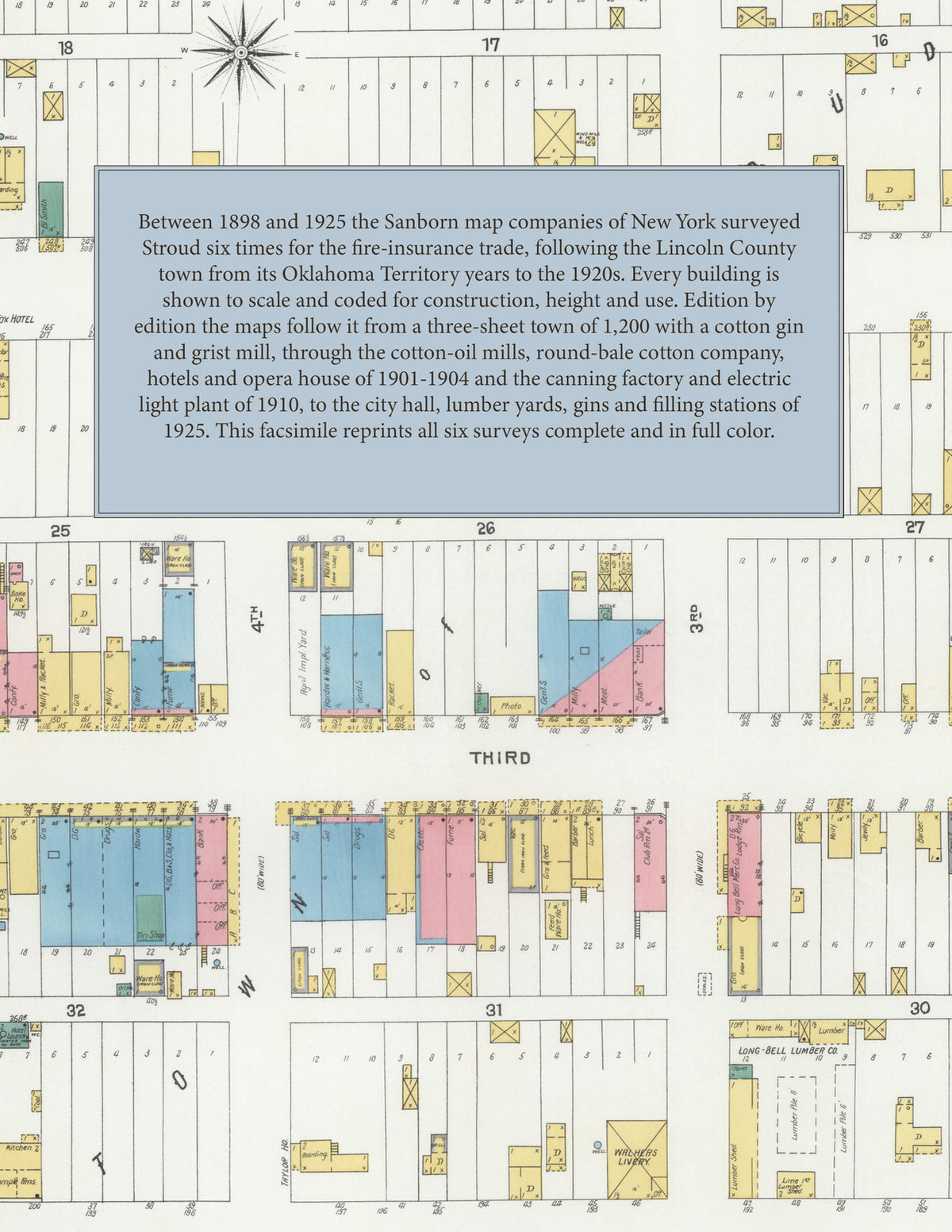
1898-1925 Fire Insurance Maps and Atlas of Stroud, Oklahoma
1898-1925 Fire Insurance Maps and Atlas of Stroud, Oklahoma
Couldn't load pickup availability
Facsimile of the six Sanborn fire-insurance surveys of Stroud, Oklahoma, made between 1898 and 1925, reproduced in full color from the Library of Congress copies. Together they cover the Lincoln County town from its Oklahoma Territory years to the 1920s: the brick and frame business blocks of the downtown, the cotton gins, cotton-oil mill, lumber yards and depot along the railroad, and the residential streets and additions around them.
The three sheets of December 1898, headed Stroud, Lincoln Co., Okla., draw a town of 1,200: the frame stores of the business district, O. L. Dowell's cotton gin and grist mill, a cotton-seed storage house and the railroad depot. In May 1901, the cartouche now reading Okla. T., three sheets index the Blue Front, Central, Missouri and Stroud hotels and the Hotel St. Louis, the J. F. Dowell & Co. and O. L. Dowell cotton gins, Eugene Dye's grist mill, the Long-Bell Lumber Co., the Oklahoma Round Bale Cotton Co., the St. L. & O. C. R. R. passenger depot and the Southwestern Cotton Seed Oil Co. mill beside the St. L. & San F. R. R. The four sheets of April 1904, headed Lincoln County, Oklahoma Ter., add the Stroud Cotton Oil Co. mill, the Stroud Gin Co., Machine Shop, Mills, Opera House, Steam Laundry and Trading Co., the Sac. & Fox Hotel, the Taylor and Graham houses and the West Side Public School. From July 1910 the cartouche reads Oklahoma, and the maps show the Farmers' & Merchants' Cotton Gin, the Stroud Canning Factory, the water works pumping station and electric light plant, the post office and the fire department; in December 1916 come the town hall, the East Side Public School and the Christian Science, Roman Catholic, Presbyterian and Methodist Episcopal (South) churches. The six sheets of November 1925 reach the City Hall, the Telephone Exchange, the Stroud Ice Co., the National Oil Supply Co., the New State, Lynch, Wickam and Wright hotels, the Evans Bros., Fullerson-Stuart, W. R. Pickering and Long-Bell lumber yards, the Independent and Round Bale gins, filling stations and the St. L. & S. F. R. R. depot.
Between 1898 and 1925 the Sanborn map companies of New York surveyed Stroud six times for the fire-insurance trade, drawing the town at fifty feet to the inch, as the cartouches of 1898 to 1910 print and the scale bars of the 1916 and 1925 editions measure. Every building is shown to scale and color-coded for construction (yellow for frame, pink for brick, blue for stone), with heights, uses, gin and mill machinery, wells, cisterns and water pipes all marked. The editions from 1901 onward add an index of named businesses, hotels, gins, mills, churches and schools, and a divider page introduces each edition.
This edition is an unabridged facsimile republication of the atlas: all twenty-four map sheets of the six editions of 1898, 1901, 1904, 1910, 1916 and 1925, with their key maps and the indexes of the 1901 to 1925 editions, each edition introduced by a divider page. Ideal for local historians, genealogists, architects, preservationists and anyone tracing a Stroud address back to 1898-1925.
32 pages. 8.5" x 11". Full color. Paperback.
Printed to order and shipped directly to you — please allow up to 7 business days before shipment.
Satisfaction guaranteed or you can send it back!