ExileBooks
1898 Fire Insurance Maps and Atlas of Joliet, Illinois
1898 Fire Insurance Maps and Atlas of Joliet, Illinois
Couldn't load pickup availability
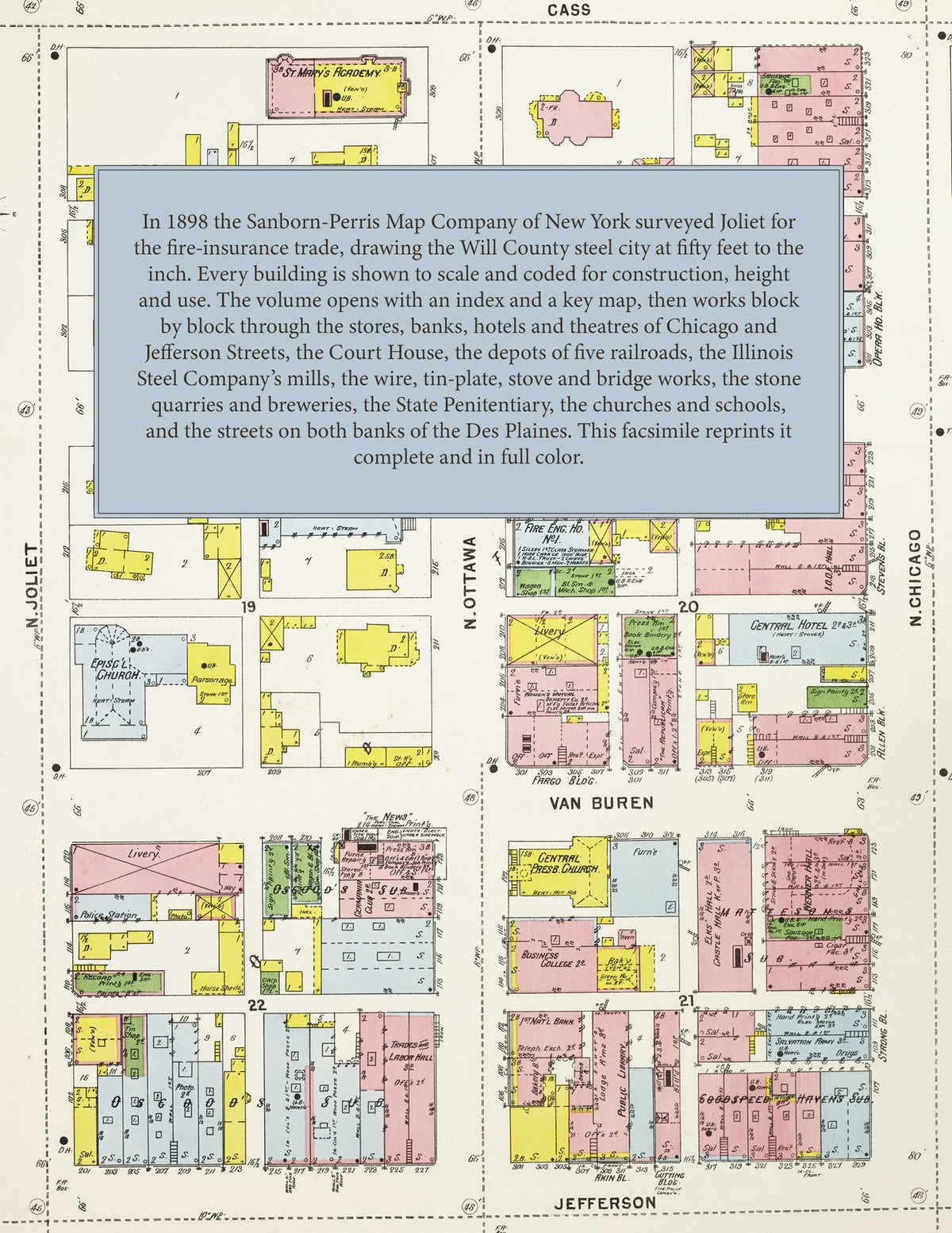
Facsimile of the 1898 Sanborn fire-insurance atlas of Joliet, Illinois, reproduced in full color from the Library of Congress copy. It covers the whole city of 36,000 people on both banks of the Des Plaines River and the Illinois and Michigan Canal, from the stores, banks, hotels and theatres around the Will County Court House, through the Illinois Steel Company's works, the wire, tin-plate and stove works, the stone quarries and the Illinois State Penitentiary, to the residential streets of the east and west sides, South Park and the American Steel and Wire Company's plant at Rockdale.
The seventy-eight numbered sheets work block by block from the stores, banks, hotels and halls along Chicago Street, Jefferson Street, Ottawa Street, Van Buren Street, Cass Street and Bluff Street - the Will County Court House and Jail, the Joliet Theatre, the Opera House, Auditorium, Metropolitan, Barber, Young and Munroe blocks, Werner Hall, the Turn Halle, Robeson Hall, the Y. M. C. A. building, the News, Times, Republican and Record printing offices, the National, Munroe, Central, Brunswick, Bissell, Belvidere, St. Nicholas and Palmer House hotels - through the Chicago and Alton, Rock Island, Santa Fe, Michigan Central and Elgin, Joliet and Eastern depots, freight houses, round houses and shops, the Illinois Steel Company's works, the American Steel and Wire Company's plants including the Rockdale Plant, the Consolidated Barb Wire, Van Fleet Wire Specialty and Laidlaw Bale-Tie works, the Great Western Tin Plate Company, the Fox Solid Pressed Steel Company, the Joliet Stove Works, the Joliet Bridge and Iron Company, the Phoenix Horse Shoe Company, the Frankfort Chair Company, the Joliet chemical, gas-light, electric and paper works, the Oliver oat-meal mills, the City and West Side flour mills, the Midland and Speer elevators, the Eagle, Sehring and Porter breweries, the Selz, Schwab shoe factory, the Porter, Globe, Western and Pioneer stone quarries and the Bowen and Rowell gravel crushers, the Joliet Mound drain-tile works, the Adam, King, Lyons and Wilcox lumber yards, and the Illinois State Penitentiary with its steel, rattan and reed prison shops, to St. Joseph's and Silver Cross hospitals, the Orphans' Home and Industrial School, the High School and the Broadway, Eastern Avenue, Henderson Avenue, Moran Street, Parks Avenue, Richards Street, Ridgewood and Woodland schools, St. Francis Convent and Academy, St. Mary's Church and Academy, St. John's, St. Joseph's, St. Patrick's, Sacred Heart and Holy Cross churches, the Central Presbyterian, Ottawa Street and Richards Street Methodist and Eastern Avenue Baptist churches, Ingall's, River View and Saengerbund parks, Oakwood Cemetery, and the residential streets of the east and west sides and South Park.
In 1898 the Sanborn-Perris Map Company of New York surveyed Joliet for the fire-insurance trade, drawing the city at fifty feet to the inch. Every building is shown to scale and color-coded for construction (yellow for frame, pink for brick, blue for stone), with heights, uses, windows, party walls, hydrants, water mains and fire stations all marked. The index lists every street and every named business, church, school, hotel, mill and works with the sheet it appears on, and the key map places the colored sheet grid over the whole city.
This edition is an unabridged facsimile republication of the atlas: the combined title and index sheet, the key map and all seventy-eight numbered map sheets. Ideal for local historians, genealogists, architects, preservationists and anyone tracing a Joliet address back to 1898.
82 pages. 8.5" x 11". Full color. Paperback.
Printed to order and shipped directly to you — please allow up to 7 business days before shipment.
Satisfaction guaranteed or you can send it back!