1900 Fire Insurance Maps and Atlas of Burlington, Vermont
1900 Fire Insurance Maps and Atlas of Burlington, Vermont
Couldn't load pickup availability
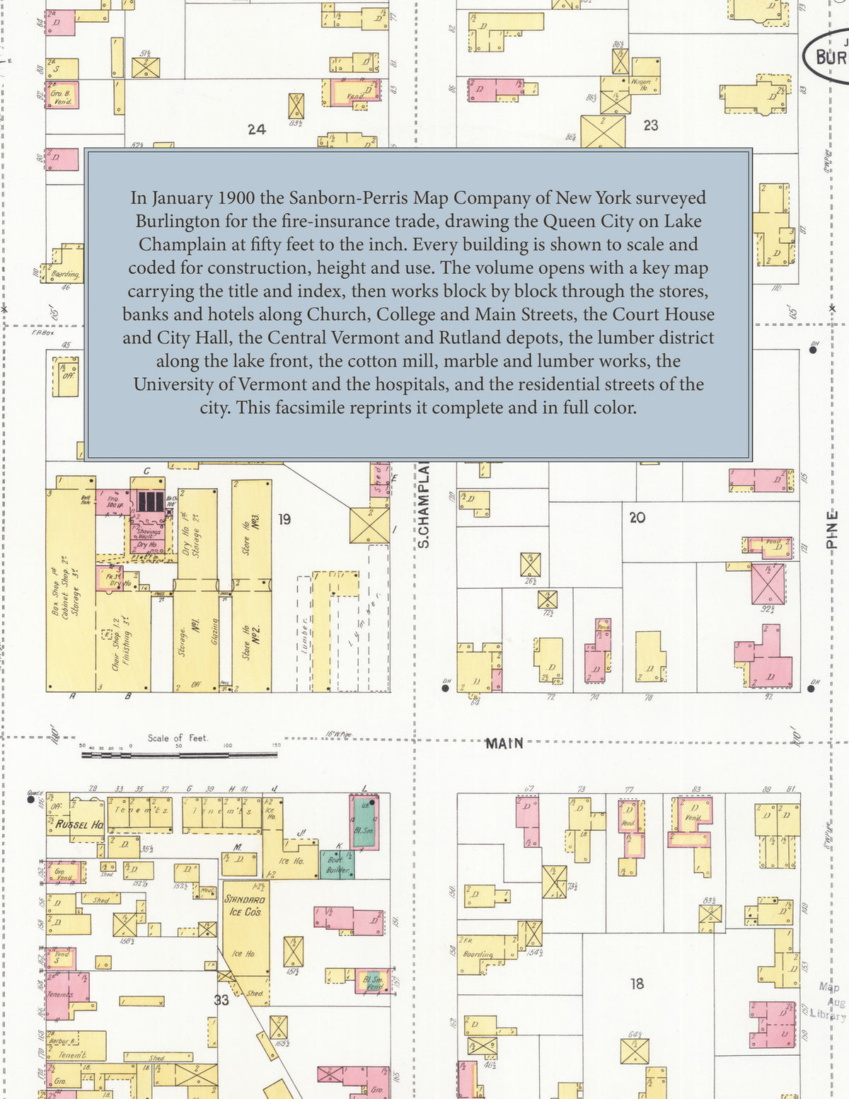
The complete 1900 Sanborn fire-insurance atlas of Burlington, Vermont, reprinted in full color. It covers the whole city, from the downtown blocks out to the city limits.
The thirty-three numbered sheets work block by block from the stores, banks and hotels along Church, College, Main, Bank and Pearl Streets, the County Court House and Jail, City Hall, the Howard Opera House, the Hotel Burlington, Van Ness House, Hotel Champlain and American Hotel, the Masonic Temple, the Fletcher Free Library and the Y.M.C.A., through the Central Vermont and Rutland Railroad depots, freight houses and yards, the Lake Champlain Yacht Club, the Champlain Transportation Company's wharf and shops, the Shepard & Morse, Robinson-Edwards and Baxter lumber yards and mills along the water front, the Queen City Cotton Company, the Burlington Venetian Blind Company, the Burlington Beef Company, the Wells & Richardson chemical works, the Booth, Vermont Marble and Goodell marble works, the Baldwin refrigerator works, the Lang & Goodhue and Robertson lard and soap factories, the Malted Cereal Company, the Bishop Hopkins Hall and Providence Orphan Asylum, to the University of Vermont, the Mary Fletcher Hospital, the Home for Aged Women, the Cathedral of the Immaculate Conception, the churches, public schools and residential streets of the city.
In 1900 the Sanborn-Perris Map Company of New York surveyed Burlington for the fire-insurance trade, drawing the city at fifty feet to the inch. Every building is shown to scale and color-coded for construction (yellow for frame, pink for brick, blue for stone), with heights, uses, windows, party walls, hydrants, water mains and fire stations all marked. The index lists every street and every named business, church, school, hotel, mill and works with the sheet it appears on, and the key map places the colored sheet grid over the whole city.
This edition is an unabridged facsimile republication of the atlas: the key map, which carries the title and index, and all thirty-three numbered map sheets. Ideal for local historians, genealogists, architects, preservationists and anyone tracing a Burlington address back to 1900.
36 pages. 8.5" x 11". Full color. Paperback.
Printed to order and shipped directly to you — please allow up to 7 business days before shipment.
Satisfaction guaranteed or you can send it back!