ExileBooks
1900 Fire Insurance Maps and Atlas of Somerville, Massachusetts
1900 Fire Insurance Maps and Atlas of Somerville, Massachusetts
Couldn't load pickup availability
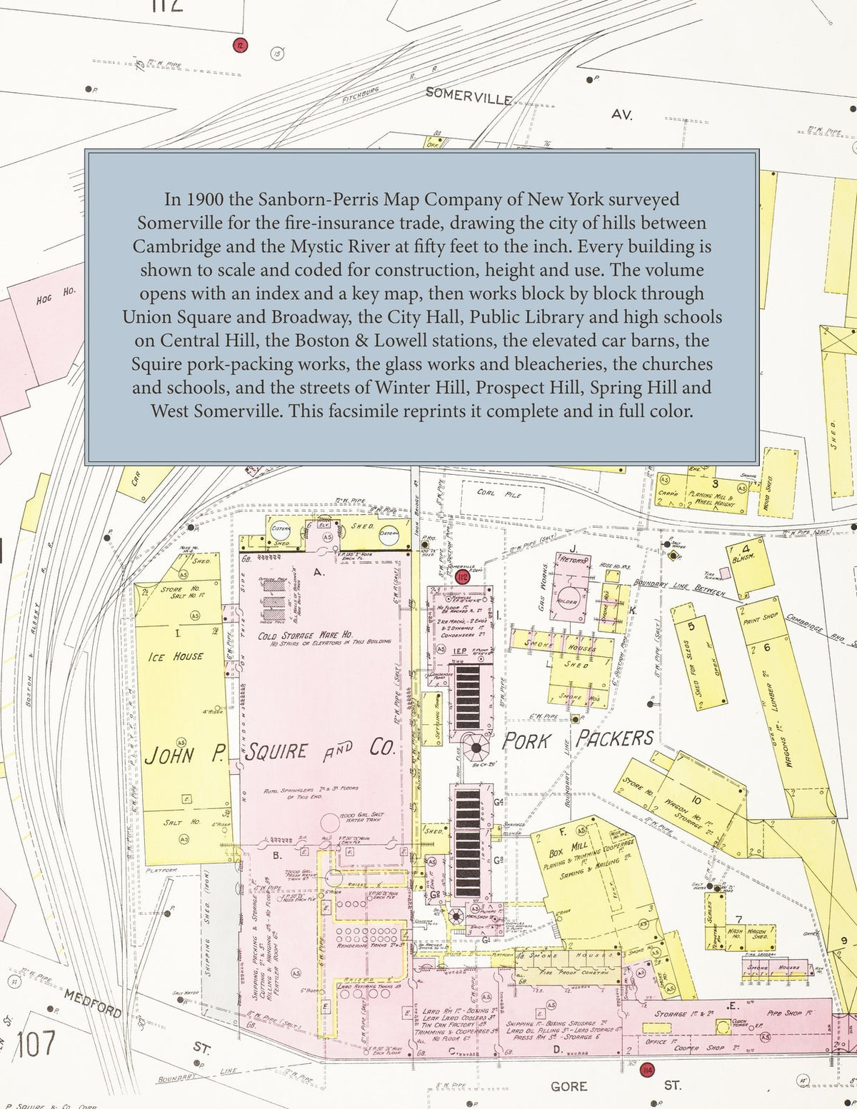
Facsimile of the 1900 Sanborn fire-insurance atlas of Somerville, Massachusetts, reproduced in full color from the Library of Congress copy. It covers the whole city of 63,000 people between Cambridge, Arlington, Medford and the Mystic River, from the stores of Union Square and Broadway and the City Hall on Central Hill, through the packing houses, glass works and bleacheries along the railroads, to the residential streets of Winter Hill, Prospect Hill, Spring Hill, Clarendon Hill, Davis Square and East and West Somerville.
The one hundred fourteen numbered sheets work block by block from the stores, halls and hotels of Union Square, Davis Square, Magoun Square and Gilman Square and along Broadway, Highland Avenue, Somerville Avenue, Washington Street, Medford Street and Elm Street - the City Hall, the Public Library, the English High School and the Somerville Latin School on Central Hill Park, the Citizen Building, the Hotel Colson, Hotel Perkins, Hotel Woodbridge and Brothers Hotel - through the Boston & Lowell Railroad's Prospect Hill and Winter Hill stations, the Boston Elevated Railway car barns and Clarendon Hill station, the city high-service water works, the John P. Squire & Co. and North Packing & Provision pork-packing houses, the Sturtevant & Haley beef house, the Middlesex Bleach, Dye and Print Works and the Gilmore bleachery, the D. Chase & Co. rum distillery, the Union Glass and New England Glass works, the Kerr Chemical Company, the American Tube Works, the Somerville and Mildram & Reed iron foundries, the spike works, the Derby Desk Company, the window-shade and picture-frame factories, the Boston Burial Case Company, the Lamb maple-sugar, Lewis preserving, Haynes and Standard vinegar, Skilton Foot pickle and Emery hulled-corn works, the Pilgrim Motor Vehicle Company, the Fresh Pond Ice Company and the Union Square mills, to the Somerville Hospital, the Little Sisters of the Poor, the Cambridge Alms House and Poor Farm, the Bell, Bennett, Bingham, Burns, Cummings, Edgerly, Forster, Hodgkins, Lincoln, Prescott and Prospect Hill schools, St. Ann's, St. Catherine's and St. Joseph's Catholic churches, St. James' and Emmanuel Episcopal churches, the Baptist, Congregational, Methodist, Universalist, Unitarian, Presbyterian and Second Advent churches of Winter Hill, Prospect Hill, Union Square and West Somerville, Broadway Park and the Fellsway, and the residential streets of Winter Hill, Prospect Hill, Spring Hill, Central Hill, Clarendon Hill and East and West Somerville.
In 1900 the Sanborn-Perris Map Company of New York surveyed Somerville for the fire-insurance trade, drawing the city at fifty feet to the inch. Every building is shown to scale and color-coded for construction (yellow for frame, pink for brick, blue for stone), with heights, uses, windows, party walls, hydrants, water mains and fire stations all marked. The index lists every street and every named business, church, school, hotel, mill and works with the sheet it appears on, and the key map places the colored sheet grid over the whole city.
This edition is an unabridged facsimile republication of the atlas: the title sheet, the index, the key map and all one hundred fourteen numbered map sheets. Ideal for local historians, genealogists, architects, preservationists and anyone tracing a Somerville address back to 1900.
118 pages. 8.5" x 11". Full color. Paperback.
Printed to order and shipped directly to you — please allow up to 7 business days before shipment.
Satisfaction guaranteed or you can send it back!