1902 Fire Insurance Maps and Atlas of Springfield, Missouri
1902 Fire Insurance Maps and Atlas of Springfield, Missouri
Couldn't load pickup availability
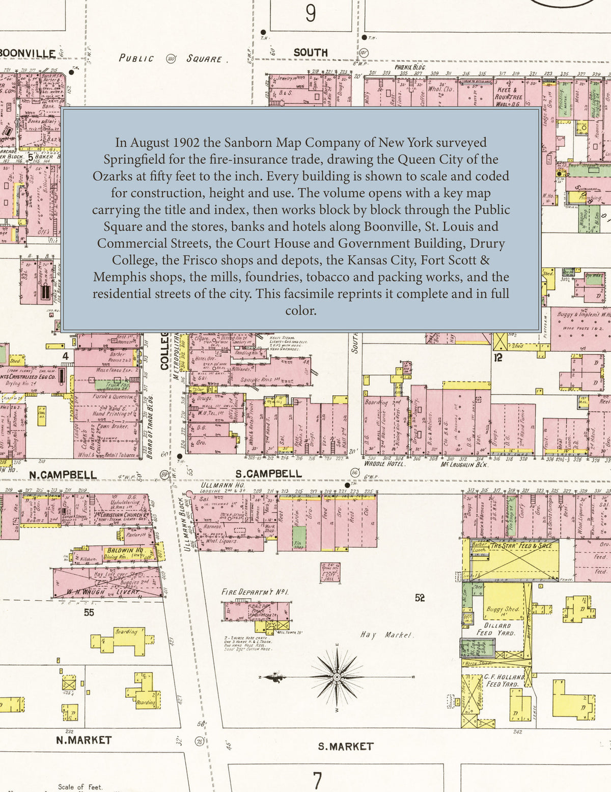
The complete 1902 Sanborn fire-insurance atlas of Springfield, Missouri, reprinted in full color. It covers the whole city, from the downtown blocks out to the city limits.
The thirty-eight numbered sheets work block by block from the Public Square and the stores, banks and hotels along Boonville, St. Louis, College, Olive and Commercial Streets, the Greene County Court House and Jail, the Government Building, the Baldwin Theatre, the Metropolitan, Arlington, Columbia, Crescent and Queen City hotels, the Baker Arcade and the Phoenix, Ullmann and Johnson blocks, through Drury College, the Normal School, the St. Louis & San Francisco passenger depot, freight house and shops, the Kansas City, Fort Scott & Memphis passenger depot and shops, the Springfield Wagon, Furniture, Iron Works, Traction and Cooperage companies, the Anchor, Eagle and Model mills, the Anthony and Porter plug-tobacco factories, the Armour and Class packing houses, the Anheuser-Busch and Hamburg brewing depots and bakeries, the Sterling Iron Works and Standard Bottling Works, the Southwestern Paper Company, Sacred Heart Catholic Church and School, St. John's Hospital and the Employees' Hospital, to the churches, schools and residential streets of the city.
In 1902 the Sanborn Map Company of New York surveyed Springfield for the fire-insurance trade, drawing the city at fifty feet to the inch. Every building is shown to scale and color-coded for construction (yellow for frame, pink for brick, blue for stone), with heights, uses, windows, party walls, hydrants, water mains and fire stations all marked. The index lists every street and every named business, church, school, hotel, mill and works with the sheet it appears on, and the key map places the colored sheet grid over the whole city.
This edition is an unabridged facsimile republication of the atlas: the key map, which carries the title and index, and all thirty-eight numbered map sheets. Ideal for local historians, genealogists, architects, preservationists and anyone tracing a Springfield address back to 1902.
40 pages. 8.5" x 11". Full color. Paperback.
Printed to order and shipped directly to you — please allow up to 7 business days before shipment.
Satisfaction guaranteed or you can send it back!