1904 Fire Insurance Maps and Atlas of Malden, Massachusetts
1904 Fire Insurance Maps and Atlas of Malden, Massachusetts
Couldn't load pickup availability
Facsimile of the 1904 Sanborn fire-insurance atlas of Malden, Massachusetts, reproduced in full color from the Library of Congress copy. It covers the whole city of 35,000 between Medford, Melrose and Everett, from the City Hall, stores and banks of Pleasant and Main Streets and the mills on the Malden River out through the West End, Oak Grove, Edgeworth, Belmont Hill, Maplewood, Linden and the Linden Highlands, with an additional sheet of 1919.
The sixty-three numbered sheets work block by block from the stores, banks and blocks of Pleasant Street, Main Street and Salem Street - the City Hall, the Public Library, the Armory, the Malden Auditorium, the Y. M. C. A., Joslin's department store, Kaulbach's Block, the Evening Mail and Evening News printing offices, the Evelyn House and Hotel Pleasant - through the Boston and Maine stations at Malden, Oak Grove, Maplewood and Linden, the Boston and Northern street railway, the Malden Electric Company and the Malden and Melrose Gas Light works, the Boston Rubber Shoe Company's mill, the Franklin Rubber, Boston Chicle and International Electro Chemical companies, the Richard Patent Leather works and Webster tannery, the Wadsworth, Howland paint works, the New England dyeing and cleansing works, the Holmes and Collins knitting mills, the Perry and American picture companies, the Harden pocket-book, Parker shoe, Middlesex and Malden last, Jordan and Cristie brush and Robinson soap factories, the granite, lumber, coal and ice yards, to the Malden City Hospital, the Home for Aged Persons, the City Alms House, the High School and the Centre, Linden, Maplewood, Belmont, Emerson, Ford, Franklin, Glenwood, Judson, Lincoln and Pierce schools, the Immaculate Conception, Sacred Heart and St. Joseph's Catholic churches, St. Paul's and St. Luke's Episcopal, the First Baptist, Trinitarian, Unitarian, Universalist, Methodist, Swedish Lutheran and colored Union Baptist churches and the synagogue, and the residential streets of the West End, Oak Grove, Edgeworth, Belmont Hill, Maplewood, Linden and the Linden Highlands, with the additional sheet of 1919 on Fairview Avenue and Summit Terrace.
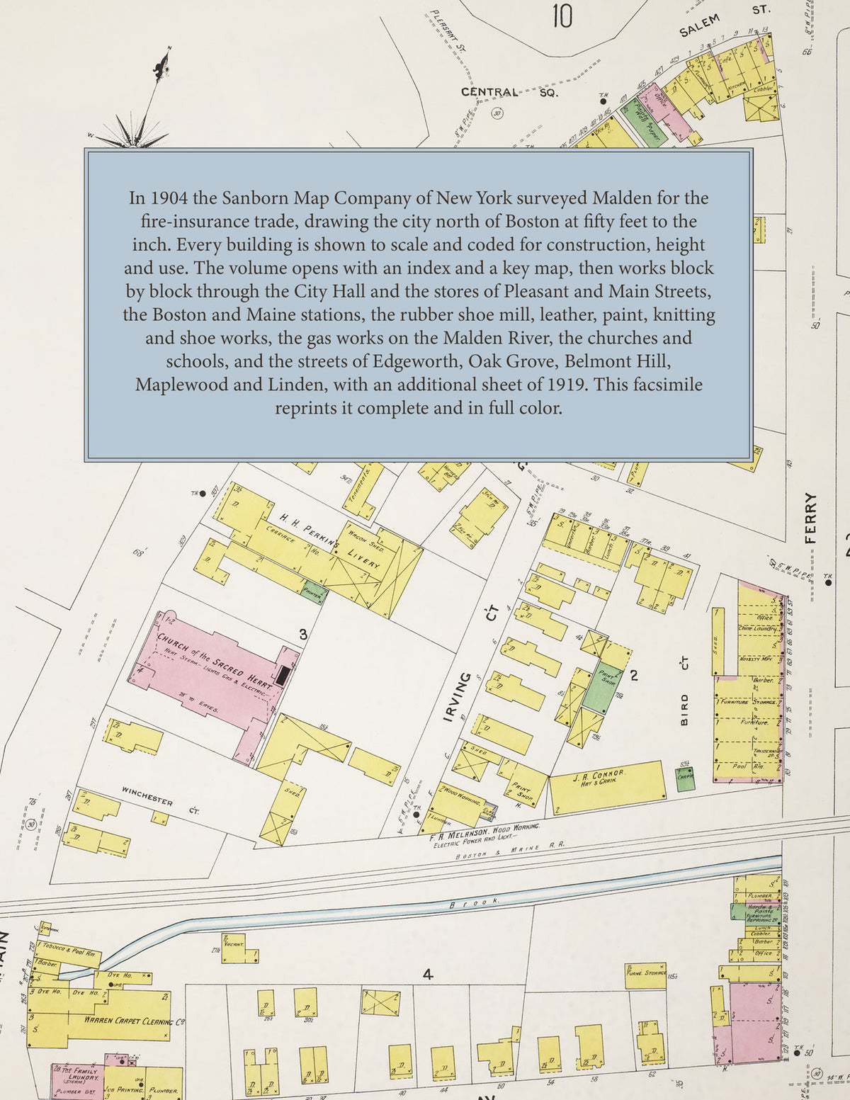
In 1904 the Sanborn Map Company of New York surveyed Malden for the fire-insurance trade, drawing the city at fifty feet to the inch and the outer streets of Maplewood and Linden at one hundred feet to the inch; an additional sheet of 1919 adds the new streets off Fairview Avenue. Every building is shown to scale and color-coded for construction (yellow for frame, pink for brick, blue for stone), with heights, uses, windows, party walls, hydrants, water mains and fire stations all marked. The index lists every street and every named business, church, school, hotel, mill and works with the sheet it appears on, and the key map places the colored sheet grid over the whole city.
This edition is an unabridged facsimile republication of the atlas: the combined title and index sheet, the key map with the report, all sixty-three numbered map sheets, and the additional sheet 64 of May 1919. Ideal for local historians, genealogists, architects, preservationists and anyone tracing a Malden address back to 1904.
68 pages. 8.5" x 11". Full color. Paperback.
Printed to order and shipped directly to you — please allow up to 7 business days before shipment.
Satisfaction guaranteed or you can send it back!