ExileBooks
1905 Fire Insurance Maps and Atlas of Fall River, Massachusetts
1905 Fire Insurance Maps and Atlas of Fall River, Massachusetts
Couldn't load pickup availability
Facsimile of the 1905 Sanborn fire-insurance atlas of Fall River, Massachusetts, reproduced in full color from the Library of Congress copy. It covers the whole city of 113,000 people, from the stores, banks and City Hall along South Main, Pleasant and Bedford Streets and the cotton mills on the Quequechan River and the Watuppa Ponds, through the wharves on Mount Hope Bay and the Taunton River, to the residential streets around North Park, South Park and Cook Pond and the villages of Somerset and Swansea.
The one hundred nineteen numbered sheets work block by block from the stores, banks, hotels and theatres along South Main Street, North Main Street, Pleasant Street, Bedford Street, Pocasset Street and Second Street - the City Hall, the Post Office and Custom House, the County Court House, the Public Library, the Armory, the Fire Department Headquarters, the Academy of Music, the Bijou, Casto and Rich's theatres and the Nickelodeon, the Granite, Borden, Troy, Nichols and Masonic buildings, the Richardson, Langford, Lafayette and McKinley hotels, the Y. M. C. A. - through the New York, New Haven & Hartford passenger station, Ferry Street depot, Watuppa station, round house, wharf and cotton sheds, the coal wharves, the American Linen, Arkwright, Barnaby, Border City, Bourne, Chace, Conanicut, Cornell, Davis, Davol, Durfee, Flint, Granite, Hargraves, King Philip, Laurel Lake, Massasoit, Mechanics, Merchants, Metacomet, Narragansett, Osborn, Parker, Pocasset, Robeson, Sagamore, Seaconnet, Seaside, Shove, Slade, Stafford, Tecumseh, Troy, Union, Wampanoag, Weetamoe and Westport cotton mills, the Kerr thread mills, the New England Cotton Yarn Company, the American Printing Company, the Algonquin Printing Works and the Fall River Bleachery, the Mount Hope Iron Works, the Fall River Boiler Works and Foundry and Machine Works, the Crescent, Bristol County and Marshall hat factories, the Goss, Holden and Small Bros. rope and cordage works, the Somerset Stove Foundry, the Swansea Dye Works, the King Philip, Old Colony and Enterprise breweries, the Fall River Gas Works and Electric Light Company, to the City Hospital and Union Hospital, St. Vincent's and St. Joseph's orphans' homes, the Children's Home, the Durfee High School, the Bradford-Durfee Textile School, the Sacred Heart Academy and the public schools, Notre Dame Cathedral, St. Anne's, St. Mary's, St. Patrick's, St. Louis' and St. Stanislaus' Polish churches, the Protestant churches of every denomination and the synagogues, the Fall River Yacht Club, North Park, South Park, Ruggles Park and Oak Grove Cemetery, and the residential streets out to Cook Pond and the Rhode Island line, with Somerset across the Taunton River and the Town Hall and Stevens Library at Swansea.
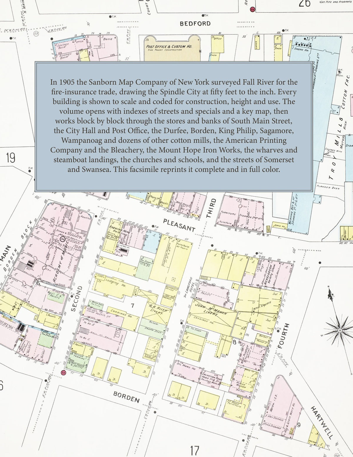
In 1905 the Sanborn Map Company of New York surveyed Fall River for the fire-insurance trade, drawing the city at fifty feet to the inch. Every building is shown to scale and color-coded for construction (yellow for frame, pink for brick, blue for stone), with heights, uses, windows, party walls, hydrants, water mains and fire stations all marked. The index lists every street and every named business, church, school, hotel, mill and works with the sheet it appears on, and the key map places the colored sheet grid over the whole city.
This edition is an unabridged facsimile republication of the atlas: the title sheet, the index of streets, the index of specials, the key map and all one hundred nineteen numbered map sheets. Ideal for local historians, genealogists, architects, preservationists and anyone tracing a Fall River address back to 1905.
124 pages. 8.5" x 11". Full color. Paperback.
Printed to order and shipped directly to you — please allow up to 7 business days before shipment.
Satisfaction guaranteed or you can send it back!