1905 Fire Insurance Maps and Atlas of Louisville, Kentucky, Volume 3
1905 Fire Insurance Maps and Atlas of Louisville, Kentucky, Volume 3
Couldn't load pickup availability
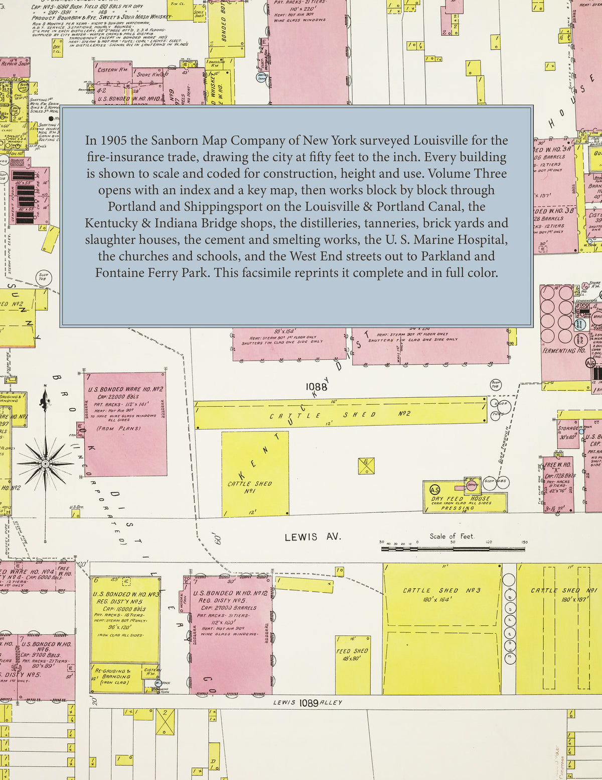
Facsimile of the third volume of the 1905 Sanborn fire-insurance atlas of Louisville, Kentucky, reproduced in full color from the Library of Congress copy. Volume Three covers the city west of Twenty-second Street: Portland and Shippingsport along the Louisville & Portland Canal and the Ohio, the West End streets between Market Street, Broadway and Magnolia Avenue out to Parkland, and the outlying sheets for Fontaine Ferry Park, Riverview Park and the slaughter houses on West Market Street.
The ninety-one numbered sheets work block by block from the river front and the Louisville & Portland Canal at Portland and Shippingsport - the U. S. Marine Hospital, the Kentucky & Indiana Bridge Railroad's coal elevator, power house and repair shops, the Southern Railroad offices, the Louisville Gas Company's Portland station and the Louisville Railway car barns on Portland Avenue, West Market, Jefferson and West Chestnut Streets - through the distilleries of the Kentucky Distilleries & Warehouse Company - the Marion County, J. W. Mattingly, John G. Roach and J. B. Wathen houses - and the Rugby, Sunny Brook, Glencoe, Bonnie Brothers and Number One distilleries, the Louisville Brewery, the Merchants Refrigerating ice factory and the Park Ice works, the Monarch Tobacco Works and the Dannenhold and Grant tobacco factories, the Eclipse and Morgan-Lyons vinegar works, the Louisville Brick, West Broadway Brick, Market Street Brick and Hydraulic Brick yards, the Louisville Cement and Cement & Lime works, the Falls City and Louisville smelting works, the Crescent bank-furniture and coffee-mill works, the Gimnich furniture factory and the Beckwith Organ Company, the Ritter tannery and the Standard Pig Skin Tannery, and the slaughter houses of West Market Street, to St. Benedict's Academy at Cedar Grove, the Good Shepherd Convent, the Colored Orphans' Home, St. Margaret's Hospital, the Church of Our Lady, St. Cecelia's, St. Charles's, St. George's and St. Antonius churches and schools, the Portland, Parkland and Twelfth Ward schools, the Portland and Parkland Baptist churches and the Woodland Avenue Presbyterian Church, the Parkland swimming pool, Riverview Park beer garden and Fontaine Ferry Park, and the residential streets of Portland, the West End and Parkland.
In 1905 the Sanborn Map Company of New York surveyed Louisville for the fire-insurance trade, drawing the city at fifty feet to the inch. Every building is shown to scale and color-coded for construction (yellow for frame, pink for brick, blue for stone), with heights, uses, windows, party walls, hydrants, water mains and fire stations all marked. The index lists every street in this volume and every named business, church, school, distillery, mill and works with the sheet it appears on, and the key map places the colored sheet grid over Portland, the canal and the West End.
This Tangletown Press edition is an unabridged facsimile republication of the atlas: the title sheet, the index, the key map and all ninety-one numbered map sheets (201 to 291). Ideal for local historians, genealogists, architects, preservationists and anyone tracing a Louisville address back to 1905.
96 pages. 8.5" x 11". Full color. Paperback.
Printed to order and shipped directly to you — please allow up to 7 business days before shipment.
Satisfaction guaranteed or you can send it back!