1907 Fire Insurance Maps and Atlas of Jackson, Michigan
1907 Fire Insurance Maps and Atlas of Jackson, Michigan
Couldn't load pickup availability
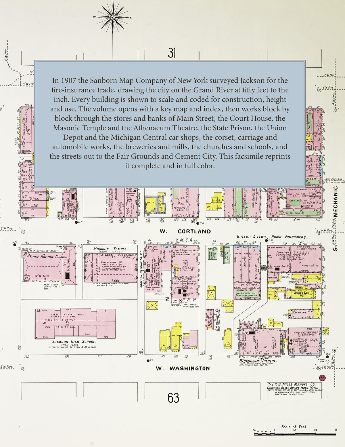
Facsimile of the 1907 Sanborn fire-insurance atlas of Jackson, Michigan, reproduced in full color from the Library of Congress copy. It covers the whole city of 33,000 people, from the stores, banks, hotels and theatres of Main, Cortland and Mechanic Streets and the Court House, through the Michigan State Prison, the Michigan Central car shops and the corset, carriage and automobile factories along the Grand River, to the residential streets out to the city limits, the outlying works and the Peninsular Portland Cement plant at Cement City.
The ninety-two numbered sheets work block by block from the stores, banks, hotels and theatres along Main Street, Cortland Street, Mechanic Street, Jackson Street and Washington Street - the County Court House and Jail, the Post Office, the Public Library, the Michigan National Guard Armory, the Masonic Temple, the Elks Temple, the Y. M. C. A. Building, the Carter and Dwight buildings, the Athenaeum and Bijou theatres, the Glasgow Bros. and L. H. Field department stores, the Hotel Blackman, Dalton, Murray and Ruhl and the Otsego Hotel - through the Michigan State Prison, the Union Depot, the Michigan Central freight depot, round house and car shops, the Grand Trunk freight house and round house, the Lake Shore & Michigan Southern freight house, the Jackson Consolidated Traction and electric railway car barns, the Jackson Automobile, Whiting Motor Car and E. C. Clark Motor companies, the Michigan Wagon Manufacturing Company, the Fuller Buggy, Ames-Dean and Granger-Teer carriage works, the Lewis Spring and Axle and Jackson Cushion Spring companies, the Jackson, Coronet, Reliance and American Lady corset factories, the skirt and underwear factories, the Frost Gear, Eureka Machine and cement-machinery works, the Jackson Drop Forging Company, the Washington and Cooley Manufacturing plants, the Michigan Condensed Milk Company, the Jackson Glass Works, the Jackson Gas Company and the Commonwealth Power Company, the City Water Works, the Eberle and Haehnle breweries, the Engel cider refinery, the Taylor, Preece and Eldred flour mills, the Bennett Sewer Pipe Company, the Jackson Press Brick Company, the Leslie and Mitchell granite works, to the Jackson City Hospital, the White Cross Sanitarium, the Home of the Friendless, the Jackson High School, the Central Union School, the East Side, West End and ward schools, St. John's Academy, the Catholic, Baptist, Methodist, Presbyterian, Congregational, Episcopal, Lutheran, Unitarian and African Methodist churches and the synagogue, the Jackson Fair Grounds Park and Arbeiter Park, and the residential streets out to the city limits, with the Peninsular Portland Cement Company's works and village at Cement City.
In 1907 the Sanborn Map Company of New York surveyed Jackson for the fire-insurance trade, drawing the city at fifty feet to the inch. Every building is shown to scale and color-coded for construction (yellow for frame, pink for brick, blue for stone), with heights, uses, windows, party walls, hydrants, water mains and fire stations all marked. The index lists every street and every named business, church, school, hotel, mill and works with the sheet it appears on, and the key map places the colored sheet grid over the whole city.
This edition is an unabridged facsimile republication of the atlas: the combined title and key map sheet, the index and all ninety-two numbered map sheets, including the outlying works and Cement City. Ideal for local historians, genealogists, architects, preservationists and anyone tracing a Jackson address back to 1907.
96 pages. 8.5" x 11". Full color. Paperback.
Printed to order and shipped directly to you — please allow up to 7 business days before shipment.
Satisfaction guaranteed or you can send it back!