1907 Fire Insurance Maps and Atlas of Youngstown, Ohio, Volume 2
1907 Fire Insurance Maps and Atlas of Youngstown, Ohio, Volume 2
Couldn't load pickup availability
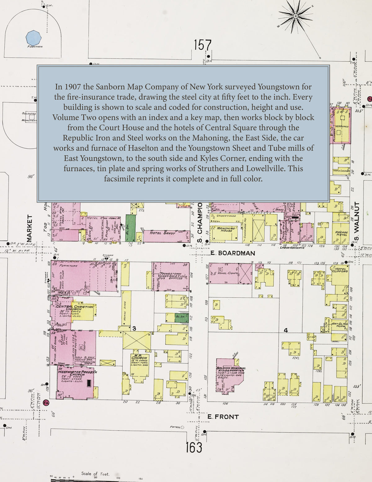
Facsimile of the second volume of the 1907 Sanborn fire-insurance atlas of Youngstown, Ohio, reproduced in full color from the Library of Congress copy. Volume Two of the Youngstown set covers the city east of Wick Avenue and Market Street: the Court House and the east side of Central Square, East Federal and Boardman Streets and the Republic iron and steel works on the Mahoning River, Wick Avenue north past Crab Creek, the East Side from Himrod Avenue to Shehy Street, Haselton and East Youngstown, the south side along South and Poland Avenues to Kyles Corner, and the mill villages of Struthers and Lowellville down the river.
The eighty-two numbered sheets work block by block from the stores, hotels and halls along East Federal Street, East Boardman Street, Front Street and Wick Avenue - the Mahoning County Court House, the Park Hotel, Iron City Hotel, Scanlon and Savoy hotels and the Tod House, the Park Theatre, Elliot Hall and Emerald Hall, the Y. M. C. A. and Y. W. C. A. buildings, the Telegram and Labor Advocate printing offices, the Morris Hardware Company and the Youngstown Consolidated Gas and Electric Company's office and plant - through the Republic Iron and Steel Company's Brown-Bonnell works, Bessemer plant, Haselton furnace and Mahoning Valley plant, the Youngstown Sheet and Tube Company, the National Tube Company, the American Bridge Company, the Youngstown Iron and Steel Roofing Company, the W. B. Pollock steel plate works, the William Tod Company's engine works, the Youngstown Car Manufacturing, Forge and Furnace and Supply companies, the Republic Rubber and American Belting companies, the General Fire Proofing Company, the National Light and Thorium Company, the Reliance Edge Tool Company, the Youngstown Macaroni Factory and Pottery Works, the Freedom Oil Works, the Jacobs and Tibbits lumber yards and the Pittsburgh and Lake Erie round house and shops, to the Oak Street, McGuffey Street, Wood Street, Market Street, Poland Avenue, Fairmount and East Youngstown schools, the Immaculate Conception, St. Columbus and St. Stanislaus Catholic churches, St. John's Episcopal, Memorial and Westminster Presbyterian, Trinity Lutheran, Welsh Baptist and Central Christian churches and the synagogue, and the residential streets of the East Side, Haselton and East Youngstown, with Struthers - the Struthers Furnace, the American Sheet and Tin Plate Company and the Morgan Spring Company - and Lowellville with the Ohio Iron and Steel Company and the Union House.
In 1907 the Sanborn Map Company of New York surveyed Youngstown for the fire-insurance trade, drawing the city at fifty feet to the inch. Every building is shown to scale and color-coded for construction (yellow for frame, pink for brick, blue for stone), with heights, uses, windows, party walls, hydrants, water mains and fire stations all marked. The index lists every street in this volume and every named business, church, school, hotel, mill and works with the sheet it appears on, and the key map places the colored sheet grid over Youngstown east of Wick Avenue and Market Street, Haselton and East Youngstown, with small keys of their own for Struthers and Lowellville.
This Tangletown Press edition is an unabridged facsimile republication of the atlas: the title sheet, the index, the key map and all eighty-two numbered map sheets (151 to 232, numbered as issued). Ideal for local historians, genealogists, architects, preservationists and anyone tracing a Youngstown address back to 1907.
86 pages. 8.5" x 11". Full color. Paperback.
Printed to order and shipped directly to you — please allow up to 7 business days before shipment.
Satisfaction guaranteed or you can send it back!