1908-1924 Fire Insurance Maps and Atlas of Bellaire, Ohio, Volume 2
1908-1924 Fire Insurance Maps and Atlas of Bellaire, Ohio, Volume 2
Couldn't load pickup availability
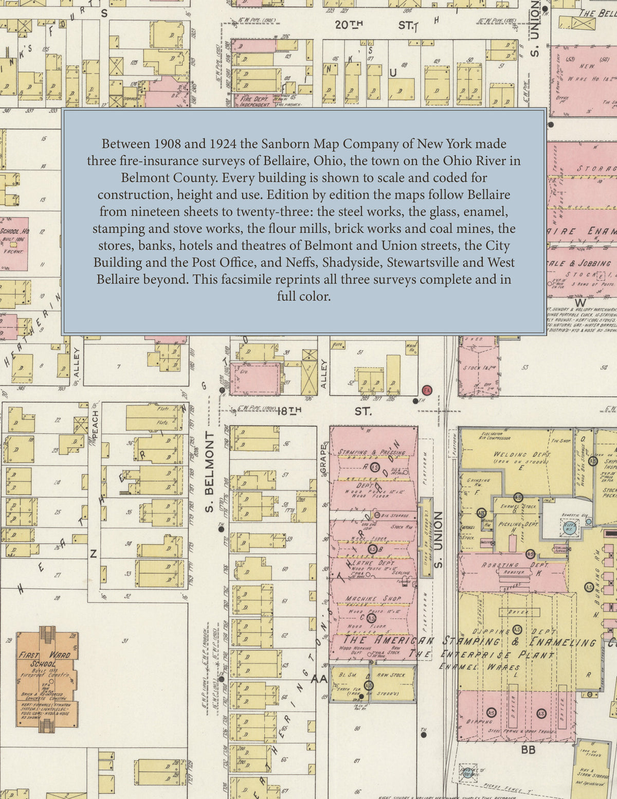
Facsimile of three Sanborn fire-insurance surveys of Bellaire, Ohio, made between 1908 and 1924, reproduced in full color from the Library of Congress copies. Together they cover the town on the Ohio River in Belmont County with Neffs and Shadyside, and by 1924 McClainsville, Stewartsville, Klee, Warnock and West Bellaire: the stores, banks, hotels and theatres of Belmont and Union streets, the City Building and the Post Office, the steel, glass, enamel, stamping and stove works along the river and the railroads, the coal mines and brick works, and the residential streets out along Indian Run and the McMahon Creek Pike.
In February 1908 nineteen sheets show the Carnegie Steel Co. and the Bellaire Steel Works, the Imperial Glass Co., the Elite Glass Works and T. A. Rodefer's glass factories, the Buckeye, Bellaire and Enterprise enamel companies, the Novelty Stamping Co., the Bellaire Stove, Bottle, Brewing, Carriage, Furniture and Paint and Color companies, the Bellaire Light and Power Co., the Daisy Roller Flour Mills, the Stewart and Ward Roller Mills and the Eastern Ohio Milling Co., the Strong Battelle M'f'g Co., the Suburban Brick Co., the Standard Stone and Brick Co., the Rail and River Coal Co.'s mines, the B. and O. R. R. freight depot, the C. and P. R. R. depots and round house, the City Building, the Columbian and Olympic theatres, Schmulbach Hall and the Exchange, Globe and Windsor hotels and Hotel Anderson. The May 1915 survey of twenty sheets adds the American Stamping and Enameling Co.'s Enterprise and Novelty plants, the Carnegie Steel Co.'s Bellaire Works, the Electric Railway Equipment Co.'s iron and steel tubular pole works, the Rodefer Glass Co., the Pursglove-Maher Coal Co.'s Black Diamond, Glenn and Pursglove mines, the Bellaire City Hospital, the Daily Leader printing office, the B. P. O. E. Building and Theatre, Hotel Wilson, the First Ward and Union Street schools and the public schools at West Bellaire; in June 1924 twenty-three sheets reach Klee, Stewartsville, Warnock and West Bellaire, with the Bond Glass Co., the Belmont Casket M'f'g Co., the Koehline Ice and Storage Co., the Cambria and Maher collieries, the Paisley Coal Co.'s Lucy Mine, the Webb and Schick Co-operative mines, the Central Coal Mining Co.'s Clifford Mine, the Youghiogheny and Ohio Coal Co.'s Dellora Mine, the Post Office, the Masonic Hall, the High School and the public school at Shadyside. The earlier surveys of 1884 to 1900 appear in Volume 1.
Between 1908 and 1924 the Sanborn Map Company of New York made three surveys of Bellaire for the fire-insurance trade, drawing the town at fifty feet to the inch (the 1924 edition by its scale bars). Every building is shown to scale and color-coded for construction (yellow for frame, pink for brick, blue for stone), with heights, uses, furnaces, engines, watchmen, hydrants and water pipes all marked. Each edition opens with a key map of the whole town and an index of named businesses, works, churches, schools and hotels, and a divider page introduces each edition.
This Tangletown Press edition is an unabridged facsimile republication of the atlas: all sixty-two map sheets of the three editions of 1908, 1915 and 1924, each edition with its key map and its index, each introduced by a divider page. Ideal for local historians, genealogists, architects, preservationists and anyone tracing a Bellaire address back to 1908-1924.
68 pages. 8.5" x 11". Full color. Paperback.
Printed to order and shipped directly to you — please allow up to 7 business days before shipment.
Satisfaction guaranteed or you can send it back!