1908 Fire Insurance Atlas of Braddock, PA and Vicinity
1908 Fire Insurance Atlas of Braddock, PA and Vicinity
Couldn't load pickup availability
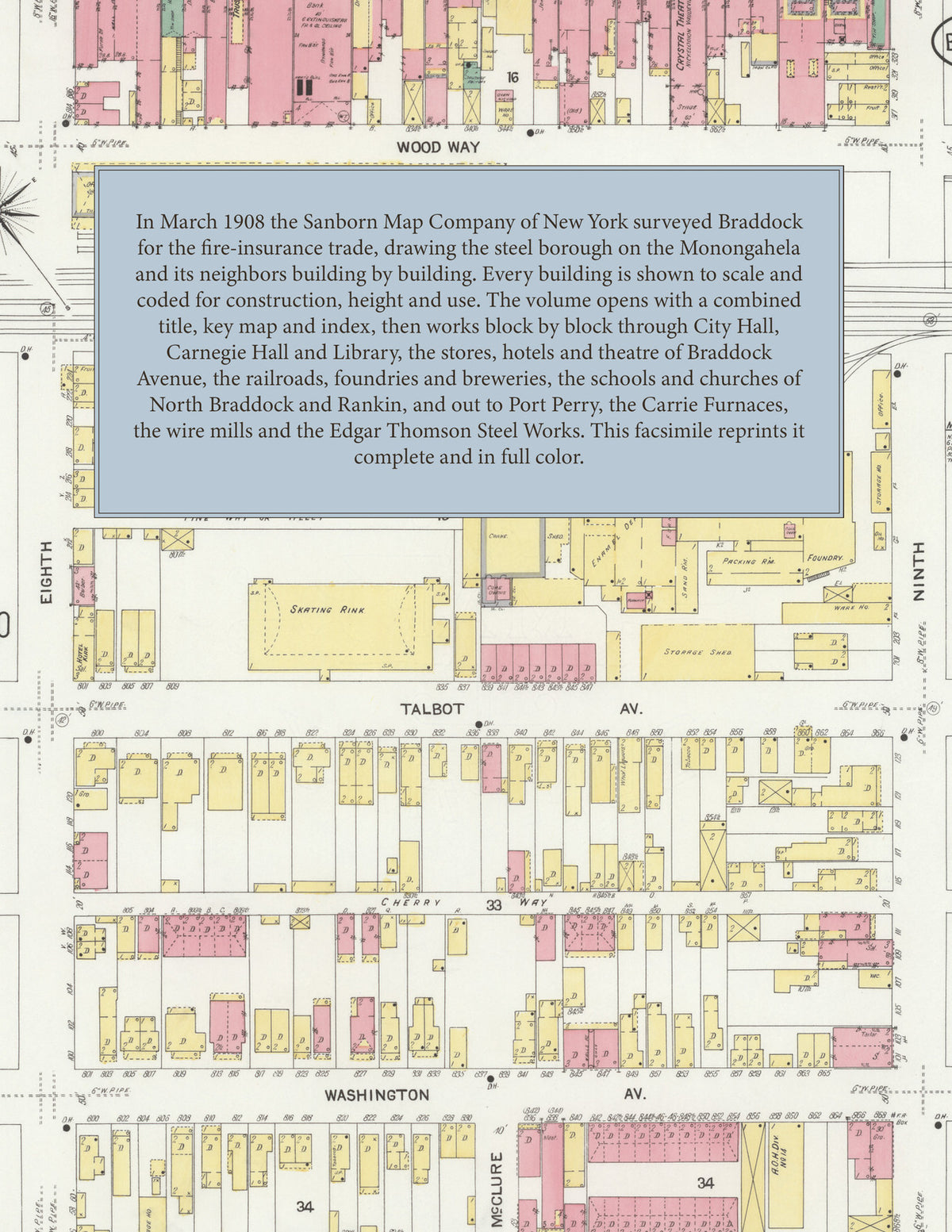
Facsimile of the 1908 Sanborn fire-insurance atlas of Braddock, Pennsylvania, reproduced in full color from the Library of Congress copy. It covers the Allegheny County steel towns of 33,000 people along the Monongahela River - Braddock, North Braddock, Rankin and Port Perry at the mouth of Turtle Creek - from the stores, banks, hotels and theatres of Braddock Avenue and City Hall out along the Pennsylvania, Baltimore and Ohio and P. McK. and Y. railroads to the Edgar Thomson Steel Works, the Carrie Furnaces and the wire mills, the schools, churches and residential streets.
The thirty-five numbered sheets that follow work block by block from the stores, banks and offices along Braddock, Talbot and Halket Avenues - City Hall and Fire Company No. 1, Carnegie Hall and Library, The Famous department store, the Trust Company Building, the Owl Building, the Crystal Theatre, Turner Hall, the Masonic Hall, the American House, the Central, Commercial, Eagle, Keystone, Star, East End, West End and U. S. hotels and the Hotels Boyle, Gelm, Kirk, Lloyd and Imperial - through the Pennsylvania, Baltimore and Ohio and P. McK. and Y. depots, the McVay and Walker foundry and enamel works, the Braddock Machine, Wagon and Gas and Light companies, the Independent and Pittsburg breweries, the Cudahy and Nelson Morris packing houses, the National Biscuit Company, the Chess Brothers rolling mills, the Central Expander Metal and Blaw Collapsible Steel Centering works, the Standard Chain and Pittsburg Chain works, the Sterling Steel Foundry, the Columbia Bridge Company, the McClintic-Marshall Construction Company shops, the United States Steel Corporation's American Steel and Wire mills at Braddock and Rankin, the Carrie Furnaces and the Edgar Thomson Steel Works, the Braddock Water Works and the lumber, ice, coal and dairy yards, to the Braddock General Hospital, the Carnegie School and Carnegie Technical School, the Hamilton, Copeland, Shady Park, Bowers, North Braddock, Rankin and Port Perry schools, St. Joseph's, St. Brendan's, St. Michael's, St. Thomas' and St. Mary's churches, the Presbyterian, United Presbyterian, Methodist, Baptist, Lutheran, Episcopal, Slavonic, Greek Catholic and A. M. E. churches, the Ladies' G. A. R. Home, and the residential streets of North Braddock and Rankin, with Port Perry at the mouth of Turtle Creek.
In March 1908 the Sanborn Map Company of New York surveyed Braddock, North Braddock, Rankin and Port Perry for the fire-insurance trade, drawing the boroughs at fifty feet to the inch and the steel works at eighty and one hundred feet to the inch. Every building is shown to scale and color-coded for construction (yellow for frame, pink for brick, blue for stone), with heights, uses, windows, party walls, hydrants, water mains and fire stations all marked. The index lists every street and every named business, church, school, hotel, mill and works with the sheet it appears on, and the key map places the colored sheet grid over the whole city.
This edition is an unabridged facsimile republication of the atlas: all thirty-six numbered map sheets, 1 to 36, sheet 1 being the combined title, key map and index sheet with its report on the water works and fire departments, the others covering Braddock, North Braddock, Rankin and Port Perry, with the Edgar Thomson Steel Works, the Carrie Furnaces and the wire mills. Ideal for local historians, genealogists, architects, preservationists and anyone tracing a Braddock address back to 1908.
38 pages. 8.5" x 11". Full color. Paperback.
Printed to order and shipped directly to you — please allow up to 7 business days before shipment.
Satisfaction guaranteed or you can send it back!