1908 Fire Insurance Maps and Atlas of Bridgeton, New Jersey
1908 Fire Insurance Maps and Atlas of Bridgeton, New Jersey
Couldn't load pickup availability
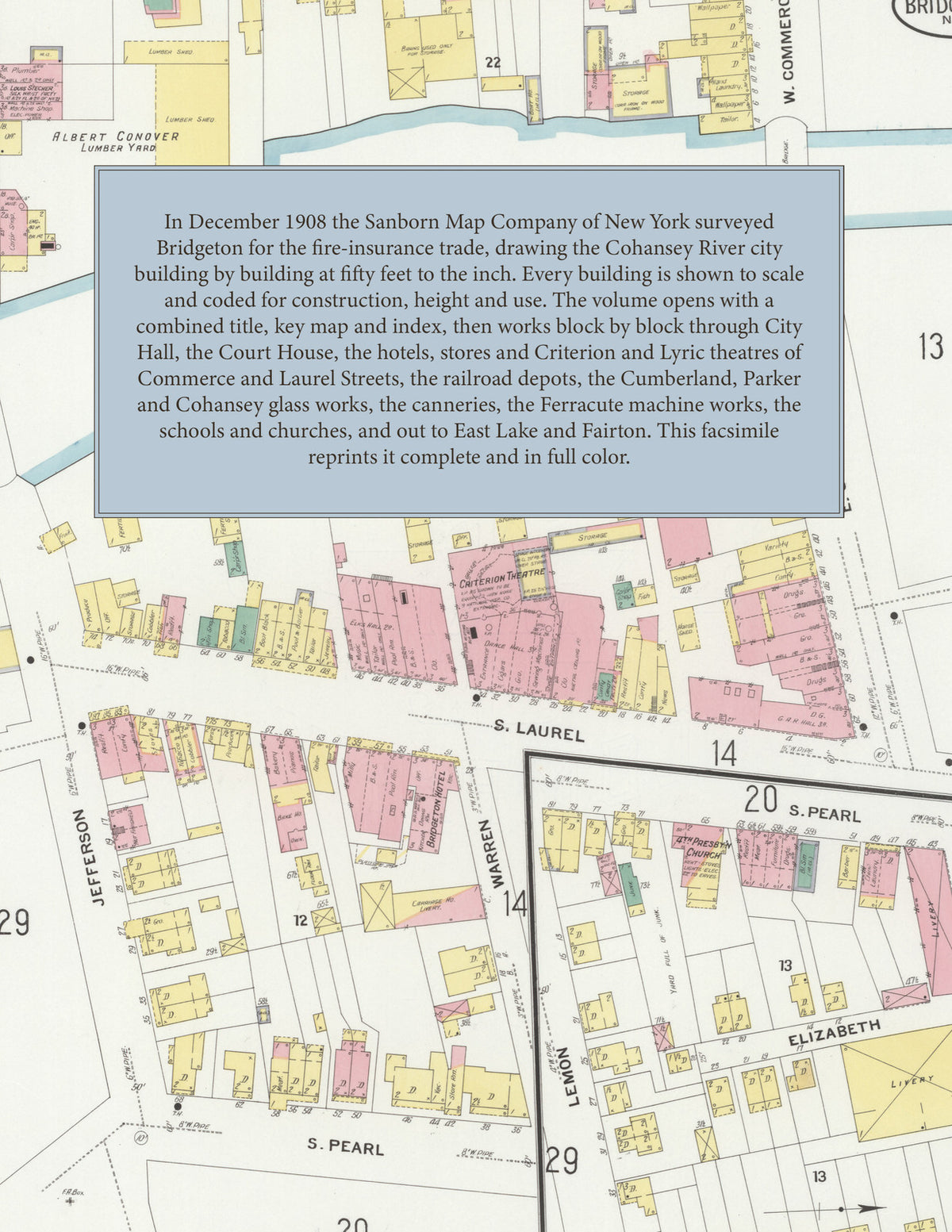
Facsimile of the 1908 Sanborn fire-insurance atlas of Bridgeton, New Jersey, reproduced in full color from the Library of Congress copy. It covers the whole Cumberland County seat of 15,000 people on both banks of the Cohansey River, from City Hall, the Court House and the stores, banks, hotels and theatres of Commerce, Laurel and Pearl Streets out along the Central Railroad of New Jersey and the West Jersey and Seashore Railroad to the glass works, canneries and machine shops, the schools, churches and residential streets around East Lake and Sunset Lake, and two factories at Fairton.
The thirty-three numbered sheets that follow work block by block from the stores, banks and offices along Commerce, Laurel, Pearl, Broad and Atlantic Streets - City Hall, the County Court House and Jail, the Fire Department Station, the Evening News and Pioneer Printing offices, the Hunt Brothers department store, the Criterion and Lyric theatres, the Bridgeton, Central, Commercial, City and West Jersey hotels - through the Central Railroad of New Jersey depots and produce house, the railroad depot by the glass works, the Cumberland Glass Manufacturing Company, the Parker Brothers, Cohansey, American Window, More and Shoemaker glass works and the Woodbury Bottle Works at Fairton, the Ayars, Baker, Fairdale, Fairton, Lanning, Pritchard and Gidden canneries, the Sanitary Can Company, the Bridgeton Condensed Milk Company, the Ferracute Machine Company, the Hettinger Engine Company, the Cox machine works, the Bridgeton Iron Company, the Crescent Art Metal and Acme Gas Fixture works, the Martin dyeing and finishing works, the shirt, silk-waist and garment factories, the candy and ice-cream makers, the Segal rolling mill, the Thompson grist mill, the Frazeur Lime Works, the Bridgeton Brick Company, the gas, electric and traction companies, the City Water Works, and the coal, lumber and ice yards, to the Bridgeton Hospital, the West Jersey Academy, the Bank Street, Vine Street, South Avenue and Monroe Street schools, St. Mary's, the Presbyterian, Methodist, Baptist, Lutheran, Episcopal and A. M. E. churches, Tumbling Dam Park, and the residential streets around East Lake, Sunset Lake and Mill Creek.
In 1908 the Sanborn Map Company of New York surveyed Bridgeton for the fire-insurance trade, drawing the city at fifty feet to the inch. Every building is shown to scale and color-coded for construction (yellow for frame, pink for brick, blue for stone), with heights, uses, windows, party walls, hydrants, water mains and fire stations all marked. The index lists every street and every named business, church, school, hotel, mill and works with the sheet it appears on, and the key map places the colored sheet grid over the whole city.
This edition is an unabridged facsimile republication of the atlas: all thirty-four numbered map sheets, 1 to 34, sheet 1 being the combined title, key map and index sheet with its report on the water works and fire department, the others covering the city on both banks of the Cohansey River from the business blocks of Commerce and Laurel Streets to the glass works, canneries and machine shops, the residential streets, and two works at Fairton. Ideal for local historians, genealogists, architects, preservationists and anyone tracing a Bridgeton address back to 1908.
36 pages. 8.5" x 11". Full color. Paperback.
Printed to order and shipped directly to you — please allow up to 7 business days before shipment.
Satisfaction guaranteed or you can send it back!