1908 Fire Insurance Maps and Atlas of Chicago, Illinois, Volume 18
1908 Fire Insurance Maps and Atlas of Chicago, Illinois, Volume 18
Couldn't load pickup availability
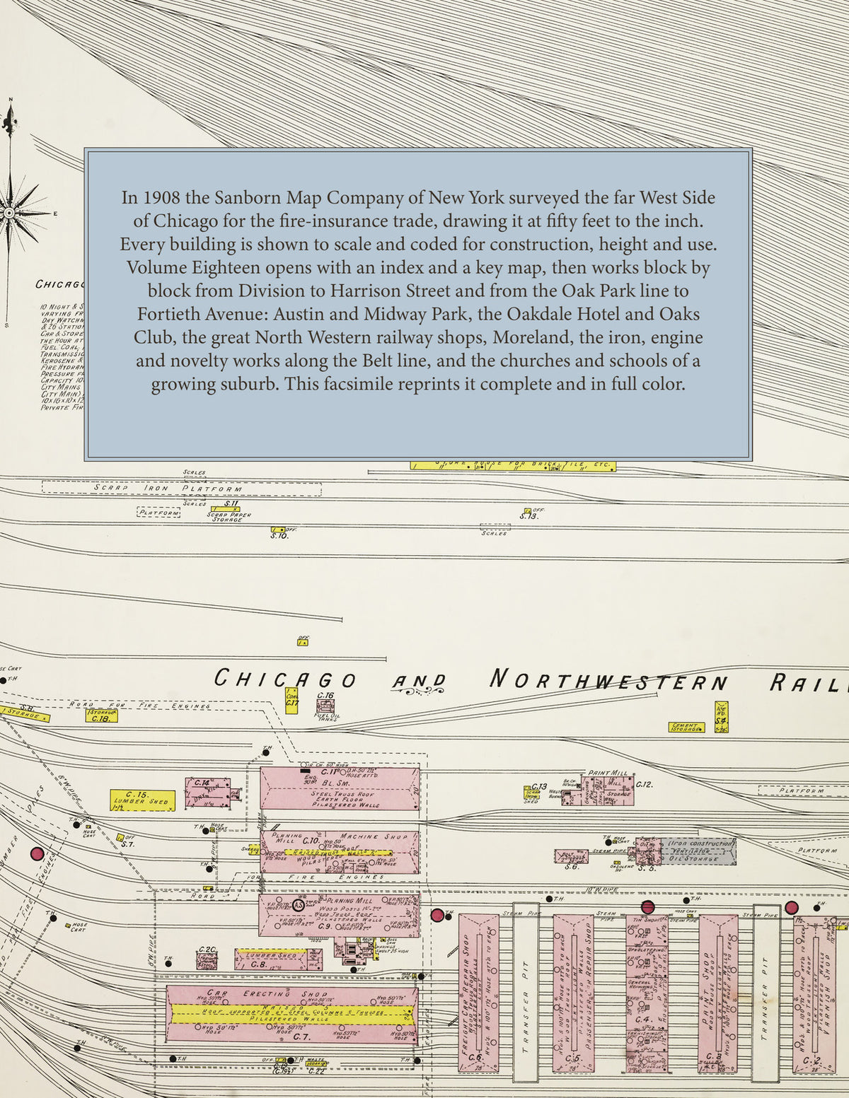
Facsimile of the 1908 Sanborn fire-insurance atlas of Chicago, Illinois, Volume Eighteen of the Chicago set, reproduced in full color from the Library of Congress copy. It covers the far West Side from Division Street south to Harrison Street and from Austin Avenue, the Oak Park line, east to Fortieth Avenue: Austin with Midway Park and its business blocks on Lake Street, Moreland, the Chicago & North Western Railway's Chicago Shops between Chicago Avenue and Kinzie Street, and the residential grid along Washington Boulevard, Madison, Adams, Jackson and Van Buren Streets.
The one hundred thirty-four numbered sheets work block by block from the business blocks of Austin along Lake Street and the North Western's Galena Division - the Oakdale and Austin hotels, the Oaks Club, the Hansell, Rehberg Hall, the Fair branch delivery station and the Y.M.C.A. of the Chicago & North Western Railway Department - through the Chicago & North Western Railway Company's Chicago Shops, the Chicago Consolidated Traction Company's barns, the Western Engine Works, the Winslow Bros. Company's ornamental iron and bronze works, the Reedy Foundry Company, the Wood tool factory, the Walsh machine shop, the Wemple shade factory, the Lincoln Standard Novelties Corporation, the Lundin patent medicine factory, the Hope Publishing Company, the Schock printing works, the Starck piano company, the Meyercord Company, the Kelly plumbers' specialties works, the Acme Supply Company, the United Sanitary Dairy, the McBride & Knobber ice cream works, the Meacham & Wright and Wisconsin Lime and Cement warehouses, the Decker storage warehouses and the Cadle and Cicero lumber, coal, hay and grain yards along the Belt line, to St. Anne's Hospital, the Austin High School, the Byford, Francis Scott Key, Tilton, Henry H. Nash, Herbert Spencer, Horatio N. May, Julia Ward Howe, Robert Emmett and Moreland schools, St. Catherine's Academy and Church, St. Mel's Church, School and Convent, Help of Christians Church and School, the German Catholic Holy Ghost Church, St. Barnabas' and St. Martin's Episcopal churches, the First Baptist, Congregational, Methodist and Presbyterian churches of Austin, the Calvary Presbyterian, Central Park Congregational, Garfield Park Baptist and Adams Street Methodist churches, the Norwegian, Swedish and German Lutheran churches, and the residential streets of Austin, Midway Park and Moreland.
In 1908 the Sanborn Map Company of New York surveyed Chicago for the fire-insurance trade, drawing the city at fifty feet to the inch. Every building is shown to scale and color-coded for construction (yellow for frame, pink for brick, blue for stone), with heights, uses, windows, party walls, hydrants, water mains and fire stations all marked. The index lists every street and every named business, church, school and works in this volume with the sheet it appears on, and the key map places the colored sheet grid over the West Side from Austin to Fortieth Avenue.
This edition is an unabridged facsimile republication of the atlas: the index, the title sheet with the key map and all one hundred thirty-four numbered map sheets. Ideal for local historians, genealogists, architects, preservationists and anyone tracing a Chicago address back to 1908.
138 pages. 8.5" x 11". Full color. Paperback.
Printed to order and shipped directly to you — please allow up to 7 business days before shipment.
Satisfaction guaranteed or you can send it back!