1908 Fire Insurance Maps & Atlas of Cortland and McGrawville, New York
1908 Fire Insurance Maps & Atlas of Cortland and McGrawville, New York
Couldn't load pickup availability
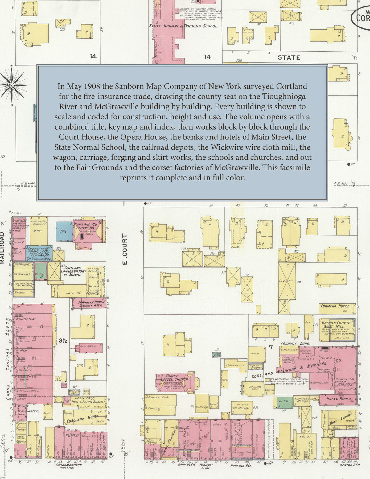
Facsimile of the 1908 Sanborn fire-insurance atlas of Cortland and McGrawville, New York, reproduced in full color from the Library of Congress copy. It covers the Cortland County seat of 14,000 people at the forks of the Tioughnioga River, from the Court House and the stores, banks, hotels and opera house of Main and Court Streets out along the Lackawanna and Lehigh Valley railroads to the Wickwire wire cloth mill, the carriage, wagon, skirt and corset works, the schools, churches and residential streets, the County Fair Grounds, and McGrawville.
The thirty-three numbered sheets that follow work block by block from the stores, banks and offices along Main, Court, Railroad and Port Watson Streets and Groton and Clinton Avenues - the County Court House and Jail, the Bank, Beaudry, Churchill, Garrison, Sager, Shermerhorn, Standard and Wallace buildings, the Grand Central, Hopkins, Keator, Samson, Squires, Goddard and Union Hall blocks, the Cortland Democrat office, the Telephone Building, the Franklin Hatch Library, the Cortland Conservatory of Music, the Cortland Opera House, the Brunswick, Burns, Empire, Venice, Farmers, European, St. Charles, Cottage, Elm, Lehigh, Arlington and Park hotels and the Cortland, Dexter and East Cortland houses, and the fire houses - through the Lackawanna and Lehigh Valley passenger and freight depots, round houses and repair shops, the E. and C. N. Y. depot at McGrawville, the Wickwire Brothers wire cloth mill and roller mills, the Wallace wall paper works, the Cortland Forging, Corundum Wheel, Foundry and Machine, Wagon, Carriage Goods, Automobile, Incubator, Sheet Metal Tool, Specialty, Skirt and Silk companies, the Gillets skirt and Davis works, the Champion Milk Cooler Company, the Newton and Keator and Wells carriage works, the Cooper Brothers foundry, the barrel works and cooperage, the grist and saw mills, the bottling works, beef company and packers, the Ekenberg milk products and Seiler milk depot, the Cortland Water Works, the gas light company and the traction power house and car barn, and the lumber and coal yards, to the Cortland Hospital, the County Alms House, the Kings Daughters Home for Children, the State Normal and Training School, the Central, Oswego Street and public schools, St. Mary of the Vale Catholic Church, the Baptist, Congregational, Dutch Reformed, Universalist, Presbyterian, Methodist and Episcopal churches, the County Fair Grounds, and the residential streets out to McGrawville, with the Empire and McGraw corset factories and the Central Paper Box Company.
In May 1908 the Sanborn Map Company of New York surveyed Cortland and McGrawville for the fire-insurance trade, drawing them at fifty feet to the inch. Every building is shown to scale and color-coded for construction (yellow for frame, pink for brick, blue for stone), with heights, uses, windows, party walls, hydrants, water mains and fire stations all marked. The index lists every street and every named business, church, school, hotel, mill and works with the sheet it appears on, and the key map places the colored sheet grid over the whole city.
This edition is an unabridged facsimile republication of the atlas: all thirty-four numbered map sheets, 1 to 34, sheet 1 being the combined title, key map and index sheet with its report on the water works and fire department, the others covering the city at the forks of the Tioughnioga River, the railroad depots and yards, the Wickwire wire cloth mill, the County Fair Grounds and the outlying works, and McGrawville. Ideal for local historians, genealogists, architects, preservationists and anyone tracing a Cortland address back to 1908.
36 pages. 8.5" x 11". Full color. Paperback.
Printed to order and shipped directly to you — please allow up to 7 business days before shipment.
Satisfaction guaranteed or you can send it back!