1908 Fire Insurance Maps and Atlas of Guthrie, Oklahoma
1908 Fire Insurance Maps and Atlas of Guthrie, Oklahoma
Couldn't load pickup availability
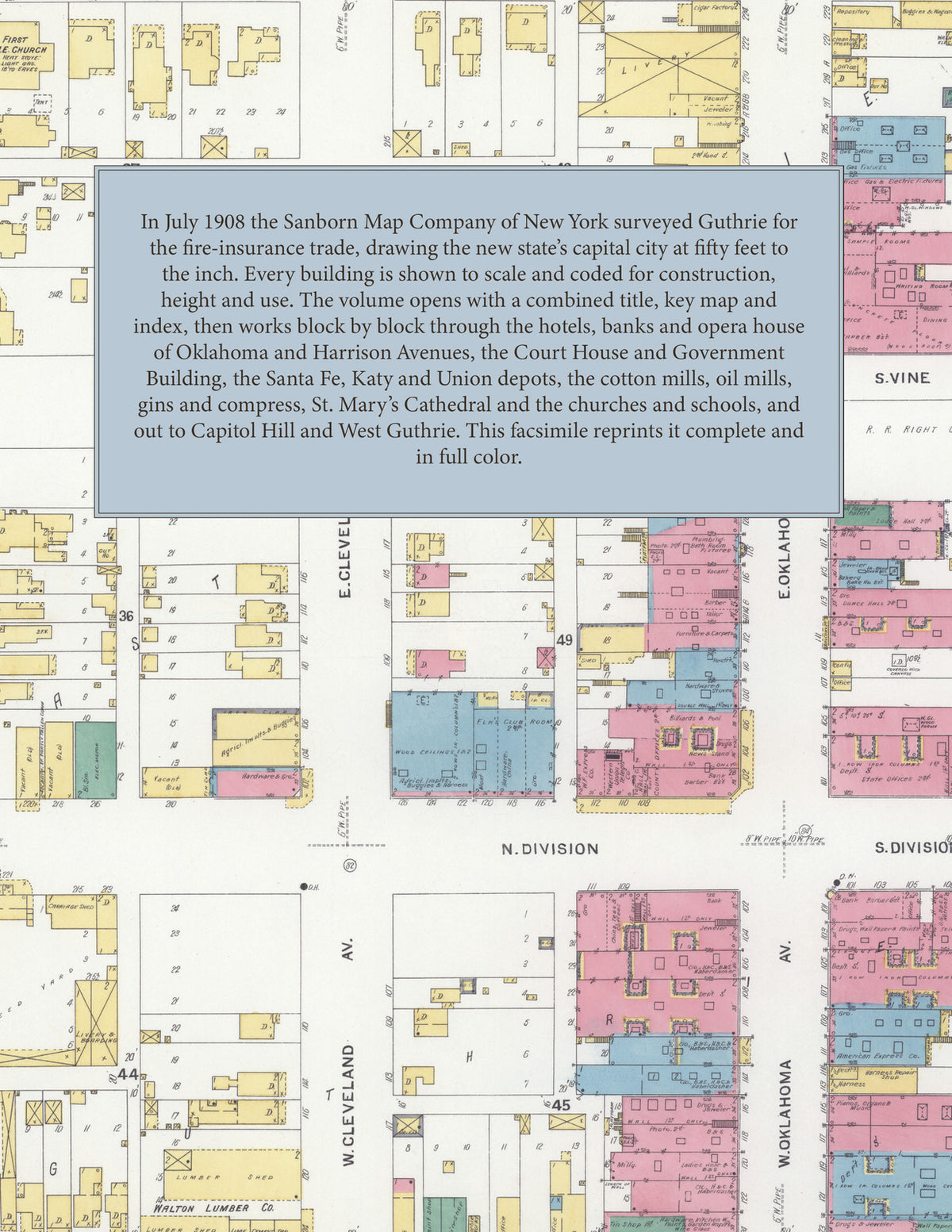
Facsimile of the 1908 Sanborn fire-insurance atlas of Guthrie, Oklahoma, reproduced in full color from the Library of Congress copy. It covers the whole Logan County city of 20,000 people, from the stores, banks and hotels of Oklahoma and Harrison Avenues and the Union Depot, across Cottonwood Creek to West Guthrie, and out to Capitol Hill, North Guthrie, the cotton and oil mills and the Santa Fe round house.
The twenty-seven numbered sheets that follow work block by block from the stores, banks and offices along Oklahoma, Harrison, Cleveland and Vilas Avenues and First, Second and Division Streets - the County Court House and Jail, the City Hall, the U. S. Government Building, the Carnegie Library, the Masonic Temple, Brook's Opera House, the State Capitol Printing Company, the fire stations, and the Daly, Elks, Guthrie, Ione, Royal, Metropolitan, Palace and New Occidental hotels - through the Union Depot, the A. T. & S. F. freight and passenger depots and round house, the M. K. & T. and C. O. & G. depots, the Pioneer Cotton Mills, the Farmers Union and Houghton & Douglass oil mills and gins, the Traders Compress, the Southwestern Iron Company, the Coyle, Guthrie and Model Roller mills and elevators, the Oklahoma Cereal Company and Cigar Box Factory, the Capital Canning Company, the Ruemmeli-Braun and Guthrie ice plants, the gas works, electric light plant and water works, the Guthrie Creamery, Bottling and Carriage works, the Muskogee Oil Refining and Waters-Pierce oil companies, the Cooper & Bones brick yard, the Arkansas, Walton, Ward and West Side lumber yards and the Williamson-Halsell-Frazer wholesale grocery, to the Methodist Episcopal Hospital, the Logan County High School, the Central, Capitol and Banner schools, the Douglas and Lincoln schools for colored children, the Oklahoma School for the Deaf, St. Mary's Cathedral and School, St. Catherine's School, St. Joseph's Retreat and Convent, the Baptist, Christian, Methodist, Presbyterian, Episcopal, Lutheran, Congregational and colored churches, and the residential streets of Capitol Hill, West Guthrie, North Guthrie and Williams Heights.
In 1908 the Sanborn Map Company of New York surveyed Guthrie for the fire-insurance trade, drawing the city at fifty feet to the inch. Every building is shown to scale and color-coded for construction (yellow for frame, pink for brick, blue for stone), with heights, uses, windows, party walls, hydrants, water mains and fire stations all marked. The index lists every street and every named business, church, school, hotel, mill and works with the sheet it appears on, and the key map places the colored sheet grid over the whole city.
This edition is an unabridged facsimile republication of the atlas: all twenty-eight numbered map sheets, 1 to 28, sheet 1 being the combined title, key map and index sheet with its report on the water facilities and fire department, and the last sheet covering the outlying cotton mills, oil mills, compress, iron works, round house and water works. Ideal for local historians, genealogists, architects, preservationists and anyone tracing a Guthrie address back to 1908.
32 pages. 8.5" x 11". Full color. Paperback.
Printed to order and shipped directly to you — please allow up to 7 business days before shipment.
Satisfaction guaranteed or you can send it back!