1908 Fire Insurance Maps and Atlas of Racine, Wisconsin
1908 Fire Insurance Maps and Atlas of Racine, Wisconsin
Couldn't load pickup availability
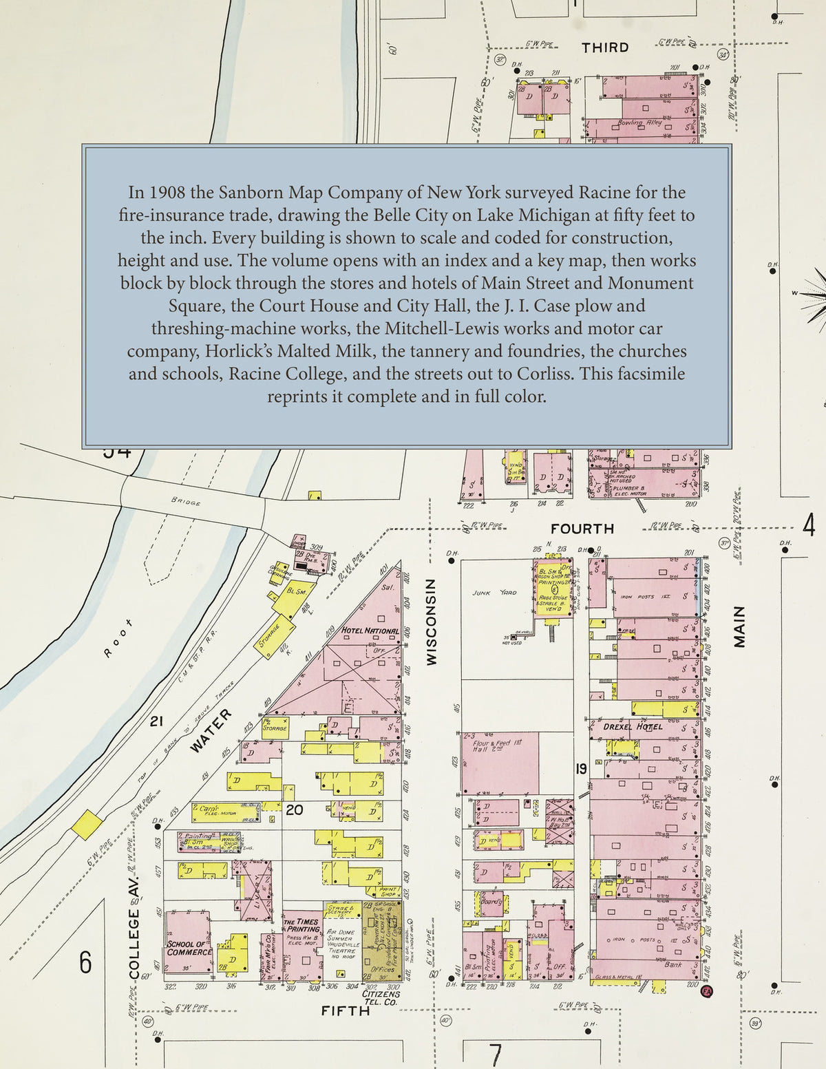
Facsimile of the 1908 Sanborn fire-insurance atlas of Racine, Wisconsin, reproduced in full color from the Library of Congress copy. It covers the whole city of 35,000 people, from the stores, hotels, City Hall and Court House around Monument Square and Main Street and the docks at the mouth of the Root River, through the J. I. Case works and the factories along the river and the railroads, to the residential streets of the north and south sides out to Racine College, Island Park, Washington Park and the suburb of Corliss.
The ninety numbered sheets work block by block from the stores, banks, hotels and theatres along Main Street, Wisconsin Street, State Street and Monument Square - the Racine County Court House and Jail, the City Hall, the U. S. Government Building, the Public Library, the Baker and Secor buildings, the Bijou and Racine theatres, Turner Hall, Dania Hall, Father Mathew Hall, the Belle City, Racine, Belvedere, Budar, Mohr, Musil, National, Central, Commercial, Drexel and Merchants hotels - through the Barry Line and Goodrich Transit docks, the Chicago & North Western and Chicago, Milwaukee & St. Paul depots and round house, the J. I. Case Plow Works and J. I. Case Threshing Machine Company, the Mitchell Lewis works, lumber yard and Motor Car Company, the Racine-Sattley wagon works, the American Seating Company, the American Skein and Foundry, Racine Malleable and Wrought Iron, Lakeside Malleable Casting, Belle City Malleable Iron, Gray Iron and Holbrook-Armstrong iron works, the Racine Iron and Engine, Pierce Engine and Racine Engine and Machinery companies, the Wisconsin Engine Company at Corliss, the Johnson & Field, Hilkers-Wiechers, Fish Bros. wagon, Racine Refrigerator, Racine Boot, Racine Trunk, Hartman Trunk, Fiebrich-Fox-Hilker Shoe, Racine Woolen Mills and Blake woolen mills, Chicago Rubber Clothing and Racine Paper Box works, the Eisendrath tannery, the Horlick Malted Milk Company and Horlick flour mill, the Root River, Case Bros., Junction and North Side flour mills, the Belle City and Weber Bros. breweries and the Klinkert brewery, the Racine Gas Light Company and Milwaukee Light, Heat and Power works, the coal docks, stone yards and brick yards, to St. Luke's and St. Mary's hospitals, the Old Ladies Home, the Racine County Insane Asylum, the High School, the McMynn, Jefferson, Franklin, Garfield, Washington and Winslow schools, St. Catherine's and Holy Rosary academies, Racine College, the Catholic, Lutheran, Danish, Norwegian, Swedish, Bohemian, Polish and German churches, the Protestant churches of every denomination and the synagogue, Island Park and Washington Park, and the residential streets of the north and south sides and of Corliss.
In 1908 the Sanborn Map Company of New York surveyed Racine for the fire-insurance trade, drawing the city at fifty feet to the inch. Every building is shown to scale and color-coded for construction (yellow for frame, pink for brick, blue for stone), with heights, uses, windows, party walls, hydrants, water mains and fire stations all marked. The index lists every street and every named business, church, school, hotel, mill and works with the sheet it appears on, and the key map places the colored sheet grid over the whole city.
This edition is an unabridged facsimile republication of the atlas: the title sheet, the index, the key map and all ninety numbered map sheets, including the two sheets of Corliss. Ideal for local historians, genealogists, architects, preservationists and anyone tracing a Racine address back to 1908.
94 pages. 8.5" x 11". Full color. Paperback.
Printed to order and shipped directly to you — please allow up to 7 business days before shipment.
Satisfaction guaranteed or you can send it back!