1908 Fire Insurance Maps and Atlas of Riverside, California
1908 Fire Insurance Maps and Atlas of Riverside, California
Couldn't load pickup availability
The complete 1908 Sanborn fire-insurance atlas of Riverside, California, reprinted in full color. It covers Riverside, Arlington, Casa Blanca, Highgrove and Pachappa, California, in the Orange Groves of Riverside County, from the downtown blocks out to the city limits.
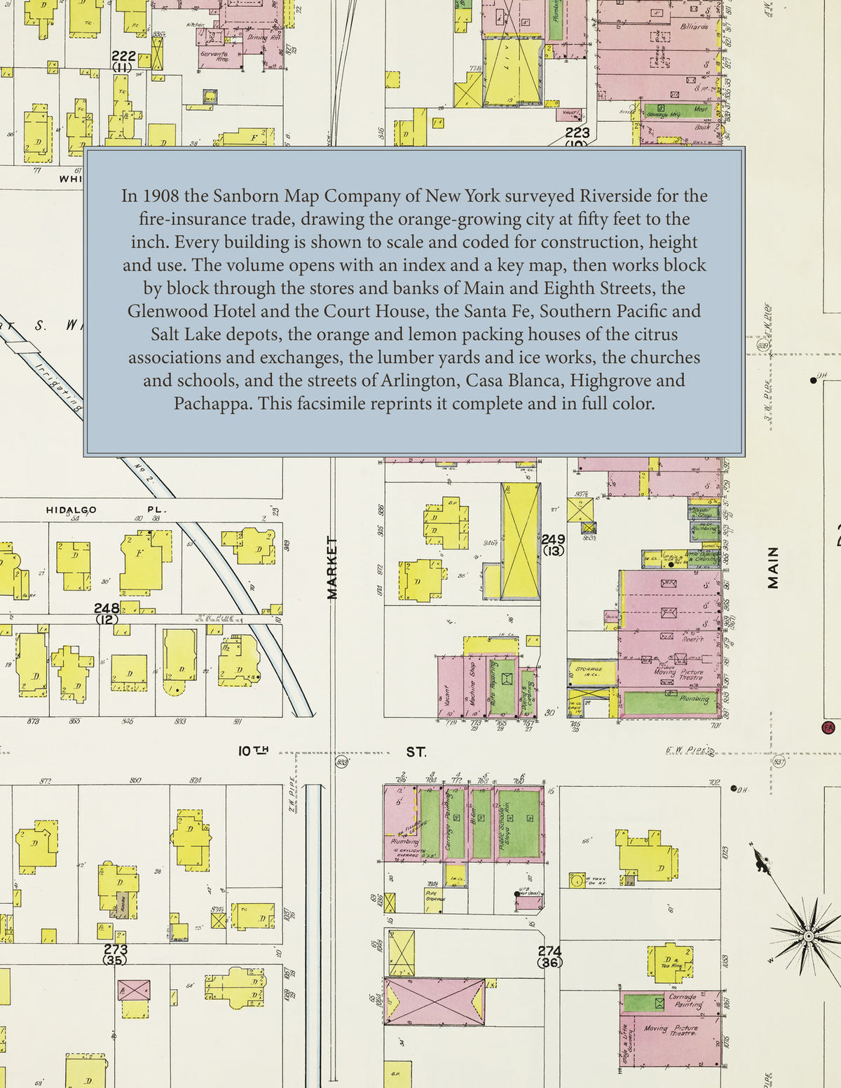
The fifty-nine numbered sheets work block by block from the stores, banks, hotels and theatres along Main Street, Eighth Street, Seventh Street, Orange Street and Market Street - the County Court House and Jail, the City Hall, the Carnegie Library, the Loring Opera House, the Masonic Temple, the I. O. O. F. Building, the Ribidoux Building, the Woman's Club House, the Glenwood, Reynolds and Holyrood hotels and the Arlington Apartments - through the Atchison, Topeka & Santa Fe freight depot and passenger station and its Casa Blanca, Highgrove and Pachappa stations, the Southern Pacific freight house, passenger station and round house, the San Pedro, Los Angeles & Salt Lake depot, the Riverside & Arlington Railway car barn, the packing houses of the California Citrus Union at Arlington Station, Casa Blanca and Highgrove, the Riverside Heights, Pachappa, Victoria Avenue, Fairview, Hawarden, Highgrove Fruit Exchange and Orange Growers' Cash associations, the Alta Cresta, Altland, Carson, Ely-Gilmore, Independent, La Mesa, Moulton & Greene, Pattee & Lett, Penn, Pinkham & McKevitt, Prenda, Randolph, Speich, Strachan, Sutherland, Verrill and Worthley & Strong fruit packing houses, the Riverside Navel Orange Company and the Lemon Curing house, the Riverside Orange Company's Balmoral, Osborne and Windsor camps, the National Ice and Cold Storage Company's ice works, the Pacific, Russ and Seaton & Kinnear lumber yards, the Riverside Foundry and Machine Shops, the Riverside Iron Works, the Miller and Cresmer manufacturing works, the Riverside Milling and Fuel Company, the Small hay and feed warehouse, the Royal and Riverside steam laundries, the Daily Press printing house, the City Electric Light Plant and the San Bernardino Gas and Electric power house at Highgrove, to the Riverside Hospital and the County Hospital, the Riverside High School, the Grant, Longfellow, Sixth Street, Thirteenth Street and Washington schools and the Arlington Place and Highgrove schools, the Catholic church on Twelfth Street, All Saints Episcopal, the Baptist, Methodist, Presbyterian, Congregational, Christian, Lutheran, Adventist, Swedish and New Jerusalem churches, the Christian Science church and the African Methodist church, and the residential streets of the city and of Arlington, Casa Blanca, Highgrove and Pachappa.
In 1908 the Sanborn Map Company of New York surveyed Riverside for the fire-insurance trade, drawing the city at fifty feet to the inch. Every building is shown to scale and color-coded for construction (yellow for frame, pink for brick, blue for stone), with heights, uses, windows, party walls, hydrants, water mains and fire stations all marked. The index lists every street and every named business, church, school, hotel, mill and works with the sheet it appears on, and the key map places the colored sheet grid over the whole city.
This edition is an unabridged facsimile republication of the atlas: the combined title and index sheet, the key map and all fifty-nine numbered map sheets. Ideal for local historians, genealogists, architects, preservationists and anyone tracing a Riverside address back to 1908.
62 pages. 8.5" x 11". Full color. Paperback.
Printed to order and shipped directly to you — please allow up to 7 business days before shipment.
Satisfaction guaranteed or you can send it back!