1909 Fire Insurance Maps and Atlas of Hanover, Pennsylvania
1909 Fire Insurance Maps and Atlas of Hanover, Pennsylvania
Couldn't load pickup availability
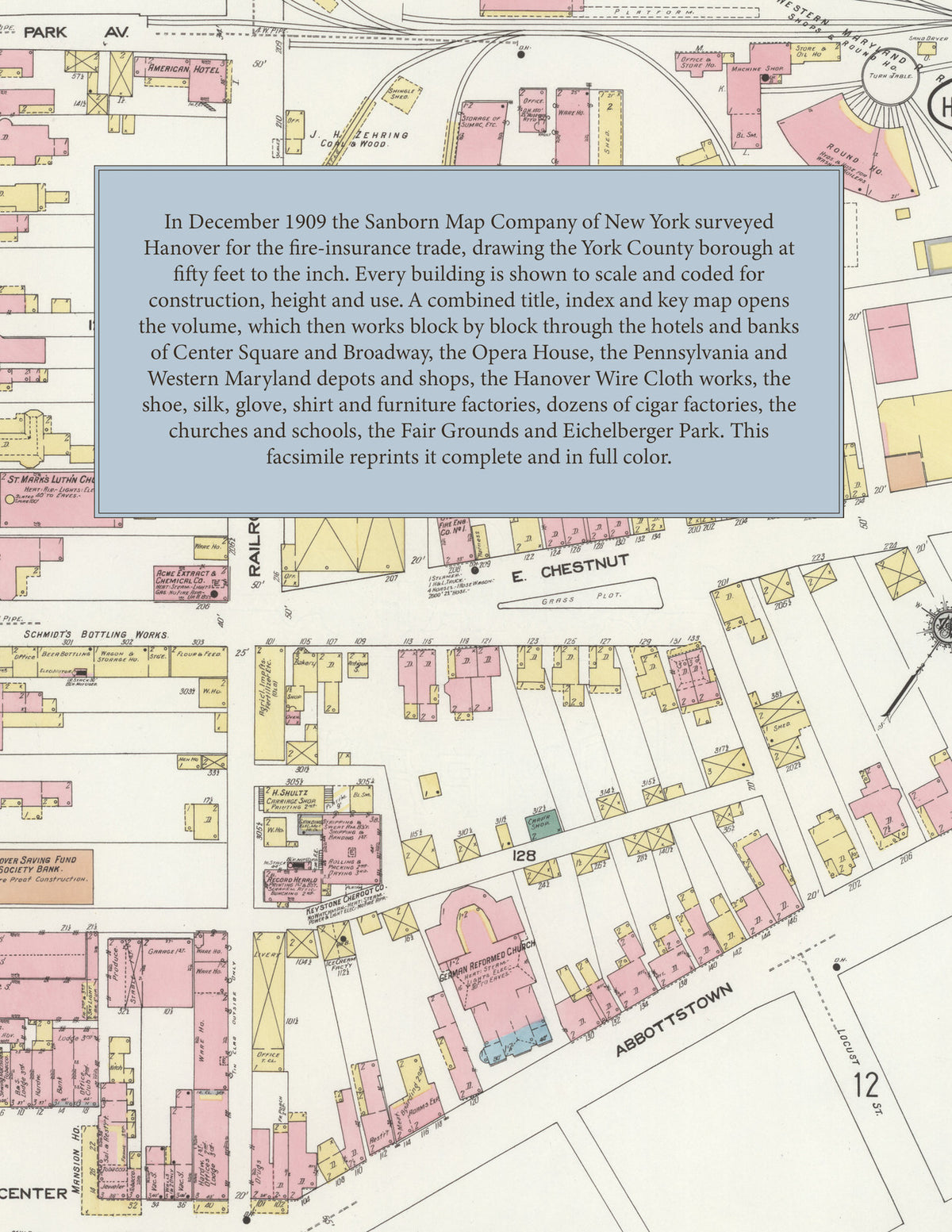
Facsimile of the 1909 Sanborn fire-insurance atlas of Hanover, Pennsylvania, reproduced in full color from the Library of Congress copy. It covers the whole York County borough of 10,000 people, from the stores, banks and hotels around Center Square and along Broadway, Baltimore and Frederick Streets out along the Pennsylvania and Western Maryland railroads to the wire cloth, shoe, silk and furniture works and the cigar factories, the schools, churches and residential streets, the Fair Grounds and Eichelberger Park.
The twenty-four numbered sheets that follow work block by block from the stores, banks and hotels around Center Square and along Broadway, Baltimore Street, Frederick Street, Carlisle Street and York Street - the Hanover Saving Fund Society bank building, the Opera House, the Fire Department, the Eagles' Club House, the Record Herald printing office, the Skating Rink and the Central, City, Franklin, Exchange, European, American, Mansion, Albaugh, Colonial, Hanover and O'Bold hotels - through the Pennsylvania Railroad freight house, the Western Maryland Railroad freight house, shops and round house, the Union Station, the Hanover and McSherrystown Street Railway car barns, the Hanover Wire Cloth Company, the Hanover Silk, Shirt, Glove, Cordage, Heel, Plow Handle, Bending and Furniture companies, the Penn Heel and Innersole Company, the Sheppard and Myers shoe factory, the Long Furniture Company, the Smith Lyraphone Company, the Hopkins wagon and truck works, the Levering Bros. and Pressler and Hoffman foundries, the Fitz Waterwheel Company, the Acme Extract and Chemical Company, the Young tanners' and dyers' extract works, the Winebrenner canning factories, the Hanover fertilizer, ice, gas and light companies, the Penn Mill, the Moul and Rohrbaugh planing mills, the Snyder brick works, the Hoke lime kilns, the Eagle Broom Works, and the cigar factories and cigar box factories of Bair, Carl, Fink, Hostetter, Imperial, Kling, Krug, Newcomer, Penn, Pfaff, Sneeringer, Sterner, Trone, Wireman and Young, to the Eichelberger, High Street, Walnut Street and Hanover Street public schools and the Penn Township School, St. Joseph's and St. Vincent's Catholic churches, St. Mark's, St. Matthew's and Third Lutheran churches, the German, Grace and Trinity Reformed churches, the Methodist Episcopal, United Brethren, Mennonite and United Evangelical churches, the Public Park, the Hanover Agricultural Association Fair Grounds, Eichelberger Park, and the residential streets out to the borough line.
In 1909 the Sanborn Map Company of New York surveyed Hanover for the fire-insurance trade, drawing the city at fifty feet to the inch. Every building is shown to scale and color-coded for construction (yellow for frame, pink for brick, blue for stone), with heights, uses, windows, party walls, hydrants, water mains and fire stations all marked. The index lists every street and every named business, church, school, hotel, mill and works with the sheet it appears on, and the key map places the colored sheet grid over the whole city.
This edition is an unabridged facsimile republication of the atlas: all twenty-five map sheets, 1 to 25, sheet 1 being the combined title, index and key map sheet with its report on the water facilities and fire department, the others covering the borough from Center Square out to the factory district, the Fair Grounds and Eichelberger Park. Ideal for local historians, genealogists, architects, preservationists and anyone tracing a Hanover address back to 1909.
32 pages. 8.5" x 11". Full color. Paperback.
Printed to order and shipped directly to you — please allow up to 7 business days before shipment.
Satisfaction guaranteed or you can send it back!