1909 Fire Insurance Maps and Atlas of Hazleton, Pennsylvania
1909 Fire Insurance Maps and Atlas of Hazleton, Pennsylvania
Couldn't load pickup availability
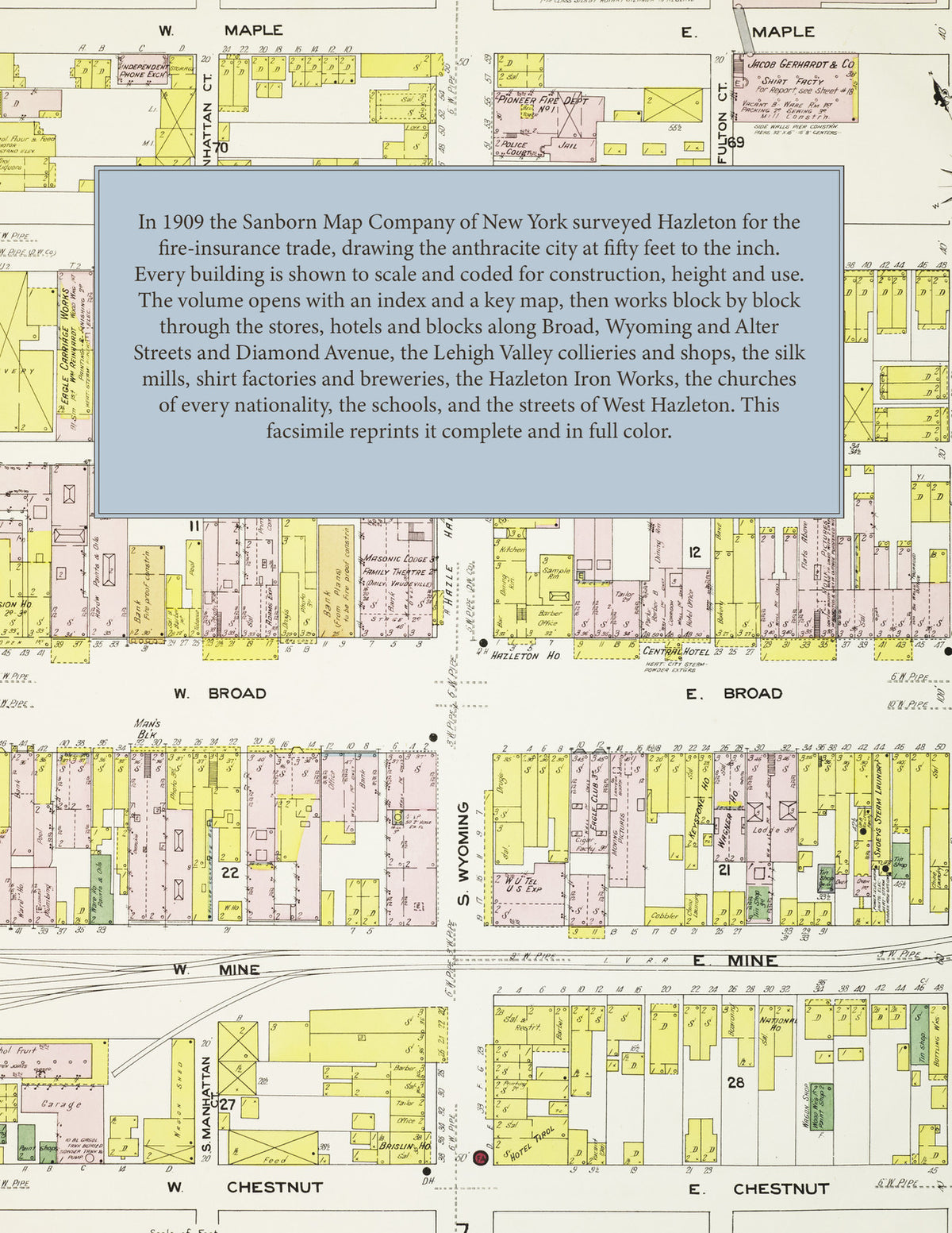
The complete 1909 Sanborn fire-insurance atlas of Hazleton, Pennsylvania, reprinted in full color. It covers Hazleton and West Hazleton, from the downtown blocks out to the city limits.
The forty-seven numbered sheets work block by block from the stores, hotels and blocks along Broad, Wyoming, Alter, Church and Laurel Streets and Diamond Avenue - the Deisroth, Glover, Seager and Man's blocks, the Grand Opera House, the Palace vaudeville theatre, the Central, Valley, Liberty, Hazleton and Terminal hotels, the Mansion House and the Bachman House, the Maennerchor Hall, the Y. M. C. A. and the Hazleton Armory - through the Lehigh Valley Coal Company's Hazleton Colliery No. 1, Shaft Colliery, Shaft No. 5 and Slope No. 3, the Lehigh Valley and Pennsylvania Railroad depots and the Wilkes-Barre & Hazleton Railway car barns and park, the Hazleton, Harleigh, Jeanesville and Benjamin iron and steel works, the Hazleton Sheet Steel Company, the Duplex and Roessel silk mills, the Gerhardt and Jacobs & Janowitz shirt factories, the Hazle and Wilde knitting mills, the Hazleton Manufacturing Company's casket factory, the Hazle, Pilsner and Pennsylvania Central breweries and the Stegmaier, Kaier, Freeland and Yuengling beer depots, the Alexandro and Hazleton macaroni factories, the Saul & Zang paper box factory, the Anthracite Separator Company, the Tunnessen mining lamp works, the Hazleton Bleach Works, the lumber yards of Bright, Campbell, Frederick, Itter, May, Myers, Rausch, Schaub and Veale, the Hazleton Electric Light & Power Company and the Hazleton Water Company's pumping station, to the Hazleton Hospital, the High School and the Township High School, the Alter, Church, Grant, Hazle, Pine, Poplar, Vine and Walnut Street schools, the Catholic, Greek Catholic, Slovak, Polish, Italian and Tyrolean churches, the Reformed, Lutheran, Methodist, Baptist, Presbyterian and Evangelical churches and the synagogue, Hazleton Park, and the residential streets of the city and of West Hazleton with its charity home, lumber yards and schools.
In 1909 the Sanborn Map Company of New York surveyed Hazleton for the fire-insurance trade, drawing the city at fifty feet to the inch. Every building is shown to scale and color-coded for construction (yellow for frame, pink for brick, blue for stone), with heights, uses, windows, party walls, hydrants, water mains and fire stations all marked. The index lists every street and every named business, church, school, hotel, mill and works with the sheet it appears on, and the key map places the colored sheet grid over the whole city.
This edition is an unabridged facsimile republication of the atlas: the title and index sheet, the key map and all forty-seven numbered map sheets together with the two skeleton sheets. Ideal for local historians, genealogists, architects, preservationists and anyone tracing a Hazleton address back to 1909.
52 pages. 8.5" x 11". Full color. Paperback.
Printed to order and shipped directly to you — please allow up to 7 business days before shipment.
Satisfaction guaranteed or you can send it back!