1909 Fire Insurance Maps and Atlas of Lake Charles, Louisiana
1909 Fire Insurance Maps and Atlas of Lake Charles, Louisiana
Couldn't load pickup availability
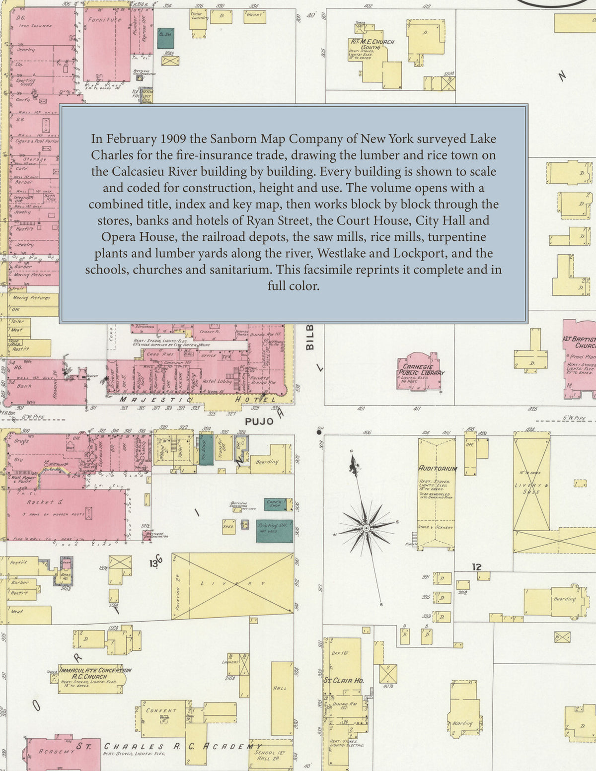
Facsimile of the 1909 Sanborn fire-insurance atlas of Lake Charles, Louisiana, reproduced in full color from the Library of Congress copy. It covers the whole Calcasieu Parish lumber and rice town of 15,000 people on the shore of Lake Charles, from the brick business blocks of Ryan Street and the Parish Court House out through the saw mills, rice mills and lumber yards along the Calcasieu River, to Westlake across the river and the Lock, Moore mill at Lockport.
The thirty-eight numbered sheets work block by block from the stores, banks and offices along Ryan, Pujo, Broad and Front Streets - the Parish Court House and Jail, City Hall and the City Jail, the Post Office, the Carnegie Public Library, the fire stations, the Auditorium, the Opera House, the Lyric Theatre and the Skating Rink, the Elks' Temple, Masonic Temple and K. of P. Hall, the Daily American and Daily Press offices, and the Majestic, City, Walden and Westlake hotels, the Lake Charles House, St. Clair House and Watkins House - through the Southern Pacific and Kansas City Southern depots and freight houses, the Calcasieu Long Leaf, Long-Bell, Powell, Hodge Fence, Hurricane Creek, Krause and Managan and J. A. Bel lumber companies, the Mt. Hope and Lock, Moore saw and planing mills, the Lake Charles, Wall and C. B. Lake rice mills, the Long-Bell and Southland turpentine plants, the Lake Charles Sugar and Macaroni works, the Calcasieu Iron Works, the Cobb Car Company, the Pelican Paint and Tulpo Ladder factories, the brick yards, the Texas Company oil station and the Lake Charles Ice, Light and Water Works, to St. Patrick's Sanitarium, the Louisiana Baptist Orphanage, the High School, Central School, St. Charles' Academy and the ward schools, Immaculate Conception, the Good Shepherd, the Synagogue, the Baptist, Methodist, Presbyterian, Christian and Lutheran churches, and the residential streets of the Bilbo, Reid, Hutchins and Lyons additions, Westlake and Lockport.
In February 1909 the Sanborn Map Company of New York surveyed Lake Charles for the fire-insurance trade, drawing the town, its river mills and Westlake at fifty feet to the inch. Every building is shown to scale and color-coded for construction (yellow for frame, pink for brick, blue for stone), with heights, uses, windows, party walls, hydrants, water mains and fire stations all marked. The index lists every street and every named business, church, school, hotel, mill and works with the sheet it appears on, and the key map places the colored sheet grid over the whole city.
This edition is an unabridged facsimile republication of the atlas: the combined title, index and key map sheet with its report on the water works and fire department, and all thirty-eight numbered map sheets that follow it, including Westlake and the Lockport mill. Ideal for local historians, genealogists, architects, preservationists and anyone tracing a Lake Charles address back to 1909.
40 pages. 8.5" x 11". Full color. Paperback.
Printed to order and shipped directly to you — please allow up to 7 business days before shipment.
Satisfaction guaranteed or you can send it back!