1909 Fire Insurance Maps and Atlas of Lakewood, New Jersey
1909 Fire Insurance Maps and Atlas of Lakewood, New Jersey
Couldn't load pickup availability
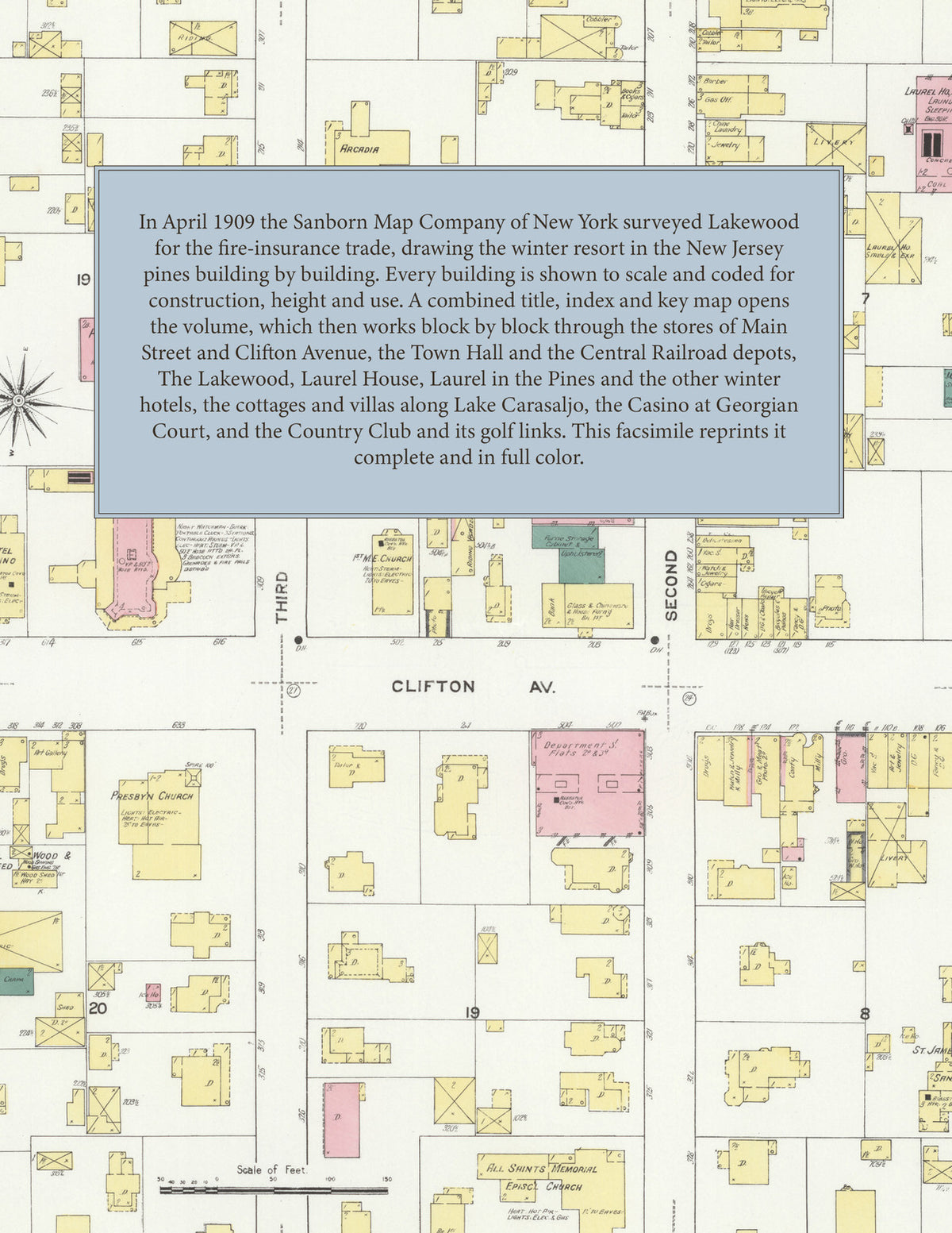
Facsimile of the 1909 Sanborn fire-insurance atlas of Lakewood, New Jersey, reproduced in full color from the Library of Congress copy. It covers the whole Ocean County resort town in the pines - 6,000 people in summer and 20,000 to 30,000 in fall and winter - from the stores of Main Street and Clifton Avenue and the Central Railroad of New Jersey depots, through the great winter hotels and cottages along Lake Carasaljo and Lake Manetta, to Georgian Court, the Country Club golf links and the pine woods beyond.
The twenty-three numbered sheets that follow work block by block from the stores and offices along Main Street, Clifton Avenue, Madison Avenue, Lexington Avenue and Second, Third and Fourth Streets - the Town Hall, the Fire Department, the I. O. O. F. Hall, the Y. M. C. A. Building, the Women's Exchange Building, the Postal Telegraph and the telegraph offices, the Skating Rink - and the winter hotels and boarding houses: The Lakewood, Laurel House, Laurel in the Pines, the Lakewood Hotel, Hotel Carasaljo, Hotel Schanno, Hotel Wrisley, the Palmer House, the Ocean Avenue House, Bartlett Inn, Seton Inn, St. Regis Inn, the Blythewood Hotel, the Albemarle, Arcadia, Ardmore, Clifton, Florence, Lenox, Manhattan and Pinemere, Oak Court, and the Beechwood, Fleischman and Woodland villas - through the Central Railroad of New Jersey depots, the Lakewood Light, Water and Power Company, the Lakewood Gas Works, the Laurel House power plant and laundry, the Lakewood Garage and Machine Company and the Central and Lexington garages, the Major box factory, the Worden beer bottling works, the Lake Hotel and Land Association, the Loomis, Brown and Wight coal, wood and lumber yards, the Buckelew & McCoe stables and the McBean florist, to St. James Hall in the Pines Sanatorium, the Jerry McAuley Mission, the Academy of St. Mary of the Lake, Public Schools Nos. 1, 5 and 7, All Saints Memorial Episcopal Church, St. Mary of the Lake Catholic Church, the Presbyterian, First Baptist, First M. E., First A. M. E. Zion, Sixth Street Baptist and Baptist (Negro) churches, Hope Presbyterian Church and parish house, the Synagogue, Georgian Court with The Court, the Casino and Gould's power house, the Country Club house and golf links with the Claflin, De Forrest and Lindley residences, and the residential streets along Lake Carasaljo, Lake Manetta, Forest Avenue and Lake Drive.
In April 1909 the Sanborn Map Company of New York surveyed Lakewood for the fire-insurance trade, drawing the town at fifty feet to the inch, Georgian Court at eighty feet and the Country Club golf links at one hundred feet to the inch. Every building is shown to scale and color-coded for construction (yellow for frame, pink for brick, blue for stone), with heights, uses, windows, party walls, hydrants, water mains and fire stations all marked. The index lists every street and every named business, church, school, hotel, mill and works with the sheet it appears on, and the key map places the colored sheet grid over the whole city.
This edition is an unabridged facsimile republication of the atlas: all twenty-four map sheets, 1 to 24, sheet 1 being the combined title, index and key map sheet with its report on the water facilities and fire department, the others covering the town from the business blocks of Main Street and Clifton Avenue out to the winter hotels, Lake Carasaljo, Georgian Court and the Country Club golf links. Ideal for local historians, genealogists, architects, preservationists and anyone tracing a Lakewood address back to 1909.
32 pages. 8.5" x 11". Full color. Paperback.
Printed to order and shipped directly to you — please allow up to 7 business days before shipment.
Satisfaction guaranteed or you can send it back!